File:Bali topography plain.png
Jump to navigation
Jump to search
Size of this preview: 800 × 492 pixels. Other resolutions: 320 × 197 pixels | 640 × 393 pixels | 1,024 × 630 pixels | 1,280 × 787 pixels | 2,048 × 1,259 pixels.
Original file (2,048 × 1,259 pixels, file size: 1.31 MB, MIME type: image/png)
Captions
Captions
Add a one-line explanation of what this file represents
Summary
[edit]| Description | ||||||||||
| PNG development | ||||||||||
| Date | ||||||||||
| Source |
Bahasa Indonesia: Karya sendiri;
English: Own work;
|
|||||||||
| Creator | ||||||||||
| Permission (Reusing this file) |
English: This file is a work by User:RXerself published under Creative Commons Attribution-Share Alike 4.0 International license. You can use it outside of Wikimedia projects as long as you appropriately provide an attribution with link according to the terms of the license as:
Bahasa Indonesia: Berkas ini merupakan karya User:RXerself yang diterbitkan menggunakan lisensi Creative Commons Attribution-Share Alike 4.0 International. Anda dapat menggunakan berkas ini di luar proyek-proyek Wikimedia dengan mencantumkan teks berpranala yang berupa:
|
|||||||||
| Geotemporal data | ||||||||||
| Bounding box |
|
|||||||||
| Other versions |
|
|||||||||


Licensing
[edit]
I, the copyright holder of this work, hereby publish it under the following license:
This file is licensed under the Creative Commons Attribution-Share Alike 4.0 International license.
Attribution: RXerself/Wikimedia Commons/CC BY-SA 4.0
- You are free:
- to share – to copy, distribute and transmit the work
- to remix – to adapt the work
- Under the following conditions:
- attribution – You must give appropriate credit, provide a link to the license, and indicate if changes were made. You may do so in any reasonable manner, but not in any way that suggests the licensor endorses you or your use.
- share alike – If you remix, transform, or build upon the material, you must distribute your contributions under the same or compatible license as the original.
File history
Click on a date/time to view the file as it appeared at that time.
| Date/Time | Thumbnail | Dimensions | User | Comment | |
|---|---|---|---|---|---|
| current | 15:05, 1 November 2018 | | 2,048 × 1,259 (1.31 MB) | RXerself (talk | contribs) | cropped |
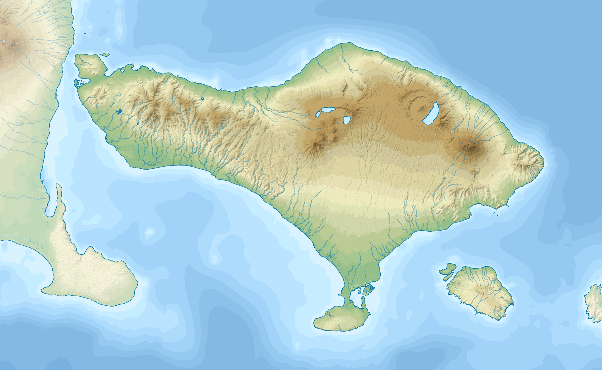
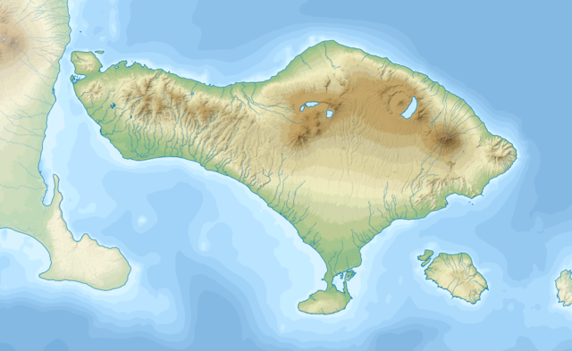
| 14:14, 1 November 2018 |  | 3,000 × 1,800 (2.79 MB) | RXerself (talk | contribs) | {{Map |Description= * {{id|Peta topografi Pulau {{W|Bali||id}}.}} * {{en|Topographic map of {{W|Bali}} in Indonesian.}} |Source= {{columns|2| {{id|Karya sendiri; * Topografi: [https://lpdaac.usgs.gov/node/527 NASA SRTMGL1 V003] (domain publik) * Batimetri: [https://www.gebco.net/data_and_products/gridded_bathymetry_data/gebco_30_second_grid/ GEBCO 30 arc-second grid] (domain publik), di-''resample'' menggunakan [https://qgis.org/en/site/ QGIS] * Garis pantai: © Kontributor [http://www.openst... |
You cannot overwrite this file.
File usage on Commons
The following page uses this file:
File usage on other wikis
The following other wikis use this file:
- Usage on ban.wikipedia.org
- Usage on bn.wikipedia.org
- Usage on ceb.wikipedia.org
- Usage on en.wikipedia.org
- Usage on eo.wikipedia.org
- Usage on es.wikipedia.org
- Usage on nl.wikipedia.org
- Ubud (plaats)
- Kuta (Badung)
- Pura Besakih
- Sanur (Indonesië)
- Denpasar
- Nusa Dua
- Tulamben
- Menjangan
- Pemuteran
- Pantai Lovina
- Sayan (Bali)
- Singaraja
- Jimbaran
- Pura Meduwe Karang
- Pura Taman Ayun
- Klungkung (paleis)
- Batubulan
- Pura Ulun Danu Batur
- Candidasa
- Tenganan
- Sjabloon:Positiekaart Bali
- Bedugul
- Cengiling
- Gelgel
View more global usage of this file.