File:Baines Cragg - Littledale near Lancaster - geograph.org.uk - 1711127.jpg
Jump to navigation
Jump to search

Size of this preview: 800 × 600 pixels. Other resolutions: 320 × 240 pixels | 640 × 480 pixels | 1,024 × 768 pixels | 1,280 × 960 pixels | 2,560 × 1,920 pixels | 3,264 × 2,448 pixels.
Original file (3,264 × 2,448 pixels, file size: 1.68 MB, MIME type: image/jpeg)
Captions
Captions
Add a one-line explanation of what this file represents
Summary
[edit]
| Description |
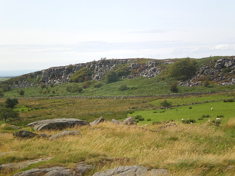
English: Baines Cragg - Littledale near Lancaster Baines Cragg in Littledale, a beautiful area just over five miles west of Lancaster, on the edge of the wild high fells of Bowland. The dry stone wall running at the bottom of Baines Cragg marks the narrow 'Littledale Road'. One can see the Irish sea in the distance to the left of this old disused millstone grit quarry of Baines Cragg. |
| Date | |
| Source | From geograph.org.uk |
| Author | Tom Howard |
| Attribution (required by the license) | Tom Howard / Baines Cragg - Littledale near Lancaster / |
| Camera location | | View this and other nearby images on: OpenStreetMap |
|---|
_heading:292.00&language=en)
| Object location | | View this and other nearby images on: OpenStreetMap |
|---|
_heading:292.00&language=en)
Licensing
[edit]

|
This image was taken from the Geograph project collection. See this photograph's page on the Geograph website for the photographer's contact details. The copyright on this image is owned by Tom Howard and is licensed for reuse under the Creative Commons Attribution-ShareAlike 2.0 license.
|
This file is licensed under the Creative Commons Attribution-Share Alike 2.0 Generic license.
Attribution: Tom Howard
- You are free:
- to share – to copy, distribute and transmit the work
- to remix – to adapt the work
- Under the following conditions:
- attribution – You must give appropriate credit, provide a link to the license, and indicate if changes were made. You may do so in any reasonable manner, but not in any way that suggests the licensor endorses you or your use.
- share alike – If you remix, transform, or build upon the material, you must distribute your contributions under the same or compatible license as the original.
File history
Click on a date/time to view the file as it appeared at that time.
| Date/Time | Thumbnail | Dimensions | User | Comment | |
|---|---|---|---|---|---|
| current | 07:38, 5 March 2011 | | 3,264 × 2,448 (1.68 MB) | GeographBot (talk | contribs) | == {{int:filedesc}} == {{Information |description={{en|1=Baines Cragg - Littledale near Lancaster Baines Cragg in Littledale, a beautiful area just over five miles west of Lancaster, on the edge of the wild high fells of Bowland. The dry stone wall runnin |
You cannot overwrite this file.
File usage on Commons
There are no pages that use this file.