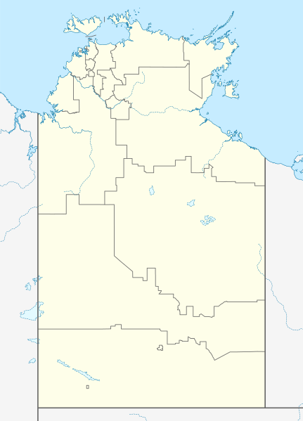
File:Australia Northern Territory location map.svg

Original file (SVG file, nominally 1,134 × 1,577 pixels, file size: 2.29 MB)
Captions
Captions
Summary
[edit]| DescriptionAustralia Northern Territory location map.svg |
Quadratische Plattkarte, N-S-Streckung 105 %. Geographische Begrenzung der Karte:
Equirectangular projection, N/S stretching 105 %. Geographic limits of the map:
|
|
| Date | ||
| Source |
Own work, using
|
|
| Author | NordNordWest | |
| Permission (Reusing this file) |
This file is licensed under the Creative Commons Attribution-Share Alike 3.0 Germany license.
 This file is licensed under the Creative Commons Attribution-Share Alike 3.0 Germany license.
 |
|
| Other versions | Derivative works of this file: Australia Northern Territory with LGA names.svg |

|
This map has been made or improved in the German Kartenwerkstatt (Map Lab). You can propose maps to improve as well.
azərbaycanca ∙ čeština ∙ Deutsch ∙ Deutsch (Sie-Form) ∙ English ∙ español ∙ français ∙ italiano ∙ latviešu ∙ magyar ∙ Nederlands ∙ Plattdüütsch ∙ polski ∙ português ∙ română ∙ sicilianu ∙ slovenščina ∙ suomi ∙ македонски ∙ русский ∙ ქართული ∙ հայերեն ∙ বাংলা ∙ ไทย ∙ +/−
|
File history
Click on a date/time to view the file as it appeared at that time.
| Date/Time | Thumbnail | Dimensions | User | Comment | |
|---|---|---|---|---|---|
| current | 10:50, 7 February 2023 |  | 1,134 × 1,577 (2.29 MB) | The2016 (talk | contribs) | Updated to current LGA boundaries. |
| 22:07, 4 April 2010 |  | 1,134 × 1,577 (533 KB) | Chumwa (talk | contribs) | Reverted to version as of 16:37, 18 December 2009 | |
| 21:56, 4 April 2010 |  | 1,134 × 1,577 (493 KB) | Roke~commonswiki (talk | contribs) | local government low salience, dont appear on general use maps | |
| 16:37, 18 December 2009 |  | 1,134 × 1,577 (533 KB) | NordNordWest (talk | contribs) | =={{int:filedesc}}== {{Information |Description= {{de|Positionskarte des Northern Territory, Australien}} Quadratische Plattkarte, N-S-Streckung 105 %. Geographische Begrenzung der Karte: * N: 10.6° S * S: 26 |
You cannot overwrite this file.
File usage on Commons
The following 2 pages use this file:
File usage on other wikis
The following other wikis use this file:
- Usage on af.wikipedia.org
- Usage on als.wikipedia.org
- Usage on azb.wikipedia.org
- Usage on bar.wikipedia.org
- Usage on ba.wikipedia.org
- Usage on bg.wikipedia.org
- Usage on ceb.wikipedia.org
- Usage on cs.wikipedia.org
- Usage on de.wikipedia.org
- Darwin (Northern Territory)
- Alice Springs
- Yulara
- Hermannsburg (Australien)
- Yuendumu
- Daly Waters
- Tennant Creek
- Darwin International Airport
- Katherine
- Jabiru (Australien)
- Palmerston (Northern Territory)
- Milikapiti
- Pine Creek (Northern Territory)
- Mataranka
- Vorlage:Positionskarte Australien Northern Territory
- Elliott (Australien)
- Timber Creek
- Wikipedia:Kartenwerkstatt/Positionskarten/Australien und Ozeanien
- Erldunda
- Papunya
- Kintore (Northern Territory)
- Adelaide River (Ortschaft)
- Haasts Bluff
- Yirrkala
- Ramingining
- Milingimbi
- Barrow Creek
- RAAF Base Tindal
- RAAF Base Darwin
- Kaltukatjara
- Benutzer:Rr2000/Vorlagentest Ort in Australien
- Connellan Airport
- Corella Creek
- Cape Crawford
- Borroloola
- Humpty Doo
- Batchelor (Australien)
- Kelly-West-Krater
- Maningrida
- Daly River (Stadt)
- Curtin Springs
View more global usage of this file.
Metadata
This file contains additional information such as Exif metadata which may have been added by the digital camera, scanner, or software program used to create or digitize it. If the file has been modified from its original state, some details such as the timestamp may not fully reflect those of the original file. The timestamp is only as accurate as the clock in the camera, and it may be completely wrong.
| Width | 1133.998 |
|---|---|
| Height | 1577.4824 |
