File:Arabian Plate map-uni.png
Jump to navigation
Jump to search

Size of this preview: 558 × 600 pixels. Other resolutions: 223 × 240 pixels | 562 × 604 pixels.
Original file (562 × 604 pixels, file size: 72 KB, MIME type: image/png)
Captions
Captions
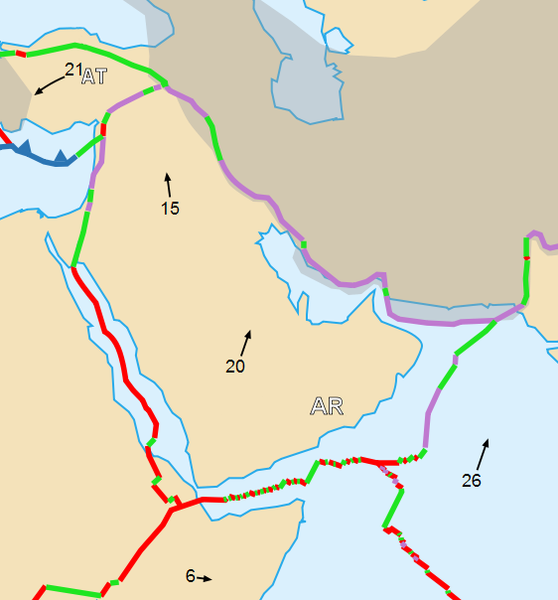
خريطة جيولوجية تظهر الصفيحة العربية (الصفيحة العربية تتضمن الشام والعراق)
Summary
[edit]
| Description |
English: Map of the Arabian Plate Français : Carte de la plaque arabique |
| Date | |
| Source | Cropped version by myself of Image:Tectonic_plates_boundaries_detailed-en.svg created by Sting under CC-BY-SA |
| Author | Sting and Woudloper |
| Permission (Reusing this file) |
This file is licensed under the Creative Commons Attribution-Share Alike 2.5 Generic license.
|
| Other versions |
Scaled version of  |
Licensing
[edit]
I, Woudloper, the copyright holder of this work, hereby publishes it under the following licenses:

|
Permission is granted to copy, distribute and/or modify this document under the terms of the GNU Free Documentation License, Version 1.2 or any later version published by the Free Software Foundation; with no Invariant Sections, no Front-Cover Texts, and no Back-Cover Texts. A copy of the license is included in the section entitled GNU Free Documentation License. |
| This file is licensed under the Creative Commons Attribution-Share Alike 3.0 Unported license. | ||
| Attribution: I, Woudloper | ||
| ||
| This licensing tag was added to this file as part of the GFDL licensing update. |
This file is licensed under the Creative Commons Attribution-Share Alike 2.5 Generic license.
Attribution: I, Woudloper
- You are free:
- to share – to copy, distribute and transmit the work
- to remix – to adapt the work
- Under the following conditions:
- attribution – You must give appropriate credit, provide a link to the license, and indicate if changes were made. You may do so in any reasonable manner, but not in any way that suggests the licensor endorses you or your use.
- share alike – If you remix, transform, or build upon the material, you must distribute your contributions under the same or compatible license as the original.
You may select the license of your choice.
File history
Click on a date/time to view the file as it appeared at that time.
| Date/Time | Thumbnail | Dimensions | User | Comment | |
|---|---|---|---|---|---|
| current | 12:28, 27 June 2007 | | 562 × 604 (72 KB) | Woudloper (talk | contribs) | {{Information |Description={{en|Map of the Arabian Plate}}{{fr|Carte de la plaque arabique}} |Source=Cropped version by myself of Image:Tectonic_plates_boundaries_detailed-en.svg created by Sting under CC-BY-SA |Date=june 2007 |Author= |
You cannot overwrite this file.
File usage on Commons
The following page uses this file:
File usage on other wikis
The following other wikis use this file:
- Usage on af.wikipedia.org
- Usage on ar.wikipedia.org
- Usage on ast.wikipedia.org
- Usage on azb.wikipedia.org
- Usage on ca.wikipedia.org
- Usage on cs.wikipedia.org
- Usage on de.wikipedia.org
- Usage on en.wikipedia.org
- Usage on es.wikipedia.org
- Usage on fi.wikipedia.org
- Usage on he.wikipedia.org
- Usage on hr.wikipedia.org
- Usage on hy.wikipedia.org
- Usage on nl.wikipedia.org
- Usage on sh.wikipedia.org
- Usage on sl.wikipedia.org
- Usage on sq.wikipedia.org
- Usage on uk.wikipedia.org
- Usage on www.wikidata.org
- Usage on zh-yue.wikipedia.org