File:Amurian Plate map-fr.png
Jump to navigation
Jump to search

Size of this preview: 680 × 599 pixels. Other resolutions: 272 × 240 pixels | 545 × 480 pixels | 724 × 638 pixels.
Original file (724 × 638 pixels, file size: 304 KB, MIME type: image/png)
Captions
Captions
Add a one-line explanation of what this file represents
| Description |
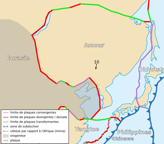
Français : Carte de la plaque de l'Amour English: Map of the Amurian Plate |
| Date | |
| Source | Cropped version by myself of Image:Tectonic_plates_boundaries_detailed-fr.svg created by Sting under CC-BY-SA |
| Author | Sting and Rémih |
| Permission (Reusing this file) |
This file is licensed under the Creative Commons Attribution-Share Alike 2.5 Generic license.
|
| Other versions |
Scaled version of  |
File history
Click on a date/time to view the file as it appeared at that time.
| Date/Time | Thumbnail | Dimensions | User | Comment | |
|---|---|---|---|---|---|
| current | 22:50, 18 November 2006 | | 724 × 638 (304 KB) | Rémih (talk | contribs) | {{Information |Description={{fr|Carte de la plaque de l'Amour}}{{en|Map of the Amurian Plate}} |Source=Cropped version by myself of Image:Tectonic_plates_boundaries_detailed-fr.svg created by Sting under CC-BY-SA |Date=18/11/2006 |Auth |
You cannot overwrite this file.
File usage on Commons
There are no pages that use this file.
File usage on other wikis
The following other wikis use this file:
- Usage on az.wikipedia.org
- Usage on ca.wikipedia.org
- Usage on cs.wikipedia.org
- Usage on de.wikipedia.org
- Usage on fr.wikipedia.org
- Usage on it.wikipedia.org
- Usage on ja.wikipedia.org
- Usage on pl.wikipedia.org
- Usage on sk.wikipedia.org
- Usage on uk.wikipedia.org
- Usage on vi.wikipedia.org