File:Am alten Kirchweg von Hemigkofen nach Gattnau aufgestelltes Wegkreuz.jpg
Jump to navigation
Jump to search
Size of this preview: 450 × 600 pixels. Other resolutions: 180 × 240 pixels | 360 × 480 pixels | 576 × 768 pixels | 768 × 1,024 pixels | 1,536 × 2,048 pixels.
Original file (1,536 × 2,048 pixels, file size: 454 KB, MIME type: image/jpeg)
Captions
Captions
Add a one-line explanation of what this file represents
Summary
[edit]
| Description |
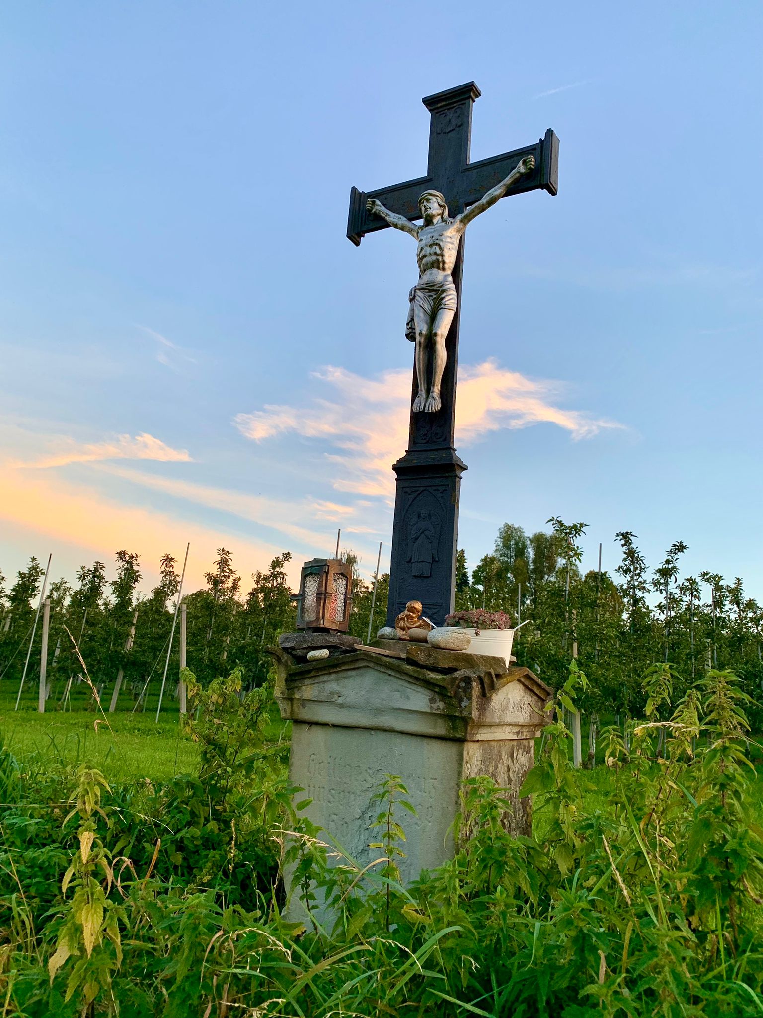
Deutsch: Grüner Sandsteinsockel mit gut gegliedertem Aufbau über rechteckigem Grundriss in primär klassizistischen Formen und mit religiöser Textinschrift; hoher, zweistufiger, gusseiserner Kreuzaufsatz mit kapitellartigen Balkenenden und einem ebenfalls aus Guss gefertigten, großen Kruzifix (Viernageltypus).
Die Erhaltung des Wegkreuzes als spezifisch bildlichen Ausdruck der katholischen Volksfrömmigkeit mit zugleich kulturlandschaftsprägender Bedeutung ist aus wissenschaftlichen Gründen von öffentlichem Interesse. |
| Date | |
| Source | Own work |
| Author | Meinkressbronn |
| Camera location | | View this and other nearby images on: OpenStreetMap |
|---|
Licensing
[edit]
I, the copyright holder of this work, hereby publish it under the following license:
This file is licensed under the Creative Commons Attribution-Share Alike 4.0 International license.
- You are free:
- to share – to copy, distribute and transmit the work
- to remix – to adapt the work
- Under the following conditions:
- attribution – You must give appropriate credit, provide a link to the license, and indicate if changes were made. You may do so in any reasonable manner, but not in any way that suggests the licensor endorses you or your use.
- share alike – If you remix, transform, or build upon the material, you must distribute your contributions under the same or compatible license as the original.

|
This image was uploaded as part of Wiki Loves Monuments 2023.
|
File history
Click on a date/time to view the file as it appeared at that time.
| Date/Time | Thumbnail | Dimensions | User | Comment | |
|---|---|---|---|---|---|
| current | 14:56, 29 September 2023 | | 1,536 × 2,048 (454 KB) | Meinkressbronn (talk | contribs) | Uploaded own work with UploadWizard |
You cannot overwrite this file.
File usage on Commons
There are no pages that use this file.
File usage on other wikis
The following other wikis use this file:
- Usage on de.wikipedia.org