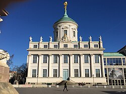
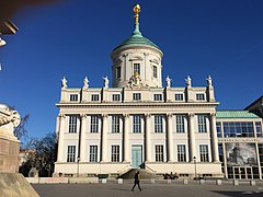
File:Altes Rathaus Potsdam mit Tambour und Atlas mit Weltkugel.jpg
From Wikimedia Commons, the free media repository
Jump to navigation
Jump to search

Size of this preview: 800 × 533 pixels. Other resolutions: 320 × 213 pixels | 640 × 427 pixels | 1,024 × 683 pixels | 1,280 × 853 pixels | 2,560 × 1,707 pixels | 5,184 × 3,456 pixels.
Original file (5,184 × 3,456 pixels, file size: 9.27 MB, MIME type: image/jpeg)
File information
Structured data
Captions
Captions
Add a one-line explanation of what this file represents
Contents
Summary
Object
| Old Town-Hall
|
||||||||||||||||||||||||||||||||||||||||||
|---|---|---|---|---|---|---|---|---|---|---|---|---|---|---|---|---|---|---|---|---|---|---|---|---|---|---|---|---|---|---|---|---|---|---|---|---|---|---|---|---|---|---|
| Architect |
|
|||||||||||||||||||||||||||||||||||||||||
| Title |
Old Town-Hall label QS:Lit,"Altes Rathaus"
label QS:Lsv,"Gamla rådhuset, Potsdam"
label QS:Lnl,"Oude raadhuis van Potsdam"
label QS:Lru,"Старая ратуша в Потсдаме"
label QS:Lka,"პოტსდამის თვითმმართველობის ძველი შენობა"
label QS:Lde,"Altes Rathaus"
label QS:Lfi,"Potsdamin vanha raatihuone"
label QS:Len,"Old Town-Hall"
label QS:Lbg,"Старо кметство (Потсдам)"
label QS:Lzh,"波茨坦博物館" |
|||||||||||||||||||||||||||||||||||||||||
| Object type |
Rathaus / house of culture / museum building |
|||||||||||||||||||||||||||||||||||||||||
| Description |
Deutsch: Altes Rathaus Potsdam mit Tambour und Atlas mit Weltkugel. Sechs Sandsteinstatuen der Bürgerlichen Tugenden (von links): Wachsamkeit, Standhaftigkeit, Überfluss, Gerechtigkeit, Kaufmannschaft/Handlung, Vorsicht von Horst Misch nach den 1945 zerstörten Statuen von Gottlieb Heymüller |
|||||||||||||||||||||||||||||||||||||||||
| Date |
1753 |
|||||||||||||||||||||||||||||||||||||||||
| Collection | ||||||||||||||||||||||||||||||||||||||||||
| Object location |
|
|||||||||||||||||||||||||||||||||||||||||
| References |
|
|||||||||||||||||||||||||||||||||||||||||
| Authority file | ||||||||||||||||||||||||||||||||||||||||||
| Other versions |
|
|||||||||||||||||||||||||||||||||||||||||
Photograph
| Date | |
| Source | Own work |
| Author | Oursana |
Licensing
I, the copyright holder of this work, hereby publish it under the following license:
| This file is made available under the Creative Commons CC0 1.0 Universal Public Domain Dedication. | |
| The person who associated a work with this deed has dedicated the work to the public domain by waiving all of their rights to the work worldwide under copyright law, including all related and neighboring rights, to the extent allowed by law. You can copy, modify, distribute and perform the work, even for commercial purposes, all without asking permission.
http://creativecommons.org/publicdomain/zero/1.0/deed.enCC0Creative Commons Zero, Public Domain Dedicationfalsefalse |
File history
Click on a date/time to view the file as it appeared at that time.
| Date/Time | Thumbnail | Dimensions | User | Comment | |
|---|---|---|---|---|---|
| current | 01:38, 1 October 2023 |  | 5,184 × 3,456 (9.27 MB) | Oursana (talk | contribs) | Uploaded own work with UploadWizard |
You cannot overwrite this file.
File usage on Commons
The following 2 pages use this file:
Metadata
This file contains additional information such as Exif metadata which may have been added by the digital camera, scanner, or software program used to create or digitize it. If the file has been modified from its original state, some details such as the timestamp may not fully reflect those of the original file. The timestamp is only as accurate as the clock in the camera, and it may be completely wrong.
| Camera manufacturer | Canon |
|---|---|
| Camera model | Canon EOS 1200D |
| Exposure time | 1/320 sec (0.003125) |
| F-number | f/10 |
| ISO speed rating | 100 |
| Date and time of data generation | 17:40, 25 February 2019 |
| Lens focal length | 41 mm |
| Horizontal resolution | 72 dpi |
| Vertical resolution | 72 dpi |
| File change date and time | 17:40, 25 February 2019 |
| Exposure Program | Not defined |
| Exif version | 2.3 |
| Date and time of digitizing | 17:40, 25 February 2019 |
| Meaning of each component |
|
| APEX shutter speed | 8.375 |
| APEX aperture | 6.625 |
| APEX exposure bias | 0 |
| Maximum land aperture | 4.7568284594513 APEX (f/5.2) |
| Metering mode | Pattern |
| Flash | Flash did not fire, compulsory flash suppression |
| DateTime subseconds | 03 |
| DateTimeOriginal subseconds | 03 |
| DateTimeDigitized subseconds | 03 |
| Supported Flashpix version | 1 |
| Color space | sRGB |
| Focal plane X resolution | 5,728.1767955801 |
| Focal plane Y resolution | 5,808.4033613445 |
| Focal plane resolution unit | inches |
| Custom image processing | Normal process |
| Exposure mode | Auto exposure |
| White balance | Auto white balance |
| Scene capture type | Standard |
| Lens used | Canon EF-S 18-135mm f/3.5-5.6 IS |
| Rating (out of 5) | 0 |
| IIM version | 2 |


