File:Aeschach-2111.jpg
Jump to navigation
Jump to search
Size of this preview: 403 × 599 pixels. Other resolutions: 161 × 240 pixels | 323 × 480 pixels | 517 × 768 pixels | 689 × 1,024 pixels | 1,379 × 2,048 pixels | 3,076 × 4,569 pixels.
Original file (3,076 × 4,569 pixels, file size: 5.96 MB, MIME type: image/jpeg)
Captions
Captions
Add a one-line explanation of what this file represents
Summary
[edit]
| Description |
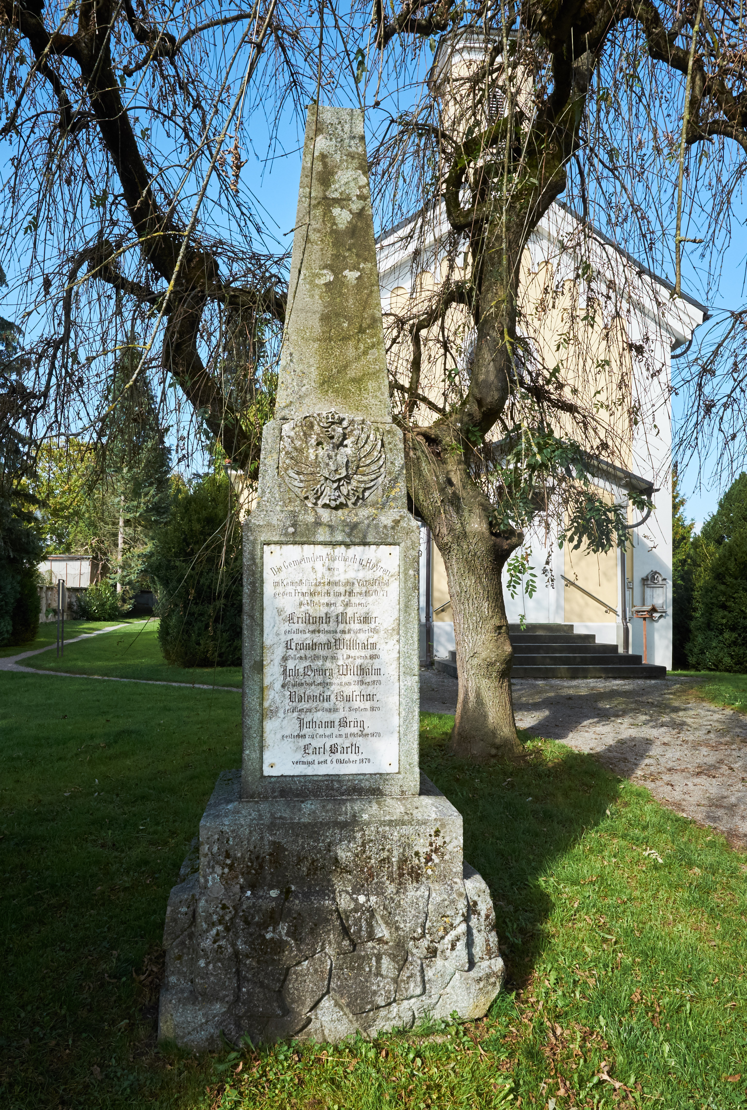
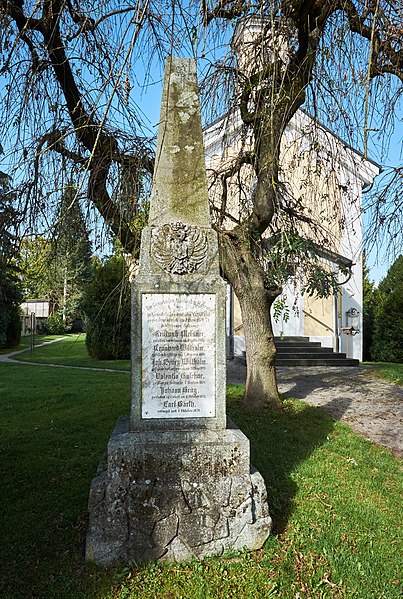
English: War memorial Franco-Prussian war, 1870/71, Alter Friedhof Aeschach ,Lindau-Aeschach, district Lindau, Bavaria, Germany
Deutsch: Alter Friedhof Aeschach, Kriegerdenkmal von 1870/71, Lindau-Aeschach, Lindau am Bodensee, Bayern, Deutschland |
| Date | Taken on 20 September 2014 |
| Source | Own work |
| Author | DKrieger |
| Camera location | | View this and other nearby images on: OpenStreetMap |
|---|
Licensing
[edit]
Dietrich Krieger, the copyright holder of this work, hereby publishes it under the following license:
This file is licensed under the Creative Commons Attribution-Share Alike 3.0 Unported license.
Attribution: Dietrich Krieger
- You are free:
- to share – to copy, distribute and transmit the work
- to remix – to adapt the work
- Under the following conditions:
- attribution – You must give appropriate credit, provide a link to the license, and indicate if changes were made. You may do so in any reasonable manner, but not in any way that suggests the licensor endorses you or your use.
- share alike – If you remix, transform, or build upon the material, you must distribute your contributions under the same or compatible license as the original.
This image has been assessed using the Quality image guidelines and is considered a Quality image.
|
File history
Click on a date/time to view the file as it appeared at that time.
| Date/Time | Thumbnail | Dimensions | User | Comment | |
|---|---|---|---|---|---|
| current | 19:18, 24 May 2016 | | 3,076 × 4,569 (5.96 MB) | DKrieger (talk | contribs) | Neu entwickelt und beschnitten |
| 10:15, 21 September 2014 |  | 2,050 × 4,285 (7.91 MB) | DKrieger (talk | contribs) | VicuñaUploader 1.20 |
You cannot overwrite this file.
File usage on Commons
The following 8 pages use this file:
- User:AndreasPraefcke/Bodenseekreis new files/2014 September 21-30
- User:AndreasPraefcke/Bodenseekreis new files/2016 May 21-31
- User:DKrieger
- User:Pingelig/Recent uploads/Canton of Thurgau/2014 September 21-30
- User:Pingelig/Recent uploads/Canton of Thurgau/2016 May 21-31
- User talk:DKrieger/Archiv 2014
- Commons:Quality images/Subject/Objects/Statues, Monuments and Plaques/archive 2014
- Commons:Quality images candidates/Archives September 24 2014