File:AUT Furth an der Triesting COA.jpg
AUT_Furth_an_der_Triesting_COA.jpg (408 × 441 pixels, file size: 38 KB, MIME type: image/jpeg)
Captions
Captions
Summary
[edit]
|
This coat of arms image could be re-created using vector graphics as an SVG file. This has several advantages; see Commons:Media for cleanup for more information. If an SVG form of this image is available, please upload it and afterwards replace this template with
{{vector version available|new image name}}.
It is recommended to name the SVG file “AUT Furth an der Triesting COA.svg”—then the template Vector version available (or Vva) does not need the new image name parameter. |
 | This coat of arms image was uploaded in the JPEG format even though it consists of non-photographic data. This information could be stored more efficiently or accurately in the PNG or SVG format. If possible, please upload a PNG or SVG version of this image without compression artifacts, derived from a non-JPEG source (or with existing artifacts removed). After doing so, please tag the JPEG version with {{Superseded|NewImage.ext}} and remove this tag. This tag should not be applied to photographs or scans. If this image is a diagram or other image suitable for vectorisation, please tag this image with {{Convert to SVG}} instead of {{BadJPEG}}. If not suitable for vectorisation, use {{Convert to PNG}}. For more information, see {{BadJPEG}}. |
| DescriptionAUT Furth an der Triesting COA.jpg |
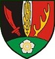
Deutsch: Wappen der Gemeinde Furth an der Triesting, Niederösterreich
English: Coat of arms of Furth an der Triesting, Lower Austria
Polski: Herb Furth an der Triesting, Dolna Austria |
| Date | |
| Source | Gemeinde Furth an der Triesting |
| Author | Unknown authorUnknown author |
Licensing
[edit]| Public domainPublic domainfalsefalse |
This image is in the public domain according to Austrian copyright law because it is part of a law, ordinance or official decree issued by an Austrian federal or state authority, or because it is of predominantly official use. (§7 UrhG)
To uploader: Please provide where the image was first published and who created it. Deutsch ∙ English ∙ മലയാളം ∙ македонски ∙ русский ∙ Nederlands ∙ français ∙ magyar ∙ +/− |

|
This image shows a flag, a coat of arms, a seal or some other official insignia. The use of such symbols is restricted in many countries. These restrictions are independent of the copyright status. |
File history
Click on a date/time to view the file as it appeared at that time.
| Date/Time | Thumbnail | Dimensions | User | Comment | |
|---|---|---|---|---|---|
| current | 15:15, 3 March 2020 |  | 408 × 441 (38 KB) | Kontrollstellekundl (talk | contribs) | neue Datei, www.furth-triesting.at/wp/ |
| 08:11, 21 July 2009 |  | 91 × 89 (9 KB) | Magul (talk | contribs) | {{Information |Description=Polski:Herb Furth an der Triesting, Dolna Austria, English:Coat of arms of Furth an der Triesting, Lower Austria |Source=de:Datei:Furthadt.jpg |Date=12:10, 29 sie 2007 |Author=de:ZL |Permission={{PD-AustrianGov}}{{Insignia}} | |
You cannot overwrite this file.
File usage on Commons
The following 2 pages use this file:
File usage on other wikis
The following other wikis use this file:
- Usage on ce.wikipedia.org
- Usage on de.wikipedia.org
- Bezirk Baden (Niederösterreich)
- Furth an der Triesting
- Liste der Wappen im Bezirk Baden
- Mieselbach
- Niemtal
- Steinwandgraben
- Wikipedia:WikiProjekt Österreich/BN/Furthergraben
- Wikipedia:WikiProjekt Österreich/BN/Prymhäuser
- Wikipedia:WikiProjekt Österreich/BN/Schromenau
- Wikipedia:WikiProjekt Österreich/BN/Harras
- Wikipedia:WikiProjekt Österreich/BN/Rohrbach
- Wikipedia:WikiProjekt Österreich/BN/Staff
- Wikipedia:WikiProjekt Österreich/BN/Kiental
- Wikipedia:WikiProjekt Österreich/BN/Lerchenfeld
- Wikipedia:WikiProjekt Österreich/WD/Landgemeinden
- Vorlage:Navigationsleiste Gemeindegliederung von Furth an der Triesting
- Wikipedia:WikiProjekt Österreich/BN/Aggsbach
- Wikipedia:WikiProjekt Österreich/BN/Dürntal
- Wikipedia:WikiProjekt Österreich/BN/Ebeltal
- Wikipedia:WikiProjekt Österreich/BN/Eberbach
- Wikipedia:WikiProjekt Österreich/BN/Furth
- Wikipedia:WikiProjekt Österreich/BN/Guglhof
- Wikipedia:WikiProjekt Österreich/BN/Hof
- Wikipedia:WikiProjekt Österreich/BN/Maierhof
- Wikipedia:WikiProjekt Österreich/BN/Niemtal
- Wikipedia:WikiProjekt Österreich/BN/Rehgras
- Wikipedia:WikiProjekt Österreich/BN/Steinwandgraben
- Wikipedia:WikiProjekt Österreich/ZZ/Navileisten N1
- Wikipedia:Österreich/Check Navigationsleisten/Niederösterreich (A-P)
- Wikipedia:WikiProjekt Österreich/BN/Amöd
- Wikipedia:WikiProjekt Österreich/checks/Navis/Niederösterreich 1
- Usage on en.wikipedia.org
- Usage on eo.wikipedia.org
- Usage on es.wikipedia.org
- Usage on et.wikipedia.org
- Usage on fa.wikipedia.org
- Usage on fr.wikipedia.org
- Usage on hu.wikipedia.org
- Usage on it.wikipedia.org
- Usage on kk.wikipedia.org
- Usage on lld.wikipedia.org
- Usage on lmo.wikipedia.org
- Usage on pl.wikipedia.org
- Usage on pt.wikipedia.org
- Usage on ru.wikipedia.org
- Usage on sk.wikipedia.org
- Usage on tt.wikipedia.org
- Usage on uz.wikipedia.org
View more global usage of this file.
Metadata
This file contains additional information such as Exif metadata which may have been added by the digital camera, scanner, or software program used to create or digitize it. If the file has been modified from its original state, some details such as the timestamp may not fully reflect those of the original file. The timestamp is only as accurate as the clock in the camera, and it may be completely wrong.
| JPEG file comment | LEAD Technologies Inc. V1.01 |
|---|---|
| Orientation | Normal |

