File:412 DSP UndergroundTanks 087 - DPLA - 45888c879db5fea52c8c7e9d80628c1b.jpg
Jump to navigation
Jump to search

Size of this preview: 399 × 600 pixels. Other resolutions: 160 × 240 pixels | 319 × 480 pixels | 511 × 768 pixels | 681 × 1,024 pixels | 1,363 × 2,048 pixels | 2,832 × 4,256 pixels.
Original file (2,832 × 4,256 pixels, file size: 1.22 MB, MIME type: image/jpeg)
Captions
Captions
Add a one-line explanation of what this file represents
Summary
[edit]
| 412_DSP_UndergroundTanks_087
( |
||||||||||||||||||||
|---|---|---|---|---|---|---|---|---|---|---|---|---|---|---|---|---|---|---|---|---|
| Creator | Environmental Protection Agency. 12/2/1970 | |||||||||||||||||||
| Title |
412_DSP_UndergroundTanks_087 |
|||||||||||||||||||
| Description |
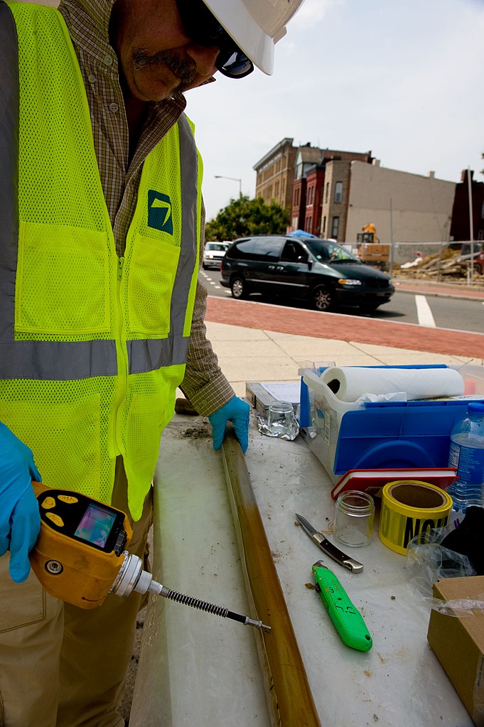
The original digital file had the following descriptive metadata embedded in its header: Name: 412_DSP_UndergroundTanks_087.jpg Date Picture Taken: 8/11/2010 1:15:19 PM [Original] Caption: Testing core samples drilled with Geo Probe for contamination. USEPA photo by Eric Vance. GPS coordinates in metadata. Byline Title: Chief Photographer, USEPA Keywords: Hazardous, LUST, Underground storage tank GPS altitude: 0 m GPS latitude: 38° 54' 55.956" N GPS longitude: 77° 1' 14.352" W [Folder Topic: Underground Storage] |
|||||||||||||||||||
| Date | 11 August 2010 | |||||||||||||||||||
| Collection |
|
|||||||||||||||||||
| Source/Photographer |
|
|||||||||||||||||||
| Permission (Reusing this file) |
|
|||||||||||||||||||
| Standardized rights statement |
|
|||||||||||||||||||
| Camera location | | View this and other nearby images on: OpenStreetMap |
|---|
File history
Click on a date/time to view the file as it appeared at that time.
| Date/Time | Thumbnail | Dimensions | User | Comment | |
|---|---|---|---|---|---|
| current | 03:58, 24 November 2020 | | 2,832 × 4,256 (1.22 MB) | DPLA bot (talk | contribs) | Uploading DPLA ID 45888c879db5fea52c8c7e9d80628c1b |
You cannot overwrite this file.
File usage on Commons
The following page uses this file: