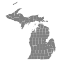
File:2022 Michigan Proposal 3 results map by county.svg

From Wikimedia Commons, the free media repository
Jump to navigation Jump to search

Original file (SVG file, nominally 810 × 810 pixels, file size: 43 KB)

Captions

Captions

Add a one-line explanation of what this file represents

Summary

[edit]
Description
English: Results map of 2022 Michigan Proposal 3 by county.
Date
Source Own work
Author Elli
image extraction process This file has been created using a standardized map of a state's counties: Michigan county map, cb 500k.svg.
A full list of available maps exists at Category:Standardized SVG county maps of US states.
original file

Licensing

[edit]
Public domain This map is ineligible for copyright and therefore in the public domain, because it consists entirely of information that is common property and contains no original authorship. For more information, see Commons:Threshold of originality § Maps.

English | Español | Galego | Română | slovenščina | العربية | 简体中文 | 繁體中文 | +/−

File history

Click on a date/time to view the file as it appeared at that time.

Date/TimeThumbnailDimensionsUserComment
current23:46, 21 July 2023Thumbnail for version as of 23:46, 21 July 2023810 × 810 (43 KB)Putitonamap98 (talk | contribs)shapes
09:21, 11 November 2022Thumbnail for version as of 09:21, 11 November 2022744 × 744 (308 KB)Elli (talk | contribs)update per NYT
22:33, 1 November 2022Thumbnail for version as of 22:33, 1 November 2022744 × 744 (309 KB)Elli (talk | contribs)Uploaded own work with UploadWizard

File usage on other wikis

The following other wikis use this file:

Metadata