File:1895 Stranahan Map of Ohio.jpg
Jump to navigation
Jump to search

Size of this preview: 750 × 600 pixels. Other resolutions: 300 × 240 pixels | 601 × 480 pixels | 961 × 768 pixels | 1,280 × 1,023 pixels | 2,560 × 2,047 pixels | 9,509 × 7,602 pixels.
Original file (9,509 × 7,602 pixels, file size: 11.09 MB, MIME type: image/jpeg)
Captions
Captions
Add a one-line explanation of what this file represents
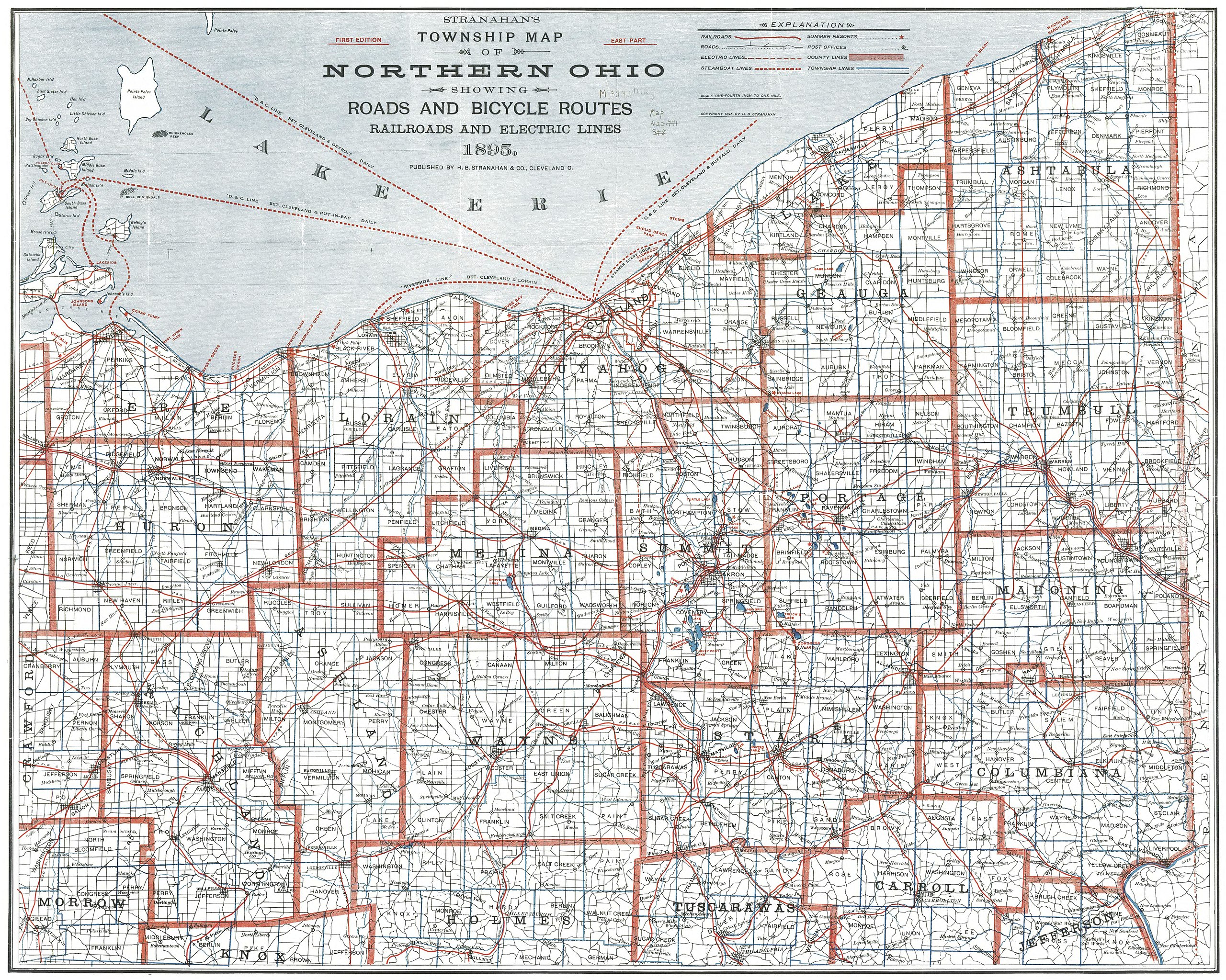
| Description | Stranahan's Township Map of Northern Ohio showing Road and Bicycle Routes Railroads and Electric Lines 1895 | ||||
| Date | see file history | ||||
| Source | Cleveland Public Library / RailsAndTrails.com | ||||
| Author | H.B. Stranahan & Co. | ||||
| Permission (Reusing this file) |
|
||||
File history
Click on a date/time to view the file as it appeared at that time.
| Date/Time | Thumbnail | Dimensions | User | Comment | |
|---|---|---|---|---|---|
| current | 22:34, 23 September 2016 | | 9,509 × 7,602 (11.09 MB) | Chumwa (talk | contribs) | {{Information |Description= Stranahan's Township Map of Northern Ohio showing Road and Bicycle Routes Railroads and Electric Lines 1895 |Author=H.B. Stranahan & Co. |Source=[http://railsandtrails.com/Maps/Stranahan1895/ Cleveland Public Library / Rails... |
You cannot overwrite this file.
File usage on Commons
The following page uses this file: