File:1864 Johnson Map of Florida - Geographicus - Florida-johnson-1864.jpg
Jump to navigation
Jump to search
Size of this preview: 748 × 600 pixels. Other resolutions: 300 × 240 pixels | 599 × 480 pixels | 958 × 768 pixels | 1,278 × 1,024 pixels | 2,555 × 2,048 pixels | 4,000 × 3,206 pixels.
Original file (4,000 × 3,206 pixels, file size: 3.86 MB, MIME type: image/jpeg)
Captions
Captions
Add a one-line explanation of what this file represents
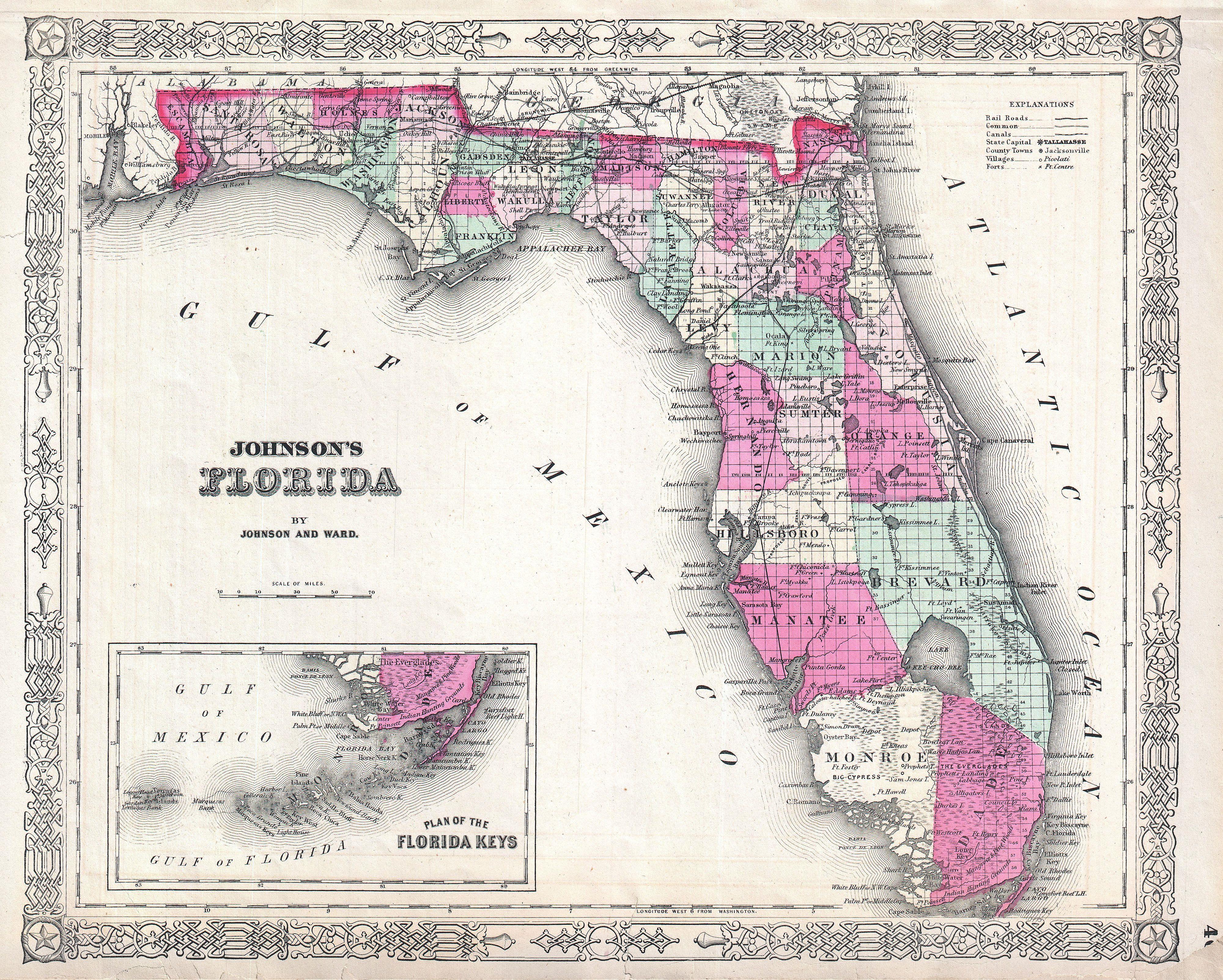
| Alvin Jewett Johnson: Johnson's Florida.
( |
|||||||||||||||||||||||
|---|---|---|---|---|---|---|---|---|---|---|---|---|---|---|---|---|---|---|---|---|---|---|---|
| Artist |
|
||||||||||||||||||||||
| Title |
Johnson's Florida. |
||||||||||||||||||||||
| Description |
English: This is Johnson and Ward’s 1864 map of the Florida. Details the stated divided by county showing towns, roads, railroads, ports, bays and internal lakes and waterways. An inset map in the lower left quadrant details the Florida Keys. Notes Miami. Features the fretwork border common to Johnson’s atlas work from 1864 to 1869. Steel plate engraving prepared by A. J. Johnson for publication as plate no. 46 in the 1864 edition of his New Illustrated Atlas… This is the last edition of the Johnson’s Atlas to bear the Johnson and Ward imprint. |
||||||||||||||||||||||
| Date | 1864 (undated) | ||||||||||||||||||||||
| Dimensions | height: 13 in (33 cm); width: 16 in (40.6 cm) | ||||||||||||||||||||||
| Accession number |
Geographicus link: Florida-johnson-1864 |
||||||||||||||||||||||
| Source/Photographer |
Johnson's New Illustrated Family Atlas, 1864 Johnson & Ward Edition.
|
||||||||||||||||||||||
| Permission (Reusing this file) |
|
||||||||||||||||||||||
File history
Click on a date/time to view the file as it appeared at that time.
| Date/Time | Thumbnail | Dimensions | User | Comment | |
|---|---|---|---|---|---|
| current | 09:14, 18 March 2011 | | 4,000 × 3,206 (3.86 MB) | BotMultichill (talk | contribs) | {{subst:User:Multichill/Geographicus |link=http://www.geographicus.com/P/AntiqueMap/Florida-johnson-1864 |product_name=1864 Johnson Map of Florida |map_title=Johnson's Florida. |description=This is Johnson and Ward’s 1864 map of the Florida. Details th |
You cannot overwrite this file.
File usage on Commons
The following page uses this file:
File usage on other wikis
The following other wikis use this file:
- Usage on en.wikipedia.org