File:1852 Levasseur Map of Africa - Geographicus - Afrique-levasseur-1852.jpg
Jump to navigation
Jump to search

Size of this preview: 800 × 580 pixels. Other resolutions: 320 × 232 pixels | 640 × 464 pixels | 1,024 × 742 pixels | 1,280 × 928 pixels | 2,560 × 1,856 pixels | 3,500 × 2,537 pixels.
Original file (3,500 × 2,537 pixels, file size: 3.08 MB, MIME type: image/jpeg)
Captions
Captions
Add a one-line explanation of what this file represents
| Afrique. | ||||||||||||||||||||||||||||||||||||
|---|---|---|---|---|---|---|---|---|---|---|---|---|---|---|---|---|---|---|---|---|---|---|---|---|---|---|---|---|---|---|---|---|---|---|---|---|
| Artist |
|
|||||||||||||||||||||||||||||||||||
| Title |
Afrique. |
|||||||||||||||||||||||||||||||||||
| Description |
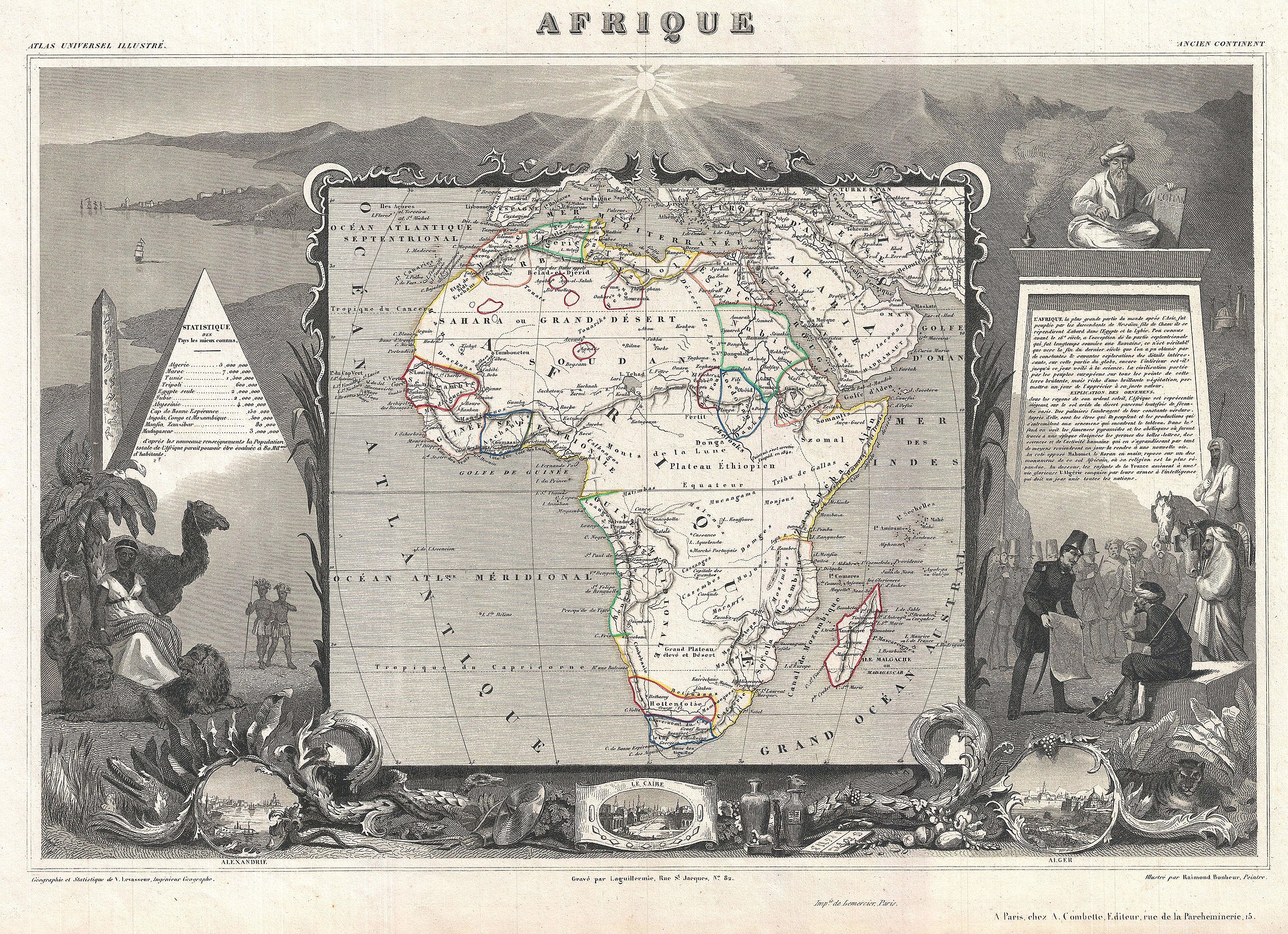
English: A fine example of V. Levasseur's desirable decorative map of Africa, dated 1852. Shows the entire continent according to perceptions of the time. Much of the interior is vague and unmapped, with the exception of the northern Nile Valley, the French colonies in Senegal, Gambia, and Algeria, and the colonies of the Dutch and English in South Africa. Offers a semi-accurate mapping of the Niger, which is uncommon for the period. Correctly identifies Lake Chad. The whole is surrounded by elaborate decorative engravings designed to illustrate both the natural beauty and trade richness of the land. These include the Pyramids, an seated Imam, the Luxor Obelisk, and views of Cairo, Alexandria, and Algiers. There is a short textual history of the regions depicted on both the left and right sides of the map. Published by V. Levasseur in the 1852 edition of his Atlas National de la France Illustree. |
|||||||||||||||||||||||||||||||||||
| Date | 1852 (undated) | |||||||||||||||||||||||||||||||||||
| Dimensions | height: 12.7 in (32.3 cm); width: 17.5 in (44.4 cm) | |||||||||||||||||||||||||||||||||||
| Accession number |
Geographicus link: Afrique-levasseur-1852 |
|||||||||||||||||||||||||||||||||||
| Source/Photographer |
Levassuer, V., Atlas National Illustre des 86 Departements et des Possessions de La France Divise par Arrondissements, Cantons et Communea avec La Trace de Toutes Les Routes, Chemins,de fer et Canaux., 1852 edition.
|
|||||||||||||||||||||||||||||||||||
| Permission (Reusing this file) |
|
|||||||||||||||||||||||||||||||||||
File history
Click on a date/time to view the file as it appeared at that time.
| Date/Time | Thumbnail | Dimensions | User | Comment | |
|---|---|---|---|---|---|
| current | 03:42, 24 March 2011 | | 3,500 × 2,537 (3.08 MB) | BotMultichillT (talk | contribs) | {{subst:User:Multichill/Geographicus |link=http://www.geographicus.com/P/AntiqueMap/Afrique-levasseur-1852 |product_name=1852 Levasseur Map of Africa |map_title=Afrique. |description=A fine example of V. Levasseur's desirable decorative map of Africa, dat |
You cannot overwrite this file.
File usage on Commons
The following page uses this file: