File:水尾工作站.jpg
From Wikimedia Commons, the free media repository
Jump to navigation
Jump to search
Size of this preview: 800 × 600 pixels. Other resolutions: 320 × 240 pixels | 640 × 480 pixels | 1,024 × 768 pixels | 1,280 × 960 pixels | 2,560 × 1,920 pixels | 3,500 × 2,625 pixels.
Original file (3,500 × 2,625 pixels, file size: 842 KB, MIME type: image/jpeg)
File information
Structured data
Captions
Summary
[edit]Description水尾工作站.jpg |
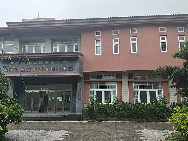
中文(臺灣):水尾工作站,為桃園大圳幹線(含導水路)輸配水系統的建設以及管理需要而設立,肩負桃園臺地和湖口臺地,三萬多公頃田地灌溉水源分配工作。 工作站的轄區,原從桃園大圳進水口自龍潭區石門水庫後池堰起,經導水路至楊梅區上田里止,設有溢流堰導入社子溪,後因湖口灌區地處高地且無可靠水源,而於民國39年(1950)完成湖口灌區幹線,自桃園大圳最末端連接導引桃園大圳的餘水入池儲存,後又於民國45年(1956)正式併入桃園水利會轄區。 桃園大圳全線,源起自龍潭區石門水庫至新竹縣新豐鄉坑子口止。工作站所管轄的主幹線流經大溪區、八德區、桃園市、中壢區、觀音區、新屋區、楊梅區,再連接光復圳經新竹縣湖口鄉、新豐鄉。其幹線配水量除龜山區、平鎮區、與龍潭區、八德區、楊梅區等部分高崗耕地無法供水灌溉外,其餘市區的耕地,均由桃園大圳幹線輸配至各支分線及貯水池供給灌溉。 |
Source | https://memory.culture.tw/Home/Detail?Id=177435&IndexCode=Culture_Place |
Author | 創作者:林煒舒。貢獻者:桃園市政府 |
Camera location | 24° 59′ 07.15″ N, 121° 14′ 20.47″ E | View this and other nearby images on: OpenStreetMap | 24.985319; 121.239020 |
---|
Licensing
[edit]This file is licensed under the Creative Commons Attribution 3.0 Taiwan license.
- You are free:
- to share – to copy, distribute and transmit the work
- to remix – to adapt the work
- Under the following conditions:
- attribution – You must give appropriate credit, provide a link to the license, and indicate if changes were made. You may do so in any reasonable manner, but not in any way that suggests the licensor endorses you or your use.
File history
Click on a date/time to view the file as it appeared at that time.
Date/Time | Thumbnail | Dimensions | User | Comment | |
---|---|---|---|---|---|
current | 06:01, 13 April 2022 | 3,500 × 2,625 (842 KB) | Muyueh Bot (talk | contribs) |
You cannot overwrite this file.
File usage on Commons
There are no pages that use this file.
Metadata
This file contains additional information such as Exif metadata which may have been added by the digital camera, scanner, or software program used to create or digitize it. If the file has been modified from its original state, some details such as the timestamp may not fully reflect those of the original file. The timestamp is only as accurate as the clock in the camera, and it may be completely wrong.
Camera manufacturer | OPPO |
---|---|
Camera model | CPH1707 |
Exposure time | 1/518 sec (0.0019305019305019) |
F-number | f/1.7 |
ISO speed rating | 89 |
Date and time of data generation | 08:53, 15 June 2018 |
Lens focal length | 4.27 mm |
Latitude | 24° 59′ 7.32″ N |
Longitude | 121° 14′ 19.87″ E |
Altitude | 134.699 meters above sea level |
Width | 4,608 px |
Height | 3,456 px |
Bits per component |
|
Pixel composition | RGB |
Orientation | Normal |
Number of components | 3 |
Horizontal resolution | 350 dpi |
Vertical resolution | 350 dpi |
Software used | Adobe Photoshop CC 2019 (Windows) |
File change date and time | 15:18, 16 January 2020 |
Y and C positioning | Centered |
Exposure Program | Not defined |
Exif version | 2.2 |
Date and time of digitizing | 08:53, 15 June 2018 |
Meaning of each component |
|
APEX shutter speed | 9.016 |
APEX aperture | 1.53 |
APEX brightness | 2.61 |
Metering mode | Center weighted average |
Flash | Flash did not fire, compulsory flash suppression |
DateTime subseconds | 978804 |
DateTimeOriginal subseconds | 978804 |
DateTimeDigitized subseconds | 978804 |
Supported Flashpix version | 1 |
Color space | sRGB |
Sensing method | One-chip color area sensor |
Scene type | A directly photographed image |
Exposure mode | Auto exposure |
White balance | Auto white balance |
Focal length in 35 mm film | 25 mm |
Scene capture type | Standard |
GPS time (atomic clock) | 00:53 |
GPS date | 15 June 2018 |
Date metadata was last modified | 23:18, 16 January 2020 |
Unique ID of original document | BB04A29F7F3A26F1D1942FE1568280BB |