File:Населені пункти Тернопільщини. Aleksander Jabłonowski. Atlas historyczny Rzeczypospolitej Polskiej (1).png
Jump to navigation
Jump to search

No higher resolution available.
Населені_пункти_Тернопільщини._Aleksander_Jabłonowski._Atlas_historyczny_Rzeczypospolitej_Polskiej_(1).png (392 × 420 pixels, file size: 303 KB, MIME type: image/png)
Captions
Captions
Add a one-line explanation of what this file represents
Summary
[edit]| Description |
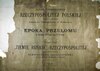
Українська: Населені пункти Тернопільщини. Aleksander Jabłonowski. Atlas historyczny Rzeczypospolitej Polskiej. |
|||||||||||||||||
| Date | 1889–1904 | |||||||||||||||||
| Source | Podlaska Biblioteka Cyfrowa | |||||||||||||||||
| Author |
|
|||||||||||||||||
| Other versions | ||||||||||||||||||
.jpg)
.png&action=edit§ion=1)
Licensing
[edit].png&action=edit§ion=2)
|
This work is in the public domain in its country of origin and other countries and areas where the copyright term is the author's life plus 70 years or fewer. | |
| This file has been identified as being free of known restrictions under copyright law, including all related and neighboring rights. | |
File history
Click on a date/time to view the file as it appeared at that time.
| Date/Time | Thumbnail | Dimensions | User | Comment | |
|---|---|---|---|---|---|
| current | 17:35, 13 August 2024 | | 392 × 420 (303 KB) | Максим Огородник (talk | contribs) | Uploaded a work by {{Creator:Aleksander Jabłonowski}} from [https://pbc.biaman.pl/dlibra/publication/835/edition/1571 Podlaska Biblioteka Cyfrowa] with UploadWizard |
You cannot overwrite this file.
File usage on Commons
There are no pages that use this file.
.png&oldid=927268450)
Categories:
- Atlas historyczny Rzeczypospolitej Polskiej
- Maps of Kovalivka, Ternopil Oblast
- Maps of Ozeriany, Buchach Hromada
- Maps of Hryhoriv
- Maps of Monastyryska
- Maps of Verbiatyn
- Maps of Bertnyky
- Maps of Chekhiv
- Maps of Dubenka, Ternopil Oblast
- Dolishnia Slobidka
- Huta, Ivano-Frankivsk Raion
- Maps of Komarivka, Chortkiv Raion
- Maps of Velesniv
- Maps of Zalishchyky (village)
- Maps of Zubrets
- Old maps of Novosilka, Buchach Hromada
- Koropets (river)
- Barysh (river)