File:Карта Морского канала Санкт-Петербурга. 1885.jpg
Jump to navigation
Jump to search

Size of this preview: 800 × 565 pixels. Other resolutions: 320 × 226 pixels | 640 × 452 pixels | 1,024 × 723 pixels | 1,280 × 904 pixels | 2,560 × 1,809 pixels | 3,554 × 2,511 pixels.
Original file (3,554 × 2,511 pixels, file size: 2.43 MB, MIME type: image/jpeg)
Captions
Captions
Add a one-line explanation of what this file represents
Summary
[edit]
| Description |
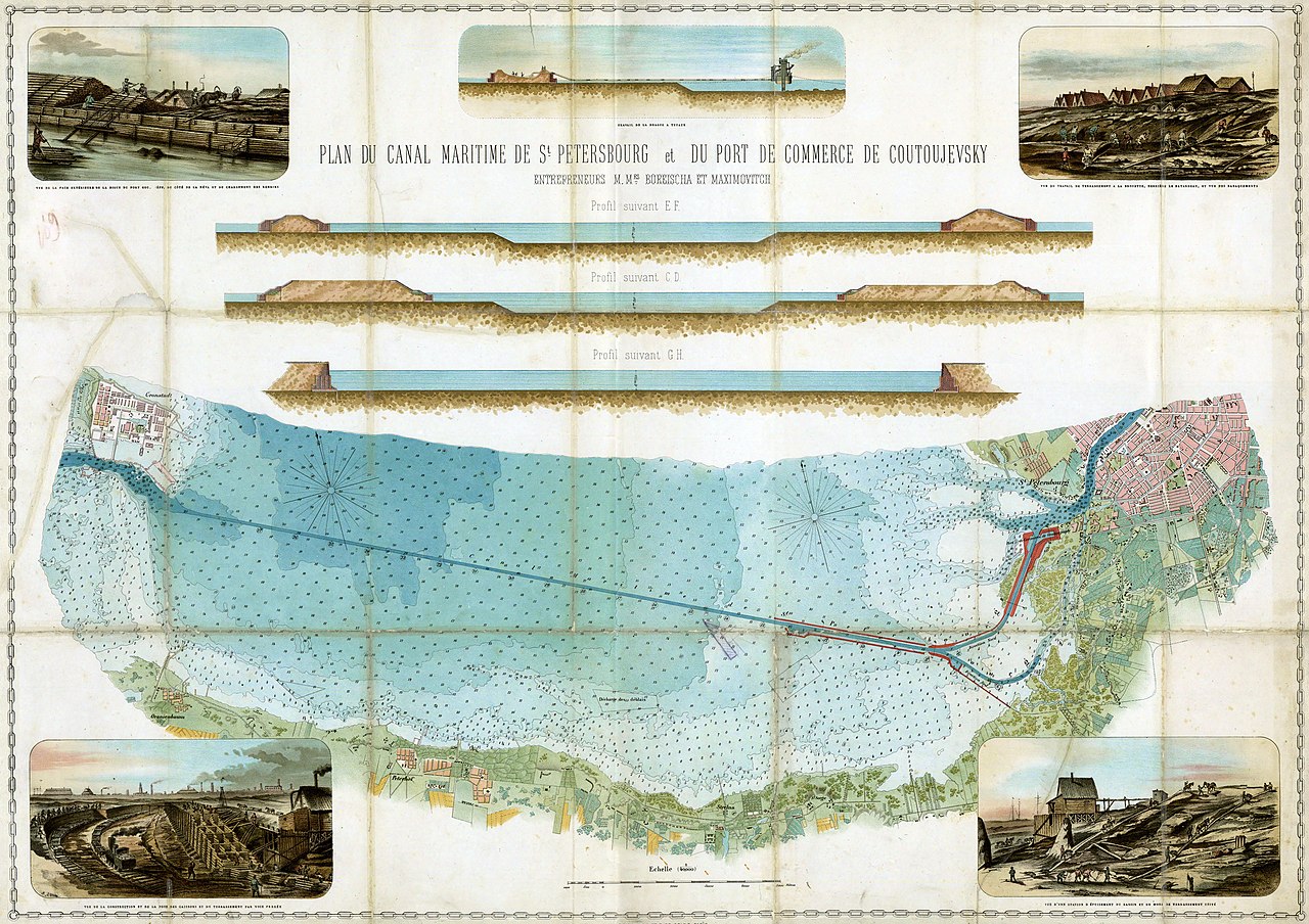
Русский: Карта Морского канала Санкт-Петербурга на французском языке. Изображены план и профиль канала, а также рисунки показывающие ход строительных работ |
| Date | between 1884 and 1886 |
| Source |
Центральный военно-морской музей. Санкт-Петербург http://navalmuseum.ru/Files/pdf/1441783195sudostroenie_3_2015.pdf |
| Author | Unknown author |
Licensing
[edit]
|
This work is in the public domain in its country of origin and other countries and areas where the copyright term is the author's life plus 70 years or fewer. | |
| This file has been identified as being free of known restrictions under copyright law, including all related and neighboring rights. | |
File history
Click on a date/time to view the file as it appeared at that time.
| Date/Time | Thumbnail | Dimensions | User | Comment | |
|---|---|---|---|---|---|
| current | 13:19, 12 October 2017 | | 3,554 × 2,511 (2.43 MB) | Germash19 (talk | contribs) | {{Information |Description ={{ru|1=Карта Морского канала Санкт-Петербурга на французском языке. Изображены план и профиль канала, а также рисунки показ... |
You cannot overwrite this file.
File usage on Commons
There are no pages that use this file.
File usage on other wikis
The following other wikis use this file:
- Usage on de.wikipedia.org
- Usage on ru.wikipedia.org
- Usage on uk.wikipedia.org