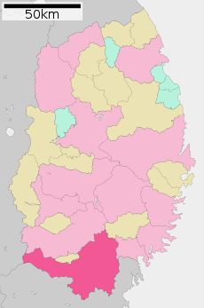
Category:Ichinoseki, Iwate
(Redirected from 一関市)
city in Iwate Prefecture, Japan | |||||
| Upload media | |||||
| Instance of | |||||
|---|---|---|---|---|---|
| Location | Iwate Prefecture, Japan | ||||
| Legal form |
| ||||
| Inception |
| ||||
| Population |
| ||||
| Area |
| ||||
| Replaces |
| ||||
| official website | |||||
 | |||||
Subcategories
This category has the following 10 subcategories, out of 10 total.
B
C
E
G
P
T
V
Media in category "Ichinoseki, Iwate"
The following 53 files are in this category, out of 53 total.
-
Emblem of Ichinoseki, Iwate.jpg 188 × 131; 7 KB
-
Emblem of Ichinoseki, Iwate.svg 450 × 291; 3 KB
-
Flag of Ichinoseki, Iwate.svg 900 × 600; 819 bytes
-
Ichinoseki city, Iwate prefecture Japan.svg 621 × 964; 19 KB
-
Ichinoseki in Iwate Prefecture Ja.svg 400 × 604; 16 KB
-
Ichinoseki in Iwate Prefecture.png 981 × 801; 33 KB
-
Population distribution of Ichinoseki, Iwate, Japan.svg 512 × 256; 22 KB
-
2004 Ichinoseki city.png 520 × 770; 25 KB
-
230727 Route 342 Ichinoseki Iwate pref Japan01s3.jpg 4,740 × 3,160; 12.77 MB
-
Area of Kubo-kawa river reservoir group Aerial photograph.1976.jpg 9,860 × 2,879; 22.42 MB
-
Arikiri-Tameike water reservoir Aerial photograph.1977.jpg 1,363 × 1,093; 1.28 MB
-
Earthquake-proof glass in Sahara-glass-park.jpg 1,280 × 960; 252 KB
-
Emblem of Ichinoseki, Iwate (1955–2005).svg 124 × 85; 2 KB
-
Flag of Former Ichinoseki Iwate.JPG 149 × 107; 4 KB
-
Former Ichinoseki Iwate chapter.JPG 68 × 42; 2 KB
-
Hagisho Civic Center Ichinono Branch Ground 202406.jpg 6,000 × 4,000; 10.36 MB
-
Hanaizumi ekimae (Ichinoseki city).JPG 2,592 × 1,944; 1.27 MB
-
Ichinoseki Athletic Stadium.jpg 1,622 × 1,000; 883 KB
-
Ichinoseki city center area Aerial photograph.1976.jpg 6,658 × 8,436; 41.31 MB
-
Ichinoseki city center area Aerial photograph.2011.jpg 9,207 × 7,105; 61.82 MB
-
Ichinoseki Football Field.jpg 1,870 × 1,010; 1,011 KB
-
Ichinoseki iwate japan.jpg 504 × 305; 190 KB
-
Ichinoseki Local Food "Mochi".jpg 640 × 480; 52 KB
-
Ichinoseki MIT IAT TVstation.JPG 3,936 × 5,248; 3.95 MB
-
Ichinoseki NHK TVstation.JPG 3,936 × 5,248; 4.35 MB
-
Ichinoseki Oyama TV Relay Station 202406.jpg 3,200 × 4,800; 7.55 MB
-
Ichinoseki Shinkin Sahara ATM.jpg 1,600 × 1,200; 429 KB
-
Ichinoseki TVI TVstation.JPG 3,936 × 5,248; 5.48 MB
-
Imaizumi Bridge Highway - panoramio.jpg 2,048 × 1,365; 940 KB
-
Iwai River(Iwate Prefecture Ichinoseki City) 1.jpg 5,184 × 3,888; 4.27 MB
-
Iwate Ichinoseki-city.png 256 × 306; 5 KB
-
JR Hanaizumi Station minami.JPG 2,592 × 1,944; 1.2 MB
-
KahoMochiAtSekinoichi01.JPG 2,620 × 2,087; 873 KB
-
Manhole cover in Geibikei.jpg 1,600 × 1,200; 791 KB
-
Michi hyakusen, Ichinoseki.jpg 1,446 × 1,085; 392 KB
-
Momonoyu Onsen - panoramio.jpg 2,048 × 1,365; 598 KB
-
N.S.P Memorial Spot Ichinoseki Iwate.jpg 4,032 × 3,024; 5.87 MB
-
Nishi3.jpg 542 × 344; 193 KB
-
Street in Iwate.jpg 1,920 × 1,080; 833 KB
-
Telephone.manhole.cover.in.ichinoseki.city.jpg 2,304 × 1,728; 1 MB
-
おいしいビール - panoramio.jpg 2,816 × 2,112; 3.01 MB
-
はためく旗 - panoramio (3).jpg 2,328 × 1,780; 1.78 MB
-
カフェ浮蓮渡 一関市 - panoramio.jpg 2,269 × 2,018; 2.45 MB
-
サハラの猫と鶏 - panoramio.jpg 2,374 × 2,031; 2.31 MB
-
一ノ関駅前にある看板.JPG 548 × 809; 101 KB
-
世界の願い交通安全 - panoramio.jpg 2,816 × 2,112; 3.37 MB
-
丸い電灯 - panoramio.jpg 2,816 × 2,112; 2.33 MB
-
南照井堰用水1.jpg 3,648 × 2,736; 3.83 MB
-
南照井堰用水2.jpg 3,648 × 2,736; 3.84 MB
-
基礎自治体位置図 03209.svg 600 × 970; 37 KB
-
室根からあげ.jpg 3,928 × 2,659; 1.67 MB
-
束稲山山頂のアンテナ群.jpg 5,472 × 3,648; 2.96 MB
-
栃が森、焼石連峰 Mt. Yakeishi ^ Tochiga-mori mountains - panoramio.jpg 1,600 × 1,071; 1.38 MB


