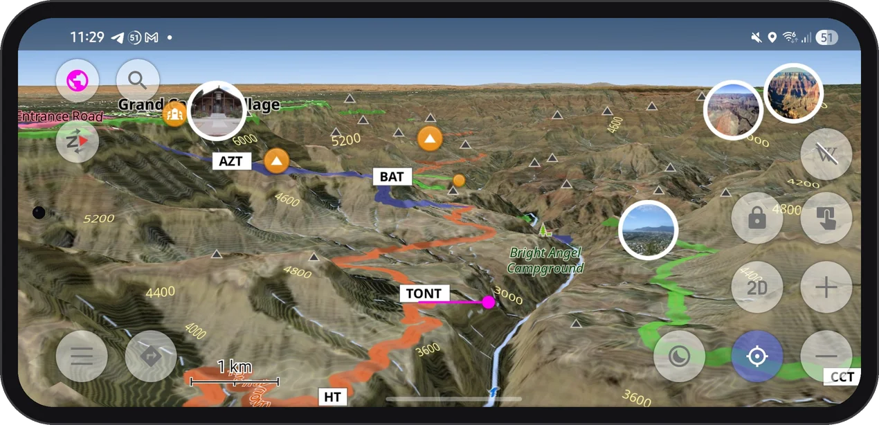
Your North America Terrain Maps Can Look Much Sharper
· 4 min read

If you hike, ski, or drive in North America, your OsmAnd terrain may already be much sharper than you think. Since spring 2026, terrain maps and contour lines for the United States (including Alaska), Canada, and Mexico are built from high-resolution national elevation data. If you have not updated these maps since then, you are still looking at the old, smoother relief.