Uploads by 21stCenturyGreenstuff
Jump to navigation
Jump to search
For 21stCenturyGreenstuff (talk · contributions · Move log · block log · uploads · Abuse filter log)
This special page shows all uploaded files that have not been deleted; for those see the upload log.
| Date | Name | Thumbnail | Size | Description |
|---|---|---|---|---|
| 21:56, 3 July 2011 | Carol Vorderman Waddington Airshow 2011 - 5.jpg (file) |  |
720 KB | |
| 21:54, 3 July 2011 | Carol Vorderman Waddington Airshow 2011 - 2.jpg (file) |  |
858 KB | |
| 21:52, 3 July 2011 | Carol Vorderman Waddington Airshow 2011 -3.jpg (file) |  |
538 KB | |
| 17:38, 3 July 2011 | Carol Vorderman Waddington Airshow 2011 -6.jpg (file) |  |
493 KB | {{Information |Description ={{en|1=Carol Vorderman posing after her charity presentation in hangar 4 at the RAF Waddington Airshow 2011}} |Source ={{own}} |Author =21stCenturyGreenstuff |Date =20 |
| 17:12, 30 June 2010 | Barry Island Railway station - Frontage.JPG (file) |  |
204 KB | {{Information |Description={{en|1=Frontage of Barry Island Railway station}} |Source={{own}} |Author=21stCenturyGreenstuff |Date=2010-06-30 |Permission= |other_versions=None }} The BR logo on the stonework related to Barry R |
| 07:46, 26 April 2010 | Skywatch.jpg (file) |  |
145 KB | {{Information |Description={{en|1=Photograph depicting Royal Observer Corps aircraft spotters in the period immediately after the Battle of Britain during 1941. Original taken in excess of 50 years ago and consequently now out of copyright under UK law.}} |
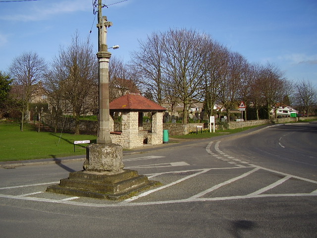
| 16:57, 22 April 2010 | Cranwell Village Centre.jpg (file) |  |
127 KB | {{Information |Description={{en|1=Cranwell village centre, showing the medieval buttercross}} |Source=http://www.geograph.org.uk |Author=Ken Brockway |Date=2007-03-10 |Permission= |other_versions=None available }} To illustrate the article on Cranwell, Li |
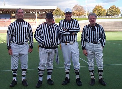
| 16:30, 21 April 2010 | BAFRA crew Saffron Lane.jpg (file) |  |
80 KB | {{Information |Description={{en|1=A British American Football Referees' Association (BAFRA) officiating crew at Saffron Lane Stadium, Leicester, UK preparing to officiate at a BYAFA National Bowl game.}} |Source={{own}} |Author=[[User:21stCenturyGreenstuf |
| 15:59, 19 May 2008 | Shrewsbury Group Control.jpg (file) |  |
36 KB | {{Information |Description=Shrewsbury 16 Group Shrewsbury, Group Control building |Source=self-made |Date=September 1987 |Author= 21stCenturyGreenstuff |Permission=Creative Commons Licence |other_versions= }} |
| 14:11, 19 May 2008 | Kingstown Industrial Estate, Carlisle.jpg (file) |  |
74 KB | {{Information |Description=Kingstown Industrial Estate |Source=Geograph |Date=29 October 2006 |Author=Adrian Taylor |Permission=Creative Commons Licence |other_versions= }} |
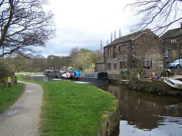
| 16:42, 9 May 2008 | Apperley Bridge.jpg (file) |  |
100 KB | {{Information |Description=Leeds Liverpool Canal |Source=Geograph |Date=5 April 2008 |Author=Geoff Pick |Permission=Creative Commons Licence |other_versions= }} |
| 16:32, 9 May 2008 | Woodhouse Grove.jpg (file) |  |
67 KB | {{Information |Description=School and playing field |Source=Geograph |Date=9 May 2008 |Author=Mick Melvin |Permission=Greative Commons Licence |other_versions= }} |
| 17:25, 1 May 2008 | St Andrews, Firsby.jpg (file) |  |
119 KB | {{Information |Description=St Andrew's Church, Firsby |Source=Geograph |Date=1 May 2008 |Author=Dave Hitchborne |Permission=Creative Commons Licence |other_versions= }} |
| 21:37, 27 April 2008 | Spilsby.jpg (file) |  |
62 KB | {{Information |Description=Spilsby Town Centre, showing Old Town Hall |Source=Geograph |Date=27 April 2008 |Author=Dave Hitchborne |Permission=Creative Commons Licence |other_versions= }} |
| 16:42, 19 April 2008 | Strata formation - Penarth cliffs.jpg (file) |  |
137 KB | {{Information |Description=Strata Formation - Cliffs near Penarth |Source=Geograph |Date=19 April 2008 |Author=Alan Bowring |Permission=Creative Commons Licence |other_versions= }} |
| 19:55, 16 April 2008 | The Westra, Dinas Powis.jpg (file) |  |
111 KB | {{Information |Description=The Westra, Dinas Powis |Source=Geograph |Date=16 April 2008 |Author=Peter Wasp |Permission=Creative Commons Licence |other_versions= }} |
| 19:17, 16 April 2008 | Cricket on Dinas Powys Common.jpg (file) |  |
73 KB | {{Information |Description=Cricket on the Common, Dinas Powys |Source=Geograph |Date=16 April 2008 |Author=Simon Hiscocks |Permission= Creative Commons Licence |other_versions= }} |
| 11:56, 16 April 2008 | Sully High Street.jpg (file) |  |
73 KB | {{Information |Description= |Source= |Date= |Author= |Permission= |other_versions= }} |
| 17:11, 21 March 2008 | Parc Cefn Onn, Lisvane.jpg (file) |  |
144 KB | {{Information |Description=Parc Cefn Onn, Lisvane |Source=Geograph |Date=21 March 2008 |Author=Steve Chapple |Permission=Creative Commons Licence |other_versions= }} |
| 23:51, 20 March 2008 | Sully Island.jpg (file) |  |
142 KB | {{Information |Description=Sully Island |Source=Geograph |Date=20 March 2008 |Author=Richard Knights |Permission=Creative Commons Licence |other_versions= }} |
| 23:30, 20 March 2008 | Lavernock Point.jpg (file) |  |
70 KB | {{Information |Description=Lavernock Point and Flat Holm |Source=Geograph |Date=20 March 2008 |Author=Penny Mayes |Permission=Creative Commons Licence |other_versions= }} |
| 23:22, 20 March 2008 | Victoria Park Canton.jpg (file) |  |
183 KB | {{Information |Description=Victoria Park, Canton, in summer |Source=Geograph |Date=20 March 2008 |Author=Peter Wasp |Permission=Creative Commons Licence |other_versions= }} |
| 23:17, 20 March 2008 | Ethel Street Canton.jpg (file) |  |
108 KB | {{Information |Description=A typical Canton Street |Source=Geograph |Date=20 March 2008 |Author=Steve Chappel |Permission=Creative Commons Licence |other_versions= }} |
| 23:10, 20 March 2008 | Canton Cross Vaults.jpg (file) |  |
101 KB | {{Information |Description=Canton Cross Valts |Source=Geograph |Date=20 March 2008 |Author=Colin Smith |Permission=Creative Commons Licence |other_versions= }} |
| 19:30, 20 March 2008 | Penarth Marina.jpg (file) |  |
111 KB | {{Information |Description=Penarth Marina Basin |Source=Geograph |Date=20 March 1980 |Author=Tony Hodge |Permission=Creative Commons Licence |other_versions= }} |
| 19:08, 20 March 2008 | Cosmeston medieval village.jpg (file) |  |
74 KB | {{Information |Description=Cosmeston Reconstructed Medieval Village |Source=Geograph |Date=20 March 2008 |Author=Andy Spenceley |Permission=Creative Commons Licence |other_versions= }} |
| 19:02, 20 March 2008 | Swans at Comeston Lakes Country Park (geograph 232385).jpg (file) | .jpg) |
114 KB | {{Information |Description=Cosmeston Lake water birds |Source=Geograph |Date=20 March 2008 |Author=Nigel Homer |Permission=Creative Commons Licence |other_versions= }} |
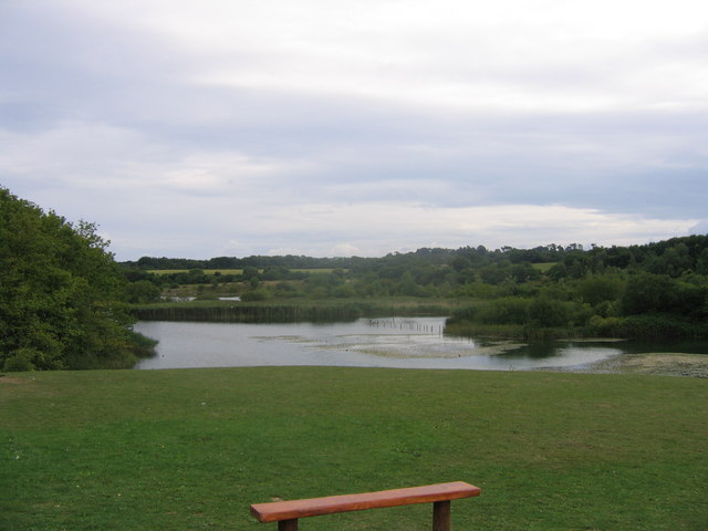
| 18:56, 20 March 2008 | Cosmeston Lake.jpg (file) |  |
51 KB | {{Information |Description=Cosmeston Lake |Source=Geograph |Date=20 March 2008 |Author=Andy Spenceley |Permission=Creative Commons Licence |other_versions= }} |
| 17:36, 20 March 2008 | Lyth Hill, Bayston Hill, South of Shrewsbury - geograph.org.uk - 129306.jpg (file) |  |
120 KB | {{Information |Description=View of the Wrekin from Lyth Hill |Source=Geograph |Date=20 March 2008 |Author=Keith Havercroft |Permission=Creative Commons Licence |other_versions= }} |
| 17:28, 20 March 2008 | Berries Lane, Bayston Hill (geograph 409901).jpg (file) | .jpg) |
91 KB | {{Information |Description=Berries Lane, Bayston Hill |Source=Geograph |Date=20 March 2008 |Author=Andrew Bennett |Permission=Creative Commons Licence |other_versions= }} |
| 16:23, 20 March 2008 | Roadsign in Bayston Hill (geograph 409880).jpg (file) | .jpg) |
88 KB | {{Information |Description=Roadsign in Bayston Hill |Source=Geograph |Date=20 March 2008 |Author=Andrew Bennett |Permission=http://creativecommons.org/licenses/by-sa/2.0/ |other_versions= }} |