File:Luftbild Ehemaliges Floriansmuehlbad.jpg
Jump to navigation
Jump to search
Size of this preview: 549 × 600 pixels. Other resolutions: 220 × 240 pixels | 439 × 480 pixels | 703 × 768 pixels | 1,222 × 1,335 pixels.
Original file (1,222 × 1,335 pixels, file size: 2.29 MB, MIME type: image/jpeg)
Captions
Captions
Add a one-line explanation of what this file represents
Summary
[edit]
| Description |
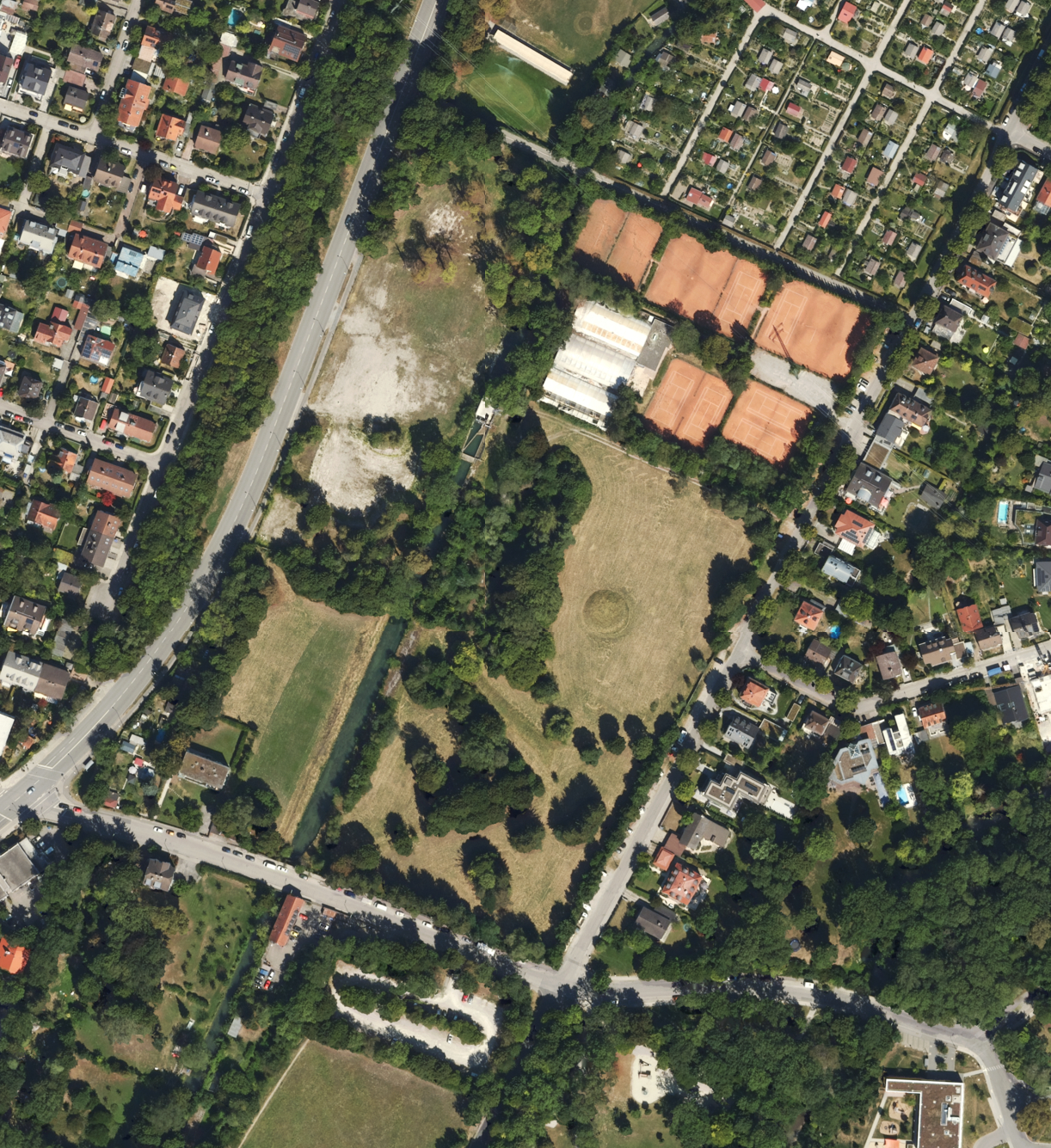
Deutsch: Luftbild des Geländes des ehemaligen Florianmühlbades (München/Freimann) |
| Date | 2020s |
| Source |
This file was derived from: |
| Author | Photograph: Bayerische Vermessungsverwaltung – www.geodaten.bayern.de / Bearbeitung (Zusammengefügt u. beschnitten, Helligkeit und Kontrast angepasst): Christoph Waghubinger (Lewenstein) |
Licensing
[edit]
This file is licensed under the Creative Commons Attribution 4.0 International license.
- You are free:
- to share – to copy, distribute and transmit the work
- to remix – to adapt the work
- Under the following conditions:
- attribution – You must give appropriate credit, provide a link to the license, and indicate if changes were made. You may do so in any reasonable manner, but not in any way that suggests the licensor endorses you or your use.
File history
Click on a date/time to view the file as it appeared at that time.
| Date/Time | Thumbnail | Dimensions | User | Comment | |
|---|---|---|---|---|---|
| current | 17:21, 20 June 2024 | | 1,222 × 1,335 (2.29 MB) | Lewenstein (talk | contribs) | {{Information |description={{de|1=Luftbild des Geländes des ehemaligen Florianmühlbades (München/Freimann)}} |date={{otherdate|s|2020}} |source={{Derived from|1=DOP40 - Landkreis München 32695 5341 (Bayerische Vermessungsverwaltung).tif|2=DOP40 - Stadt München 32694 5340 (Bayerische Vermessungsverwaltung).tif|3=DOP40 - Stadt München 32694 5341 (Bayerische Vermessungsverwaltung).tif|4=DOP40 - Landkreis München 32695 5340 (Bayerische Vermessungsverwaltung).tif}} |author={{Photo}}: Bayerische Ve... |
You cannot overwrite this file.
File usage on Commons
There are no pages that use this file.
File usage on other wikis
The following other wikis use this file:
- Usage on de.wikipedia.org