File:Lee Moor claypit 1979 - geograph.org.uk - 65094.jpg
Jump to navigation
Jump to search
Size of this preview: 602 × 599 pixels. Other resolutions: 241 × 240 pixels | 482 × 480 pixels | 640 × 637 pixels.
Original file (640 × 637 pixels, file size: 128 KB, MIME type: image/jpeg)
Captions
Captions
Add a one-line explanation of what this file represents
Summary
[edit]
| Description |
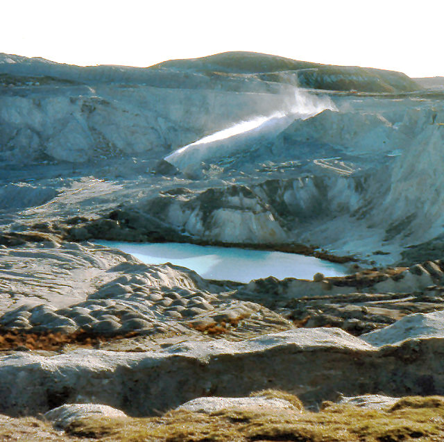
English: Lee Moor claypit 1979. Clay mining by giant hose. Photograph taken in south westerly direction from the road from Cadover Bridge near Blackaton Cross as marked on the 1940's OS 1" map. This road is no longer a through road. At the time of the photograph the workings came close to the edge of the road. |
| Date | |
| Source | From geograph.org.uk |
| Author | Crispin Purdye |
| Attribution (required by the license) | Crispin Purdye / Lee Moor claypit 1979 / |
| Camera location | | View this and other nearby images on: OpenStreetMap |
|---|
_&language=en)
| Object location | | View this and other nearby images on: OpenStreetMap |
|---|
_&language=en)
Licensing
[edit]

|
This image was taken from the Geograph project collection. See this photograph's page on the Geograph website for the photographer's contact details. The copyright on this image is owned by Crispin Purdye and is licensed for reuse under the Creative Commons Attribution-ShareAlike 2.0 license.
|
This file is licensed under the Creative Commons Attribution-Share Alike 2.0 Generic license.
Attribution: Crispin Purdye
- You are free:
- to share – to copy, distribute and transmit the work
- to remix – to adapt the work
- Under the following conditions:
- attribution – You must give appropriate credit, provide a link to the license, and indicate if changes were made. You may do so in any reasonable manner, but not in any way that suggests the licensor endorses you or your use.
- share alike – If you remix, transform, or build upon the material, you must distribute your contributions under the same or compatible license as the original.
File history
Click on a date/time to view the file as it appeared at that time.
| Date/Time | Thumbnail | Dimensions | User | Comment | |
|---|---|---|---|---|---|
| current | 20:53, 14 December 2016 | | 640 × 637 (128 KB) | Smalljim (talk | contribs) | adjust contrast and colour balance |
| 16:32, 30 January 2010 |  | 640 × 637 (124 KB) | GeographBot (talk | contribs) | == {{int:filedesc}} == {{Information |description={{en|1=Lee Moor claypit 1979. Clay mining by giant hose. Photograph taken in south westerly direction from the road from Cadover Bridge near Blackaton Cross as marked on the 1940's OS 1" map. This road is |
You cannot overwrite this file.
File usage on Commons
There are no pages that use this file.
File usage on other wikis
The following other wikis use this file:
- Usage on de.wikipedia.org
- Usage on en.wikipedia.org