File:Granite tramway, Holwell Tor - geograph.org.uk - 1233076.jpg
Jump to navigation
Jump to search
No higher resolution available.
Granite_tramway,_Holwell_Tor_-_geograph.org.uk_-_1233076.jpg (640 × 480 pixels, file size: 113 KB, MIME type: image/jpeg)
Captions
Captions
Add a one-line explanation of what this file represents
Summary
[edit]| Description |
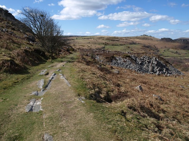
English: Granite tramway, Holwell Tor. A reverse view down the length of tramway shown in 1233043, with a spoilheap on the right indicating a quarry face to the left at the same point. In the foreground is a junction of two tracks.
From http://www.9fairfield.eclipse.co.uk/haytor/fmatextrac.htm "The vehicles that were on use on the tramway were probably slightly adapted flat-topped road wagons which were usually lined up twelve at a time to make the train. In 1918, H.L. Hopwood wrote when records were still available and remains were still around that the vehicles were about 13 ft long with a wheel base of about 10 ft. The wheels were 2 ft in diameter and 3 inches wide on tread and were loose on the axles. The wheels were flangeless. The breaking system was a primitive using a 10-12 ft pole which was manually applied to the wheel rim. This device must have been on constant use during descent although the built in friction between the track and the wheels will have helped slow down the vehicle. A local jingle tells of there being 18 horses to a train of 12 cars." |
||
| Date | |||
| Source | From geograph.org.uk | ||
| Author | Derek Harper | ||
| Permission (Reusing this file) |
This file is licensed under the Creative Commons Attribution-Share Alike 2.0 Generic license. Attribution: Derek Harper
|
||
| Attribution (required by the license) | Derek Harper / Granite tramway, Holwell Tor / | ||

| Camera location | | View this and other nearby images on: OpenStreetMap |
|---|
_heading:292.00&language=en)
| Object location | | View this and other nearby images on: OpenStreetMap |
|---|
_heading:292.00&language=en)
File history
Click on a date/time to view the file as it appeared at that time.
| Date/Time | Thumbnail | Dimensions | User | Comment | |
|---|---|---|---|---|---|
| current | 13:18, 26 February 2011 | | 640 × 480 (113 KB) | GeographBot (talk | contribs) | == {{int:filedesc}} == {{Information |description={{en|1=Granite tramway, Holwell Tor A reverse view down the length of tramway shown in 1233043, with a spoilheap on the right indicating a quarry face to the left at the same point. In the foreground i |
You cannot overwrite this file.
File usage on Commons
There are no pages that use this file.