File:Aglais io (47925484886).jpg

Original file (2,725 × 2,411 pixels, file size: 4.51 MB, MIME type: image/jpeg)
Captions
Captions
Summary
[edit]| DescriptionAglais io (47925484886).jpg |
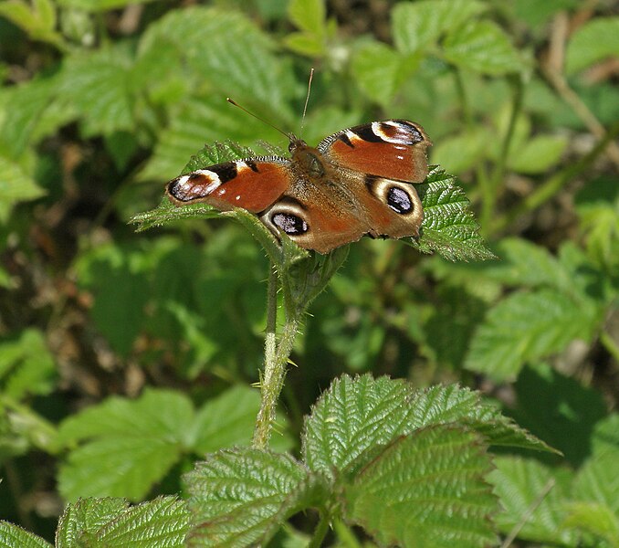
Peacock Butterfly The stream flowing from Bedworth Slough forms a brook which flows south, under Newtown Road, between the housing to Rectory Drive and then continues beside Silk Weavers Way to cross beneath the A444. It runs parallel to Bowling Green Lane, crossing School Lane to feed the moat of Tudor Court, beneath the M6 and thence across the fields behind St Giles Church. Here it is joined by the Breach Brook. It passes back under the A444 to Sowe Meadows Nature Park, under Rowley's Green Lane, the railway line and finally Grindle Road, where it is just visible as it is culverted beneath the housing and adjacent Coventry canal, thence across Longford Community Nature Reserve to the Longford Road. From here it emerges into the green oasis of Longford Park to exit not far from Alderman's Green Road. The River Sowe is a river in Warwickshire and West Midlands. It is a tributary of the River Avon, and flows into it just south of Stoneleigh about 5 miles (8 km) south of Coventry. It is about 12 miles (19 km) long. The Sowe rises in Bedworth 5.5 miles (9 km) to the north of Coventry. Its route takes it through Exhall near to Junction 3 of the M6 motorway and the A444 road, to the northern and then the eastern suburbs of Coventry, in particular the districts of Longford, Wood End, Walsgrave, Binley, Willenhall and near the village of Baginton. Near Baginton the river has a large steep bank on its southern side and the remains of the Roman Lunt Fort have been found at the top of this bank. There is an established local park called the Sowe Valley Footpath that runs alongside the river for 8½ miles from Hawkesbury Junction Conservation Area to Stonebridge Meadows Local Nature. It also runs through Wyken Slough Local Nature Reserve, Wyken Croft Nature Park and Stoke Floods Local Nature Reserve. |
| Date | |
| Source | Coventry's Other River. The Sowe: Bedworth to Longford Park: Church Lane, Exhall to A444 Crossing |
| Author | Amanda Slater from Coventry, West Midlands, UK |
| Camera location | 52° 27′ 38.43″ N, 1° 29′ 53.24″ W | View this and other nearby images on: OpenStreetMap |
|---|
Licensing
[edit]- You are free:
- to share – to copy, distribute and transmit the work
- to remix – to adapt the work
- Under the following conditions:
- attribution – You must give appropriate credit, provide a link to the license, and indicate if changes were made. You may do so in any reasonable manner, but not in any way that suggests the licensor endorses you or your use.
- share alike – If you remix, transform, or build upon the material, you must distribute your contributions under the same or compatible license as the original.
| This image was originally posted to Flickr by amandabhslater at https://flickr.com/photos/15181848@N02/47925484886. It was reviewed on 22 April 2020 by FlickreviewR 2 and was confirmed to be licensed under the terms of the cc-by-sa-2.0. |
22 April 2020
File history
Click on a date/time to view the file as it appeared at that time.
| Date/Time | Thumbnail | Dimensions | User | Comment | |
|---|---|---|---|---|---|
| current | 15:22, 22 April 2020 |  | 2,725 × 2,411 (4.51 MB) | Killarnee (talk | contribs) | Transferred from Flickr via #flickr2commons |
You cannot overwrite this file.
File usage on Commons
The following page uses this file:
Metadata
This file contains additional information such as Exif metadata which may have been added by the digital camera, scanner, or software program used to create or digitize it. If the file has been modified from its original state, some details such as the timestamp may not fully reflect those of the original file. The timestamp is only as accurate as the clock in the camera, and it may be completely wrong.
| Image title |
|
|---|---|
| Camera manufacturer | OLYMPUS IMAGING CORP. |
| Camera model | u1060,S1060 |
| Exposure time | 1/500 sec (0.002) |
| F-number | f/5.1 |
| ISO speed rating | 64 |
| Date and time of data generation | 14:59, 22 May 2019 |
| Lens focal length | 28.1 mm |
| Orientation | Normal |
| Horizontal resolution | 72 dpi |
| Vertical resolution | 72 dpi |
| Software used | Adobe Photoshop Elements 8.0 Windows |
| File change date and time | 17:19, 22 May 2019 |
| Y and C positioning | Co-sited |
| Exposure Program | Normal program |
| Exif version | 2.21 |
| Date and time of digitizing | 14:59, 22 May 2019 |
| Meaning of each component |
|
| Image compression mode | 2 |
| APEX exposure bias | −1 |
| Maximum land aperture | 3.61 APEX (f/3.49) |
| Metering mode | Spot |
| Light source | Unknown |
| Flash | Flash did not fire, compulsory flash suppression |
| Supported Flashpix version | 1 |
| Color space | sRGB |
| File source | Digital still camera |
| Scene type | A directly photographed image |
| Custom image processing | Normal process |
| Exposure mode | Manual exposure |
| White balance | Auto white balance |
| Digital zoom ratio | 0 |
| Focal length in 35 mm film | 159 mm |
| Scene capture type | Standard |
| Scene control | None |
| Contrast | Normal |
| Saturation | Normal |
| Sharpness | Normal |
| Supported Flashpix version | 1 |
| Image width | 2,725 px |
| Image height | 2,411 px |
| Date metadata was last modified | 18:19, 22 May 2019 |
| Unique ID of original document | xmp.did:2E0D025CAC7CE911AC13BDD08682415F |