File:2011 Lake Martin EF2 damage Alabama State Route 9.png
(Redirected from File:2011 Lake Martin EF@ damage C. Plank Road.png)
No higher resolution available.
2011_Lake_Martin_EF2_damage_Alabama_State_Route_9.png (795 × 526 pixels, file size: 546 KB, MIME type: image/png)
Captions
Captions
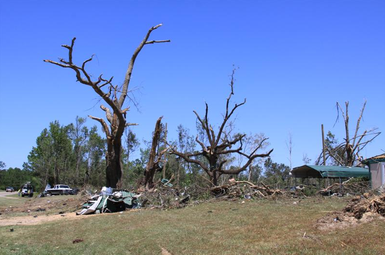
EF2 damage to trees located on SR 9.
Summary
[edit]
| Description |
English: EF2 damage to trees located on SR 9. |
| Date | |
| Source | https://apps.dat.noaa.gov/StormDamage/DamageViewer/ |
| Author | Unknown author |
Licensing
[edit]
This file is in the public domain in the United States because it was solely created by employees of the National Weather Service or National Severe Storms Laboratory using the Damage Assessment Toolkit (DAT), an interactive map and database.
|

|
This media file is uncategorized.
Please help improve this media file by adding it to one or more categories, so it may be associated with related media files (how?), and so that it can be more easily found.
Please notify the uploader with {{subst:Please link images|File:2011 Lake Martin EF2 damage Alabama State Route 9.png}} ~~~~ |
File history
Click on a date/time to view the file as it appeared at that time.
| Date/Time | Thumbnail | Dimensions | User | Comment | |
|---|---|---|---|---|---|
| current | 19:02, 29 July 2024 | | 795 × 526 (546 KB) | Sir MemeGod (talk | contribs) | Uploaded a work by {{Unknown|author}} from https://apps.dat.noaa.gov/StormDamage/DamageViewer/ with UploadWizard |
You cannot overwrite this file.
File usage on Commons
The following page uses this file:
- File:2011 Lake Martin EF@ damage C. Plank Road.png (file redirect)
File usage on other wikis
The following other wikis use this file:
- Usage on en.wikipedia.org