Commons:Wiki Loves Monuments in Switzerland/Lucerne/A-I
Jump to navigation
Jump to search
Adligenswil
| Location | Upload | Photo | Object | Cat. | Coordinates | KGS-Nr | |
|---|---|---|---|---|---|---|---|
| Adligenswil | 
|
Kapelle Dottenberg | B | 47°04′51″N 8°22′46″E / 47.080806°N 8.379503°E | 3625 | ||
| Adligenswil | 
|
Katholische Kirche St. Martin | B | 47°04′14″N 8°21′54″E / 47.07045°N 8.36504°E | 3624 | ||
| Adligenswil | 
|
Dottenberg | ISOS | 47°04′52″N 8°22′45″E / 47.0811°N 8.3793°E | |||
Aesch
| Location | Upload | Photo | Object | Cat. | Coordinates | KGS-Nr | |
|---|---|---|---|---|---|---|---|
| Aesch | 
|
Katholische Kirche St. Luzia mit Pfarrhaus | B | 47°15′31″N 8°14′00″E / 47.258486°N 8.233463°E | 3626 | ||
Alberswil
| Location | Upload | Photo | Object | Cat. | Coordinates | KGS-Nr | |
|---|---|---|---|---|---|---|---|
| Alberswil | 
|
Schweizerisches Agrarmuseum Burgrain | A | 47°08′36″N 8°00′00″E / 47.143204°N 7.999864°E | 8587 | ||
| Alberswil | 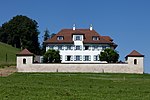
|
Herrenhaus Kastelen | B | 47°08′54″N 7°59′48″E / 47.148378426°N 7.996758167°E | 3627 | ||
| Alberswil | 
|
Kapelle St. Blasius | B | 47°08′31″N 7°59′53″E / 47.141913863°N 7.998022274°E | 3628 | ||
| Alberswil | 
|
Kulturlandschaft Kastelen | ISOS | 47°08′50″N 7°59′59″E / 47.1472°N 7.9997°E | |||
| Alberswil | 
|
Ruine Kastelen | A | 47°08′49″N 7°59′35″E / 47.146944°N 7.992994°E | 3629 | ||
Altbüron
| Location | Upload | Photo | Object | Cat. | Coordinates | KGS-Nr | |
|---|---|---|---|---|---|---|---|
| Altbüron | 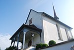
|
Kapelle St. Antonius von Padua | B | 47°10′48″N 7°52′56″E / 47.179900624°N 7.88233619°E | 3631 | ||
Altishofen
| Location | Upload | Photo | Object | Cat. | Coordinates | KGS-Nr | |
|---|---|---|---|---|---|---|---|
| Altishofen | 
|
Altishofen | ISOS | 47°11′59″N 7°58′00″E / 47.199722222°N 7.966666666°E | |||
| Altishofen | 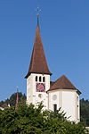
|
Katholische Kirche St. Martin mit Pfarrhaus | B | 47°12′06″N 7°57′37″E / 47.201584122°N 7.960292396°E | 3632 | ||
| Altishofen | 
|
Schloss mit Oekonomiegebäuden | B | 47°12′04″N 7°57′34″E / 47.20109307°N 7.959482507°E | 3633 | ||
Ballwil
| Location | Upload | Photo | Object | Cat. | Coordinates | KGS-Nr | |
|---|---|---|---|---|---|---|---|
| Ballwil | 
|
Katholische Kirche St. Margaretha | B | 47°09′08″N 8°19′14″E / 47.152251°N 8.320638°E | 3634 | ||
Beromünster
| Location | Upload | Photo | Object | Cat. | Coordinates | KGS-Nr | |
|---|---|---|---|---|---|---|---|
| Beromünster | 
|
Sammlung Dr. Edmund Müller | B | 47°12′23″N 8°11′30″E / 47.20628°N 8.19179°E | 8577 | ||
| Beromünster | 
|
Haus zum Dolder | B | 47°12′22″N 8°11′30″E / 47.206235°N 8.191768°E | 3640 | ||
| Beromünster | 
|
Kirchenschatz (Beromünster) | A | 8621 | |||
| Beromünster | 
|
Stiftsbibliothek Chorherrenstift St. Michael Beromünster | A | 9304 | |||
| Beromünster | 
|
Chorherren- und Pfrundhäuser Nordgruppe (Häuser Stift 5, 6, 7-11, 13-17, 19, 20, 22-23, 24, 25, 26) | A | 3636 | |||
| Beromünster | 
|
Chorherren- und Pfrundhäuser Südgruppe (Häuser Stift 33, 35, 38, 40, 41, 43 sowie Badweg 2, 4) | A | 10094 | |||
| Beromünster | 
|
Ehemaliges Amthaus (Gasthof Hirschen) | A | 3638 | |||
| Beromünster | 
|
Kustorei | A | 10095 | |||
| Beromünster | 
|
Propstei | A | 3642 | |||
| Beromünster | 
|
Stiftsarchiv Beromünster | A | 8908 | |||
| Beromünster | 
|
Stiftskirche, Stift | A | 3637 | |||
| Beromünster | 
|
Wallfahrtskirche Gormund mit Kaplanei | A | 3847 | |||
| Beromünster | 
|
Beinhaus der Katholischen Kirche St. Agatha | B | 47°10′36″N 8°12′35″E / 47.17666147°N 8.20976303°E | 16146 | ||
| Beromünster | 
|
Katholische Kirche St. Agatha | B | 47°10′36″N 8°12′36″E / 47.176551322°N 8.210091257°E | 3848 | ||
| Beromünster | 
|
Katholische Kirche St. Stephan | B | 47°12′25″N 8°11′36″E / 47.206854°N 8.193361°E | 3639 | ||
| Beromünster | 
|
Mooskapelle | B | 3641 | |||
| Beromünster | 
|
Pfarrhaus der katholischen Kirche St. Agatha | B | 47°10′35″N 8°12′36″E / 47.17629065°N 8.21006112°E | 16147 | ||
| Beromünster | 
|
Saffental, gemauerter Speicher (1575), in Gunzwil | B | 47°12′11″N 8°09′30″E / 47.203080237°N 8.158364845°E | 3682 | ||
| Beromünster | 
|
Schloss (Heimatmuseum) | B | 47°11′44″N 8°12′36″E / 47.195677°N 8.209865°E | 3643 | ||
| Beromünster | 
|
Blosenbergturm | A | 47°11′22″N 8°10′31″E / 47.189555555°N 8.175416666°E | 10093 | ||
| Beromünster | 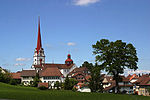
|
Beromünster | ISOS | 47°11′59″N 8°12′00″E / 47.199722222°N 8.2°E | |||
Buchrain
| Location | Upload | Photo | Object | Cat. | Coordinates | KGS-Nr | |
|---|---|---|---|---|---|---|---|
| Buchrain | 
|
Perlen, katholische Kirche (Wandzyklus v. Pietro Chiesa) | B | 47°06′37″N 8°21′40″E / 47.110364835°N 8.361150008°E | 3645 | ||
| Buchrain | 
|
Perlen LU | ISOS | 47°06′36″N 8°22′03″E / 47.1101°N 8.3675°E | |||
Büron
| Location | Upload | Photo | Object | Cat. | Coordinates | KGS-Nr | |
|---|---|---|---|---|---|---|---|
| Büron | 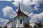
|
Katholische Kirche St. Gallus und Urban | B | 47°12′59″N 8°05′47″E / 47.216264°N 8.096329°E | 3647 | ||
| Büron | 
|
Pfarrhaus der katholischen Kirche St. Gallus und Urban | B | 47°12′57″N 8°05′44″E / 47.21595019°N 8.09543288°E | 16148 | ||
Buttisholz
| Location | Upload | Photo | Object | Cat. | Coordinates | KGS-Nr | |
|---|---|---|---|---|---|---|---|
| Buttisholz | 
|
St. Ottilien (Buttisholz) | B | 47°06′06″N 8°05′58″E / 47.10174°N 8.09945°E | 3651 | ||
| Buttisholz | 
|
Schloss und Schlossgut | A | 47°06′54″N 8°05′49″E / 47.115101°N 8.097011°E | 3649 | ||
| Buttisholz | 
|
Sammlung Schloss Buttisholz (Bernhard und Gaby Pfyffer-Feer zu Buttisholz) | B | 47°06′55″N 8°05′49″E / 47.11514°N 8.09707°E | 10638 | ||
| Buttisholz | 
|
Buttisholz | ISOS | 47°06′49″N 8°05′40″E / 47.113611111°N 8.094444444°E | |||
Dagmersellen
| Location | Upload | Photo | Object | Cat. | Coordinates | KGS-Nr | |
|---|---|---|---|---|---|---|---|
| Dagmersellen | 
|
Chammeren, römischer Gutshof | B | 47°12′19″N 8°02′50″E / 47.205381°N 8.047095°E | 3646 | ||
| Dagmersellen | 
|
Katholische Kirche St. Laurentius | B | 16149 | |||
| Dagmersellen | 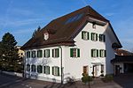
|
Pfarrhaus der katholischen Kirche St. Laurentius | B | 47°12′50″N 7°59′23″E / 47.213779274°N 7.989677592°E | 3652 | ||
Dierikon
| Location | Upload | Photo | Object | Cat. | Coordinates | KGS-Nr | |
|---|---|---|---|---|---|---|---|
| Dierikon | 
|
Dierikon | ISOS | 47°05′49″N 8°22′17″E / 47.096944444°N 8.371388888°E | |||
| Dierikon | 
|
Schlössli Götzental mit Kapelle | A | 47°05′30″N 8°22′37″E / 47.091792°N 8.376996°E | 3653 | ||
Doppleschwand
| Location | Upload | Photo | Object | Cat. | Coordinates | KGS-Nr | |
|---|---|---|---|---|---|---|---|
| Doppleschwand | 
|
Katholische Kirche St. Nikolaus | B | 47°01′08″N 8°03′20″E / 47.01891°N 8.05545°E | 3654 | ||
Ebikon
| Location | Upload | Photo | Object | Cat. | Coordinates | KGS-Nr | |
|---|---|---|---|---|---|---|---|
| Ebikon | 
|
Erziehungsheim Rathausen | B | 47°04′49″N 8°18′43″E / 47.08017°N 8.311937°E | 3656 | ||
| Ebikon | 
|
Schindler Group, Historisches Archiv | B | 47°05′19″N 8°21′06″E / 47.088733839°N 8.351755786°E | 10585 | ||
| Ebikon | 
|
Landsitz Hünenberg | B | 47°04′02″N 8°19′06″E / 47.067343274°N 8.318254189°E | 3655 | ||
Egolzwil
| Location | Upload | Photo | Object | Cat. | Coordinates | KGS-Nr | |
|---|---|---|---|---|---|---|---|
| Egolzwil | Wauwilermoos (Egolzwil, Wauwil, Schötz, Ettiswil, Mauensee) paläolithisch-neolithische Ufersiedlung | A | 3657 | ||||
| Egolzwil | 
|
Katholische Kirche Herz Jesu | B | 47°11′06″N 8°00′46″E / 47.184936445°N 8.012826384°E | 3658 | ||
Eich
| Location | Upload | Photo | Object | Cat. | Coordinates | KGS-Nr | |
|---|---|---|---|---|---|---|---|
| Eich | 
|
Katholische Kirche St. Laurentius | B | 47°09′11″N 8°10′10″E / 47.152948°N 8.169393°E | 3659 | ||
Emmen
| Location | Upload | Photo | Object | Cat. | Coordinates | KGS-Nr | |
|---|---|---|---|---|---|---|---|
| Emmen | 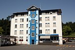
|
Von Moos Stahl AG, Historisches Archiv | A | 47°04′13″N 8°16′03″E / 47.070181°N 8.267602°E | 8805 | ||
| Emmen | 
|
Flugzeugmontagehalle RUAG | A | 47°05′24″N 8°18′36″E / 47.08991°N 8.30987°E | 10097 | ||
| Emmen | 
|
Rothenburger Brücke | A | 10098 | |||
| Emmen | 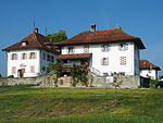
|
Landsitz Holzhof | B | 47°05′08″N 8°13′52″E / 47.085591506°N 8.231026232°E | 3660 | ||
Entlebuch
| Location | Upload | Photo | Object | Cat. | Coordinates | KGS-Nr | |
|---|---|---|---|---|---|---|---|
| Entlebuch | 
|
Katholische Kirche St. Martin | B | 46°59′32″N 8°03′53″E / 46.99219°N 8.064662°E | 3661 | ||
Ermensee
| Location | Upload | Photo | Object | Cat. | Coordinates | KGS-Nr | |
|---|---|---|---|---|---|---|---|
| Ermensee | 
|
Ermensee | ISOS | 47°13′59″N 8°14′00″E / 47.233055555°N 8.233333333°E | |||
Eschenbach
| Location | Upload | Photo | Object | Cat. | Coordinates | KGS-Nr | |
|---|---|---|---|---|---|---|---|
| Eschenbach | 
|
Kloster Eschenbach | B | 47°07′58″N 8°19′14″E / 47.132818°N 8.320573°E | 3662 | ||
Escholzmatt-Marbach
| Location | Upload | Photo | Object | Cat. | Coordinates | KGS-Nr | |
|---|---|---|---|---|---|---|---|
| Escholzmatt-Marbach | 
|
Entlebucher Heimatarchiv | B | 46°54′52″N 7°56′06″E / 46.914371°N 7.935125°E | 10586 | ||
| Escholzmatt-Marbach | 
|
Katholische Kirche St. Jakob | B | 46°54′50″N 7°56′05″E / 46.913941°N 7.934727°E | 3664 | ||
| Escholzmatt-Marbach | 
|
Marbach | ISOS | 46°51′15″N 7°54′00″E / 46.854166666°N 7.9°E | |||
Ettiswil
| Location | Upload | Photo | Object | Cat. | Coordinates | KGS-Nr | |
|---|---|---|---|---|---|---|---|
| Ettiswil | 
|
Schloss Wyher | B | 47°08′32″N 8°01′25″E / 47.142087°N 8.0237°E | 3667 | ||
| Ettiswil | Wauwilermoos (Egolzwil, Wauwil, Schötz, Ettiswil, Mauensee), paläolitisch-neolithische Ufersiedlungen | A | 11748 | ||||
| Ettiswil | 
|
Bauernhaus des Schloss Wyher | B | 47°08′29″N 8°01′22″E / 47.14140427°N 8.02273566°E | 16154 | ||
| Ettiswil | 
|
Einsiedlerhof bei der katholischen Kirche St. Maria und St. Stephan | B | 47°08′58″N 8°01′03″E / 47.14932899°N 8.0174029°E | 16150 | ||
| Ettiswil | 
|
Friedhofkapelle der katholischen Kirche St. Maria und St. Stephan | B | 47°09′01″N 8°01′04″E / 47.15025425°N 8.0176502°E | 16151 | ||
| Ettiswil | 
|
Kapellsigristenhaus | B | 47°09′05″N 8°00′59″E / 47.15144732°N 8.01651586°E | 16153 | ||
| Ettiswil | 
|
Katholische Kirche St. Maria und St. Stephan | B | 47°09′00″N 8°01′04″E / 47.15°N 8.01765°E | 3665 | ||
| Ettiswil | 
|
Kornspeicher Bisang / Bucher | B | 47°09′40″N 8°02′42″E / 47.161226°N 8.04501°E | 3712 | ||
| Ettiswil | 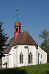
|
Sakramentskapelle | B | 47°09′05″N 8°00′58″E / 47.15148°N 8.016155°E | 3666 | ||
| Ettiswil | 
|
Schlosskapelle Schloss Wyher | B | 47°08′29″N 8°01′18″E / 47.14149024°N 8.02174785°E | 16155 | ||
| Ettiswil | 
|
St. Annakapelle | B | 47°09′06″N 8°00′59″E / 47.1515378°N 8.01641135°E | 16152 | ||
| Ettiswil | 
|
Seewagen | ISOS | 47°10′15″N 8°02′34″E / 47.1709°N 8.0429°E | |||
| Ettiswil | 
|
Kulturlandschaft Kastelen | ISOS | 47°08′50″N 7°59′59″E / 47.1472°N 7.9997°E | |||
Fischbach
| Location | Upload | Photo | Object | Cat. | Coordinates | KGS-Nr | |
|---|---|---|---|---|---|---|---|
| Fischbach | 
|
Kapelle St. Aper | B | 47°09′22″N 7°54′28″E / 47.156142499°N 7.907840398°E | 3668 | ||
Flühli
| Location | Upload | Photo | Object | Cat. | Coordinates | KGS-Nr | |
|---|---|---|---|---|---|---|---|
| Flühli | 
|
Falkenbach, Bauernhaus (um 1750) | B | 46°53′51″N 7°59′31″E / 46.897577°N 7.991912°E | 3669 | ||
| Flühli | 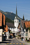
|
Katholische Kirche St. Josef | B | 46°53′05″N 8°00′55″E / 46.884778°N 8.015266°E | 3670 | ||
Gettnau
| Location | Upload | Photo | Object | Cat. | Coordinates | KGS-Nr | |
|---|---|---|---|---|---|---|---|
| Gettnau | 
|
Stadtägertli, Burgstelle | A | 47°08′03″N 7°57′49″E / 47.134281°N 7.96364°E | 10480 | ||
| Gettnau | 
|
Kapelle St. Niklaus und Anna | B | 47°08′29″N 7°58′20″E / 47.141438°N 7.972279°E | 3672 | ||
| Gettnau | 
|
Kulturlandschaft Kastelen | ISOS | 47°08′50″N 7°59′59″E / 47.1472°N 7.9997°E | |||
Geuensee
| Location | Upload | Photo | Object | Cat. | Coordinates | KGS-Nr | |
|---|---|---|---|---|---|---|---|
| Geuensee | 
|
Kapelle St. Niklaus | B | 47°12′00″N 8°06′26″E / 47.199919°N 8.107346°E | 3673 | ||
| Geuensee | 
|
Krummbach, Kapelle St. Wendelin (1576) | B | 47°12′34″N 8°07′30″E / 47.209490772°N 8.124909371°E | 3674 | ||
| Geuensee | 
|
Krumbach | ISOS | 47°12′34″N 8°07′38″E / 47.2095°N 8.1273°E | |||
Greppen
| Location | Upload | Photo | Object | Cat. | Coordinates | KGS-Nr | |
|---|---|---|---|---|---|---|---|
| Greppen | 
|
Greppen | ISOS | 47°03′18″N 8°25′46″E / 47.055°N 8.429444444°E | |||
| Greppen | 
|
Katholische Kirche St. Wendelin | B | 47°03′20″N 8°25′48″E / 47.055464°N 8.429866°E | 3675 | ||
Grossdietwil
| Location | Upload | Photo | Object | Cat. | Coordinates | KGS-Nr | |
|---|---|---|---|---|---|---|---|
| Grossdietwil | 
|
Gasthof Löwen | B | 47°10′18″N 7°53′06″E / 47.171533372°N 7.885129141°E | 3676 | ||
| Grossdietwil | 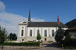
|
Katholische Kirche St. Joh. Baptist | B | 47°10′18″N 7°53′20″E / 47.17157233°N 7.888967977°E | 3677 | ||
Grosswangen
| Location | Upload | Photo | Object | Cat. | Coordinates | KGS-Nr | |
|---|---|---|---|---|---|---|---|
| Grosswangen | 
|
Katholische Kirche St. Konrad | B | 47°07′59″N 8°03′00″E / 47.133004946°N 8.049994954°E | 3678 | ||
| Grosswangen | 
|
Oberrot, Kapelle St. Gallus und Othmar | B | 47°07′46″N 8°04′04″E / 47.129481748°N 8.06782738°E | 3679 | ||
| Grosswangen | 
|
Schulhaus (1936) | B | 47°07′49″N 8°02′58″E / 47.130264238°N 8.049462801°E | 3680 | ||
| Grosswangen | 
|
Vorder-Wellberg, Bauernhof mit Speicher | B | 47°07′25″N 8°01′41″E / 47.123495141°N 8.027943608°E | 3681 | ||
Hasle
| Location | Upload | Photo | Object | Cat. | Coordinates | KGS-Nr | |
|---|---|---|---|---|---|---|---|
| Hasle | 
|
Heiligkreuzkirche | A+ISOS | 46°56′58″N 8°02′54″E / 46.949537°N 8.048397°E | 3683 | ||
| Hasle | 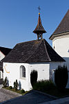
|
Beinhauskapelle bei der katholischen Kirche | B | 46°58′48″N 8°03′05″E / 46.980058659°N 8.051474523°E | 3684 | ||
| Hasle | 
|
Hinter-Grund, Käsespeicher (1776) | B | 46°55′56″N 8°07′15″E / 46.932135352°N 8.120777658°E | 3685 | ||
Hergiswil bei Willisau
| Location | Upload | Photo | Object | Cat. | Coordinates | KGS-Nr | |
|---|---|---|---|---|---|---|---|
| Hergiswil bei Willisau | [[File:|150x150px|Wegkapelle Hübeli]] | Wegkapelle Hübeli | B | 47°03′55″N 7°57′12″E / 47.06528607°N 7.953227221°E | 3686 | ||
Hildisrieden
| Location | Upload | Photo | Object | Cat. | Coordinates | KGS-Nr | |
|---|---|---|---|---|---|---|---|
| Hildisrieden | 
|
Katholische Kirche St. Maria (1904, Hardegger) | B | 47°09′02″N 8°13′52″E / 47.150658°N 8.231203°E | 3688 | ||
Hitzkirch
| Location | Upload | Photo | Object | Cat. | Coordinates | KGS-Nr | |
|---|---|---|---|---|---|---|---|
| Hitzkirch | 
|
Richensee | ISOS | 47°13′14″N 8°15′05″E / 47.22055556°N 8.25138889°E | |||
| Hitzkirch | 
|
Sammlung des Schloss Heidegg | B | 47°13′00″N 8°16′23″E / 47.216649°N 8.272975°E | 8576 | ||
| Hitzkirch | 
|
Ehemalige Deutschordenskommende | A | 47°13′30″N 8°17′29″E / 47.225089°N 8.29151°E | 3691 | ||
| Hitzkirch | 
|
Megaliththurm | A | 47°13′12″N 8°15′07″E / 47.220092°N 8.251891°E | 3690 | ||
| Hitzkirch | Schloss Heidegg mit Wohnhaus und Kapelle | Schloss Heidegg mit Wohnhaus und Kapelle | A+ISOS | 47°13′00″N 8°16′23″E / 47.216757°N 8.27303°E | 3671 | ||
| Hitzkirch | [[File:|150x150px|Seematt, neolithische Seeufersiedlung]] | Seematt, neolithische Seeufersiedlung | A | 47°12′57″N 8°14′52″E / 47.215839°N 8.247879°E | 3689 | ||
| Hitzkirch | 
|
Katholische Kirche St. Pankratius | B | 47°13′30″N 8°15′52″E / 47.225086°N 8.264352°E | 3692 | ||
| Hitzkirch | 
|
Hitzkirch | ISOS | 47°13′30″N 8°15′44″E / 47.225°N 8.262222222°E | |||
Hochdorf
| Location | Upload | Photo | Object | Cat. | Coordinates | KGS-Nr | |
|---|---|---|---|---|---|---|---|
| Hochdorf | 
|
Kloster Baldegg, Archiv | B | 47°10′47″N 8°17′01″E / 47.17984715°N 8.283703141°E | 8909 | ||
| Hochdorf | 
|
Baldegg, neolithische/bonzezeitliche Seeufersiedlung | A | 47°10′55″N 8°16′26″E / 47.181922°N 8.273753°E | 9587 | ||
| Hochdorf | 
|
Katholische Kirche St. Martin mit Beinhauskapelle, Pfarrhaus und Friedhofhalle | B | 47°10′01″N 8°17′35″E / 47.167040488°N 8.293089868°E | 3693 | ||
| Hochdorf | 
|
Reckenbrunnen, Bauernhaus mit Nebengebäuden | B | 47°08′33″N 8°18′33″E / 47.142444703°N 8.309032312°E | 3694 | ||
Hohenrain
| Location | Upload | Photo | Object | Cat. | Coordinates | KGS-Nr | |
|---|---|---|---|---|---|---|---|
| Hohenrain | Burgruine Nünegg | Burgruine Nünegg | A | 47°12′32″N 8°18′14″E / 47.208883°N 8.303861°E | 3715 | ||
| Hohenrain | 
|
Ehemalige Johanniterkomturei | A | 47°10′46″N 8°19′07″E / 47.17943°N 8.318478°E | 3695 | ||
| Hohenrain | 
|
Ottenhusen, römischer Gutshof | A | 47°09′58″N 8°20′03″E / 47.166176°N 8.33418°E | 3696 | ||
| Hohenrain | 
|
Ferren, Bauernhaus Geisshüsler | B | 47°11′28″N 8°17′16″E / 47.191069504°N 8.287852667°E | 3697 | ||
| Hohenrain | 
|
Haus Ratsherr Joseph Leu | B | 47°10′15″N 8°18′36″E / 47.170827631°N 8.309863197°E | 3698 | ||
| Hohenrain | 
|
Ottenhusen, Haus Leu | B | 47°09′59″N 8°19′42″E / 47.16649504°N 8.32824545°E | 3699 | ||
| Hohenrain | 
|
Hohenrain | ISOS | 47°10′51″N 8°19′04″E / 47.180833333°N 8.317777777°E | |||
Honau
| Location | Upload | Photo | Object | Cat. | Coordinates | KGS-Nr | |
|---|---|---|---|---|---|---|---|
| Honau | 
|
Kapelle St. Eligius | B | 47°07′58″N 8°24′23″E / 47.132895564°N 8.406355493°E | 3701 | ||
Horw
| Location | Upload | Photo | Object | Cat. | Coordinates | KGS-Nr | |
|---|---|---|---|---|---|---|---|
| Horw | 
|
Bauernhaus Oberdorni | A | 47°00′31″N 8°19′59″E / 47.008645°N 8.333038°E | 3702 | ||
| Horw | 
|
Kastanienbaum, Villa Annemarie | B | 47°00′27″N 8°20′22″E / 47.007402196°N 8.339548852°E | 3704 | ||
| Horw | 
|
katholische Kirche St. Katharina (1815) | B | 47°01′09″N 8°18′46″E / 47.019141737°N 8.312781095°E | 3703 | ||
| Horw | 
|
Landsitz Stutz (Mitte 17. Jh.) mit Gartenpavillon | B | 47°02′01″N 8°20′03″E / 47.033665776°N 8.334279875°E | 3705 | ||
| Horw | 
|
St. Niklausen, Villa Krämerstein mit Pförtnerhaus und Park | B | 47°00′53″N 8°20′24″E / 47.014856587°N 8.339937137°E | 3706 | ||
| Horw | 
|
St. Niklausen, Villa Kreuzfluh (1906) mit Nebengebäuden | B | 47°01′05″N 8°20′30″E / 47.018145061°N 8.341583977°E | 3707 | ||
Inwil
| Location | Upload | Photo | Object | Cat. | Coordinates | KGS-Nr | |
|---|---|---|---|---|---|---|---|
| Inwil | 
|
Alt-Eschenbach, mittelalterliche Stadtwüstung, Burgruine | A | 47°06′58″N 8°21′16″E / 47.116091°N 8.354427°E | 9588 | ||
| Inwil | 
|
Kapelle St. Katharina mit Bauernhaus | B | 47°07′10″N 8°22′05″E / 47.11949°N 8.368058°E | 3710 | ||
| Inwil | 
|
katholische Kirche St. Peter und Paul mit Beinhauskapelle | B | 47°07′19″N 8°21′01″E / 47.122061°N 8.350311°E | 3709 | ||