Commons:Wiki4Alps/Vevey

From Wikimedia Commons, the free media repository
Jump to navigation Jump to search
KGS-Nr Upload Foto   Object Other Cov. Cat. Type Address Town Coordinates
8707 Upload a file Alimentarium (Ernährungsmuseum) Alimentarium (Ernährungsmuseum) No images A S Quai Perdonnet 25 [[:Category:|]]
46° 27′ 30.13″ N, 6° 50′ 47.26″ E Kartographer map based on OpenStreetMap.View all coordinates using: OpenStreetMapinfo


6516 Upload a file Château de l’Aile Château de l’Aile No images A G Grande Place 1 [[:Category:|]]
46° 27′ 33.37″ N, 6° 50′ 27.49″ E Kartographer map based on OpenStreetMap.View all coordinates using: OpenStreetMapinfo


6525 Upload a file Cour au Chantre Cour au Chantre No images A G Rue du Simplon 22 [[:Category:|]]
46° 27′ 36.25″ N, 6° 50′ 44.48″ E Kartographer map based on OpenStreetMap.View all coordinates using: OpenStreetMapinfo


8898 Upload a file Historisches Archiv der Nestlé AG No images A S Avenue Nestlé 55 [[:Category:|]]
46° 27′ 59.11″ N, 6° 50′ 05.57″ E Kartographer map based on OpenStreetMap.View all coordinates using: OpenStreetMapinfo


6534 Upload a file Hôtel des Trois-Couronnes Hôtel des Trois-Couronnes No images A G Rue du Château 1 [[:Category:|]]
46° 27′ 29.63″ N, 6° 50′ 54.31″ E Kartographer map based on OpenStreetMap.View all coordinates using: OpenStreetMapinfo


6517 Upload a file Katholische Kirche Notre-Dame Katholische Kirche Notre-Dame No images A G Rue des Chenevières [[:Category:|]]
46° 27′ 31.54″ N, 6° 51′ 10.19″ E Kartographer map based on OpenStreetMap.View all coordinates using: OpenStreetMapinfo


6532 Upload a file Kornhalle und Marktplatz Kornhalle und Marktplatz No images A G Grande Place 29 [[:Category:|]]
46° 27′ 37.55″ N, 6° 50′ 33.79″ E Kartographer map based on OpenStreetMap.View all coordinates using: OpenStreetMapinfo


8717 Upload a file Musée Jenisch No images A S Avenue de la Gare 2 [[:Category:|]]
46° 27′ 41.47″ N, 6° 50′ 43.12″ E Kartographer map based on OpenStreetMap.View all coordinates using: OpenStreetMapinfo


8708 Upload a file Museum der Bruderschaft der Winzer Museum der Bruderschaft der Winzer No images A S Rue du Château 2 [[:Category:|]]
46° 27′ 29.02″ N, 6° 50′ 56.51″ E Kartographer map based on OpenStreetMap.View all coordinates using: OpenStreetMapinfo


6521 Upload a file Nestlé-Hauptverwaltung Nestlé-Hauptverwaltung No images A G Avenue Nestlé 55 [[:Category:|]]
46° 27′ 59.47″ N, 6° 50′ 05.21″ E Kartographer map based on OpenStreetMap.View all coordinates using: OpenStreetMapinfo


6528 Upload a file Orthodoxe Kirche Orthodoxe Kirche No images A G Rue des Communaux 12 {{{Town}}}
46° 27′ 42.84″ N, 6° 50′ 43.76″ E Kartographer map based on OpenStreetMap.View all coordinates using: OpenStreetMapinfo


6533 Upload a file Rathaus Rathaus No images A G Rue du Lac 2 [[:Category:|]]
46° 27′ 32.08″ N, 6° 50′ 49.06″ E Kartographer map based on OpenStreetMap.View all coordinates using: OpenStreetMapinfo


6519 Upload a file Reformierte Kirche Saint-Martin Reformierte Kirche Saint-Martin No images A G Boulevard Saint-Martin [[:Category:|]]
46° 27′ 43.63″ N, 6° 50′ 48.98″ E Kartographer map based on OpenStreetMap.View all coordinates using: OpenStreetMapinfo


8718 Upload a file Schweizer Kameramuseum Schweizer Kameramuseum No images A S Grande Place [[:Category:|]]
46° 27′ 35.75″ N, 6° 50′ 28.9″ E Kartographer map based on OpenStreetMap.View all coordinates using: OpenStreetMapinfo


11688 Upload a file Tour Saint-Jean und Brunnen Tour Saint-Jean und Brunnen No images A G Rue du Lac [[:Category:|]]
46° 27′ 31.97″ N, 6° 50′ 49.7″ E Kartographer map based on OpenStreetMap.View all coordinates using: OpenStreetMapinfo


6531 Upload a file Bahnhof Vevey Bahnhof Vevey No images B G Rue de la Gare 3 [[:Category:|]]
46° 27′ 46.91″ N, 6° 50′ 35.45″ E Kartographer map based on OpenStreetMap.View all coordinates using: OpenStreetMapinfo


6523 Upload a file Bernerschloss Bernerschloss No images B G Rue du Château 2 / Rue d’Italie 43 [[:Category:|]]
46° 27′ 29.93″ N, 6° 50′ 55.62″ E Kartographer map based on OpenStreetMap.View all coordinates using: OpenStreetMapinfo


6522 Upload a file Casino du Rivage No images B G Rue Louis-Meyer 1 [[:Category:|]]
46° 27′ 34.63″ N, 6° 50′ 27.2″ E Kartographer map based on OpenStreetMap.View all coordinates using: OpenStreetMapinfo


6524 Upload a file Collège No images B G Rue du Collège 30 [[:Category:|]]
46° 27′ 33.23″ N, 6° 50′ 51.32″ E Kartographer map based on OpenStreetMap.View all coordinates using: OpenStreetMapinfo


14757 Upload a file Collège de la Veveyse No images B G Rue du Torrent 27 [[:Category:|]]
46° 27′ 40.69″ N, 6° 50′ 19.83″ E Kartographer map based on OpenStreetMap.View all coordinates using: OpenStreetMapinfo


6526 Upload a file École du Clos No images B G Rue du Clos 15 [[:Category:|]]
46° 27′ 39.38″ N, 6° 50′ 45.46″ E Kartographer map based on OpenStreetMap.View all coordinates using: OpenStreetMapinfo


6520 Upload a file Ehemaliges Hôtel Moser mit Nebengebäuden und Park No images B G Boulevard Henri-Plumhof 3 [[:Category:|]]
46° 27′ 44.28″ N, 6° 51′ 11.95″ E Kartographer map based on OpenStreetMap.View all coordinates using: OpenStreetMapinfo


6537 Upload a file Ehemaliges Maison La Part-Dieu No images B G Rue d’Italie 2 [[:Category:|]]
46° 27′ 28.55″ N, 6° 51′ 08.28″ E Kartographer map based on OpenStreetMap.View all coordinates using: OpenStreetMapinfo


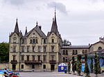
6539 Upload a file Ehemaliges Nestlé-Verwaltungsgebäude (Ernährungsmuseum) Ehemaliges Nestlé-Verwaltungsgebäude (Ernährungsmuseum) No images B G Quai Perdonnet 25 [[:Category:|]]
46° 27′ 30.06″ N, 6° 50′ 47.47″ E Kartographer map based on OpenStreetMap.View all coordinates using: OpenStreetMapinfo


6527 Upload a file Englische Kirche No images B G Avenue de Blonay 4 [[:Category:|]]
46° 27′ 36.18″ N, 6° 51′ 01.48″ E Kartographer map based on OpenStreetMap.View all coordinates using: OpenStreetMapinfo


14759 Upload a file Galerie du Rivage No images B G Rue du Torrent 5 [[:Category:|]]
46° 27′ 36.69″ N, 6° 50′ 28.08″ E Kartographer map based on OpenStreetMap.View all coordinates using: OpenStreetMapinfo


8957 Upload a file Districtarchiv No images B S Rue du Lac 2 [[:Category:|]]
46° 27′ 32.55″ N, 6° 50′ 47.95″ E Kartographer map based on OpenStreetMap.View all coordinates using: OpenStreetMapinfo


9372 Upload a file Districtbibliothek Districtbibliothek No images B S Quai Perdonnet 33 [[:Category:|]]
46° 27′ 30.49″ N, 6° 50′ 41.06″ E Kartographer map based on OpenStreetMap.View all coordinates using: OpenStreetMapinfo


6541 Upload a file Districttheater No images B G Rue du Théâtre 4 [[:Category:|]]
46° 27′ 37.3″ N, 6° 50′ 35.09″ E Kartographer map based on OpenStreetMap.View all coordinates using: OpenStreetMapinfo


8764 Upload a file Historisches Museum Historisches Museum No images B S Rue du Château 2 / Rue d’Italie 43 [[:Category:|]]
46° 27′ 29.7″ N, 6° 50′ 55.86″ E Kartographer map based on OpenStreetMap.View all coordinates using: OpenStreetMapinfo


6535 Upload a file Hôtel du Lac Hôtel du Lac No images B G Rue d’Italie 1 [[:Category:|]]
46° 27′ 27.36″ N, 6° 51′ 07.34″ E Kartographer map based on OpenStreetMap.View all coordinates using: OpenStreetMapinfo


6529 Upload a file Kirche Sainte-Claire No images B G Rue du Collège [[:Category:|]]
46° 27′ 32.58″ N, 6° 50′ 53.38″ E Kartographer map based on OpenStreetMap.View all coordinates using: OpenStreetMapinfo


6530 Upload a file Kriegerbrunnen (Fontaine du Guerrier) No images B K Rue du Centre [[:Category:|]]
46° 27′ 34.2″ N, 6° 50′ 42.22″ E Kartographer map based on OpenStreetMap.View all coordinates using: OpenStreetMapinfo


6536 Upload a file Maison Le Castel No images B G Rue du Conseil 23 [[:Category:|]]
46° 27′ 35.57″ N, 6° 50′ 36.29″ E Kartographer map based on OpenStreetMap.View all coordinates using: OpenStreetMapinfo


14758 Upload a file Maison Paschoud No images B G Rue des Chevenières 1 [[:Category:|]]
46° 27′ 29.13″ N, 6° 51′ 08.51″ E Kartographer map based on OpenStreetMap.View all coordinates using: OpenStreetMapinfo


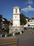
6542 Upload a file Uhrenturm und Brunnen Uhrenturm und Brunnen No images B G Rue d’Italie [[:Category:|]]
46° 27′ 29.77″ N, 6° 51′ 00.25″ E Kartographer map based on OpenStreetMap.View all coordinates using: OpenStreetMapinfo