Category:Whitegate, Cheshire
Jump to navigation
Jump to search
village in Cheshire, England, United Kingdom  | |||||
| Upload media | |||||
| Instance of | |||||
|---|---|---|---|---|---|
| Location | Whitegate and Marton, Cheshire West and Chester, Cheshire, North West England, England | ||||
| Different from | |||||
 | |||||
English: Whitegate is a small village in Cheshire, England, located near the towns of Northwich and Winsford. It is situated in the civil parish of Whitegate and Marton, in the unitary authority of Cheshire West and Chester.
Subcategories
This category has the following 3 subcategories, out of 3 total.
M
W
- Whitegate railway station (7 F)
- Whitegate War Memorial (1 F)
Media in category "Whitegate, Cheshire"
The following 37 files are in this category, out of 37 total.
-
 Ambitious garden sculpture, Whitegate - geograph.org.uk - 6279391.jpg 2,927 × 3,596; 4.29 MB
-
 Between the school and the churchyard - geograph.org.uk - 994150.jpg 640 × 428; 108 KB
-
 Down The Bright Stream - geograph.org.uk - 1773874.jpg 2,304 × 3,072; 2.7 MB
-
 Downstream - geograph.org.uk - 1773865.jpg 3,072 × 2,304; 1.84 MB
-
 Foxwist Green, Whitegate - geograph.org.uk - 192636.jpg 640 × 480; 105 KB
-
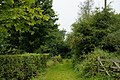
 It's easy to miss the beginning of this public footpath - geograph.org.uk - 1773832.jpg 2,304 × 3,072; 3.41 MB
-
 Luxury housing, Whitegate - geograph.org.uk - 6279383.jpg 4,832 × 3,222; 4.52 MB
-
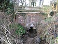
 Newbridge swing bridge - geograph.org.uk - 60315.jpg 640 × 480; 71 KB
-
 Old coach house, now a village hall - geograph.org.uk - 994017.jpg 640 × 428; 70 KB
-
 Pool next to Whitegate Way - geograph.org.uk - 432.jpg 512 × 640; 64 KB
-

-
 St Mary's Drive - geograph.org.uk - 6279479.jpg 3,692 × 2,725; 2.16 MB
-
 St Mary's Drive, Vale Royal - geograph.org.uk - 2752610.jpg 1,024 × 768; 184 KB
-
 Start of footpath with stile - geograph.org.uk - 1773857.jpg 3,072 × 2,304; 1.63 MB
-
 Start of the boardwalk - geograph.org.uk - 1773871.jpg 2,304 × 3,072; 3.52 MB
-
 Stile on Grange Lane, Winsford - geograph.org.uk - 192805.jpg 640 × 480; 136 KB
-
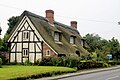
 Thatched cottage, Whitegate, Cheshire - geograph.org.uk - 192600.jpg 640 × 466; 111 KB
-
 Thatched farm building (1) - geograph.org.uk - 1773837.jpg 3,072 × 2,304; 1.37 MB
-
 Thatched farm building (2) - geograph.org.uk - 1773845.jpg 2,304 × 3,072; 2.67 MB
-
 The Lodge, Whitegate.jpg 1,800 × 1,350; 692 KB
-
 The old post office - geograph.org.uk - 993917.jpg 640 × 428; 74 KB
-
 The outflow from Petty Pool Lake (2) - geograph.org.uk - 1773854.jpg 2,304 × 3,072; 3.57 MB
-
 The outflow from Petty Pool Lake - geograph.org.uk - 1773849.jpg 3,072 × 2,304; 1.4 MB
-
 The outflow from Petty Pool Lake - geograph.org.uk - 1773862.jpg 2,304 × 3,072; 3.5 MB
-
 Whitegate - geograph.org.uk - 6247560.jpg 5,277 × 3,570; 1.68 MB
-
 Whitegate - geograph.org.uk - 6247562.jpg 6,000 × 4,000; 2 MB
-

-
 Whitegate House, Whitegate, Cheshire 01.jpg 4,000 × 3,000; 5.08 MB
-
 Whitegate House, Whitegate, Cheshire 02.jpg 4,000 × 3,000; 5.13 MB
-
 Dawn at the Whitegate Way - geograph.org.uk - 61212.jpg 640 × 478; 102 KB
-
 Entrance to Bark House Farm - geograph.org.uk - 192557.jpg 640 × 472; 76 KB
-
 Mowing at Marton Green - geograph.org.uk - 192766.jpg 640 × 477; 87 KB
-
 Parkside Farm, Mill Lane - geograph.org.uk - 192553.jpg 640 × 485; 141 KB
-
 Step Into Cheshire^ - geograph.org.uk - 22163.jpg 640 × 480; 69 KB
-
 Weaver Navigation - geograph.org.uk - 158509.jpg 640 × 480; 77 KB
-
 Whitegate Way, Grange Lane - geograph.org.uk - 192803.jpg 640 × 512; 182 KB
-
 Whitegate Way, Martonsands - geograph.org.uk - 192796.jpg 640 × 480; 123 KB


_-_geograph.org.uk_-_1773837.jpg)
_-_geograph.org.uk_-_1773845.jpg)


_-_geograph.org.uk_-_1773854.jpg)


