Category:Tarka Trail
Jump to navigation
Jump to search
English: The Tarka Trail is a series of footpaths and cyclepaths around north Devon, England that follow the route taken by Tarka the Otter in the book of that name. It is a figure-of-eight route, based on Barnstaple, and covers some of path.
Polski: Tarka Trail system pieszych i rowerowych szlaków turystycznych w Wielkiej brytanii, w hrabstwie Devon. Całkowita długość szlaku wynosi 290 km.
series of footpaths and cycle paths in North Devon, England | |||||
| Upload media | |||||
| Location |
| ||||
|---|---|---|---|---|---|
| |||||
Subcategories
This category has the following 2 subcategories, out of 2 total.
I
- Instow Tunnel (2 F)
L
- Landcross Tunnel (6 F)
Media in category "Tarka Trail"
The following 200 files are in this category, out of 355 total.
(previous page) (next page)-
 "Severn Sands" at Fremington Quay - geograph.org.uk - 808764.jpg 640 × 376; 51 KB
-
 A "clinker built" shelter - geograph.org.uk - 33490.jpg 640 × 480; 78 KB
-
-
 A Path for Everybody - geograph.org.uk - 315627.jpg 640 × 427; 83 KB
-
 A riverside walkway, Barnstaple - geograph.org.uk - 1356179.jpg 480 × 640; 82 KB
-

-
 A39 at Hilsford Bridge.jpg 3,991 × 2,684; 5.11 MB
-
 A399 at Combe Martin - geograph.org.uk - 1604194.jpg 640 × 480; 82 KB
-
 Abbeyford Woods - geograph.org.uk - 80111.jpg 480 × 640; 52 KB
-
 Abbeyford Woods, Devon - panoramio (1).jpg 2,048 × 1,365; 1.33 MB
-
 Abbeyford Woods.jpg 4,128 × 2,848; 7.19 MB
-

-
 Approaching Woolacombe - geograph.org.uk - 1365168.jpg 640 × 480; 111 KB
-
 Baggy Point - geograph.org.uk - 1366685.jpg 640 × 480; 91 KB
-
 Ball Hill Footpath, Okehampton - panoramio (1).jpg 2,048 × 1,280; 1.26 MB
-
 Ball Hill Footpath, Okehampton - panoramio.jpg 2,048 × 1,365; 1.5 MB
-
 Beech trees at Berrynarbor - geograph.org.uk - 1393304.jpg 640 × 480; 116 KB
-
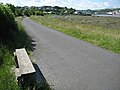 Bench beside the cycleway, Bideford - geograph.org.uk - 1357062.jpg 640 × 480; 92 KB
-
 Berry Lane - geograph.org.uk - 1600935.jpg 640 × 480; 150 KB
-
 Berrynarbor, Sandy Cove Hotel - geograph.org.uk - 886365.jpg 640 × 427; 205 KB
-
 Berrynarbor, the Old Coast Road - geograph.org.uk - 886363.jpg 640 × 427; 261 KB
-
 Berrynarbor, the Old Coast Road 2 - geograph.org.uk - 886368.jpg 640 × 415; 260 KB
-

-
 Braunton Burrows - geograph.org.uk - 1399456.jpg 640 × 480; 99 KB
-
 Bridge near Westacott Wood - geograph.org.uk - 83477.jpg 640 × 480; 39 KB
-
 Bridge on the Tarka Trail - geograph.org.uk - 995958.jpg 640 × 480; 114 KB
-
 Bridge over the Heddon - geograph.org.uk - 1287229.jpg 640 × 480; 131 KB
-
 Bridge over the River Heddon - geograph.org.uk - 1603965.jpg 640 × 480; 141 KB
-
 Bridge over the River Taw at East Rowden - geograph.org.uk - 1726846.jpg 640 × 480; 128 KB
-
 Bridge over the Tarka Trail - geograph.org.uk - 1360743.jpg 640 × 480; 117 KB
-

-
 Bridge over the Venn - geograph.org.uk - 621142.jpg 640 × 480; 130 KB
-
 Bridge, East Rowden, Devon - geograph.org.uk - 448409.jpg 640 × 480; 127 KB
-
 Bridleway near Belstone - geograph.org.uk - 1015509.jpg 640 × 480; 159 KB
-
 Cairn on Great Hangman - geograph.org.uk - 1603971.jpg 640 × 480; 79 KB
-
 Capstone Parade - geograph.org.uk - 102435.jpg 640 × 480; 47 KB
-
 Castle Quay - geograph.org.uk - 315071.jpg 640 × 480; 84 KB
-
 Castle Rock - geograph.org.uk - 1250430.jpg 428 × 640; 79 KB
-
 Cheriton Ridge - geograph.org.uk - 445684.jpg 640 × 426; 139 KB
-
 Cliff path at Torrs Park - geograph.org.uk - 480086.jpg 640 × 418; 71 KB
-

-
 Climbing out of Bennett's Mouth - geograph.org.uk - 722247.jpg 425 × 640; 94 KB
-

-
 Coast Path (4902404902).jpg 2,736 × 3,648; 4.04 MB
-
 Coast path above Highveer Point - geograph.org.uk - 1287012.jpg 640 × 459; 95 KB
-
 Coast path and Taw estuary - geograph.org.uk - 1397928.jpg 640 × 480; 92 KB
-
 Coast path at North Cleave - geograph.org.uk - 1596960.jpg 640 × 480; 92 KB
-
 Coast path at North Cleave - geograph.org.uk - 1596961.jpg 640 × 480; 97 KB
-
 Coast path at Woody Bay - geograph.org.uk - 480424.jpg 640 × 625; 111 KB
-

-
 Coast path near Lynton - geograph.org.uk - 559183.jpg 640 × 480; 131 KB
-
 Coast path on Hollerday Hill - geograph.org.uk - 560562.jpg 640 × 480; 137 KB
-
 Coast path to Baggy Point - geograph.org.uk - 1366694.jpg 640 × 480; 97 KB
-
 Coast path west of Great Hangman - geograph.org.uk - 1604172.jpg 640 × 480; 105 KB
-
 Coast path west of Woody Bay - geograph.org.uk - 480408.jpg 640 × 625; 79 KB
-
 Coastal path looking west - geograph.org.uk - 689074.jpg 1,600 × 1,200; 1.59 MB
-
 Coastal Paths, near Mortehoe - geograph.org.uk - 609381.jpg 640 × 428; 108 KB
-
-
 Coastpath reflections - geograph.org.uk - 106567.jpg 480 × 640; 57 KB
-
 Combe Martin with the tide in - geograph.org.uk - 1330107.jpg 640 × 480; 105 KB
-
 Combe Martin, the climb to Little Hangman - geograph.org.uk - 73479.jpg 640 × 427; 191 KB
-

-
 Combe Martin, west to Great Hangman - geograph.org.uk - 93644.jpg 640 × 426; 117 KB
-
 Combe martin.jpg 640 × 404; 73 KB
-
 Cottage at New Bridge - geograph.org.uk - 1404332.jpg 640 × 428; 119 KB
-
 Cottage near Lee Abbey - geograph.org.uk - 1471552.jpg 640 × 480; 101 KB
-
 Cottages at Lee - geograph.org.uk - 775167.jpg 640 × 512; 83 KB
-
 Cottages in South Tawton - geograph.org.uk - 1772738.jpg 1,024 × 768; 593 KB
-
 Country lane, near Nethercott House - geograph.org.uk - 1135161.jpg 640 × 480; 128 KB
-
 Croyde Burrows - geograph.org.uk - 1342554.jpg 640 × 434; 135 KB
-
 Cutting on dismantled railway at Penhill - geograph.org.uk - 33479.jpg 640 × 480; 104 KB
-
 Cycle Path past RAF Chivenor - geograph.org.uk - 315062.jpg 640 × 480; 126 KB
-
 Cycle route marker - geograph.org.uk - 1595896.jpg 480 × 640; 145 KB
-

-

-
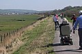
 Cyclist on the Tarka Trail - geograph.org.uk - 1331542.jpg 640 × 480; 164 KB
-
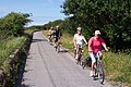 Cyclists on the Tarka Trail - geograph.org.uk - 42702.jpg 640 × 427; 115 KB
-
 Dark skies ahead - geograph.org.uk - 1345590.jpg 640 × 480; 167 KB
-
 Descending into Heddon's Valley - geograph.org.uk - 1603963.jpg 640 × 480; 81 KB
-
 Descent to Grunta Beach - geograph.org.uk - 876084.jpg 640 × 427; 88 KB
-
 Devon coast near Bull Point - geograph.org.uk - 1421875.jpg 640 × 480; 97 KB
-
 Disused railway line at Instow - geograph.org.uk - 1355640.jpg 640 × 480; 111 KB
-
 Duke of York, Iddesleigh - geograph.org.uk - 1135395.jpg 640 × 492; 61 KB
-

-
 Dunsbear holt railway station.jpg 640 × 427; 140 KB
-
 Entering the Landcross tunnel - geograph.org.uk - 1345464.jpg 640 × 480; 178 KB
-
 Entrance to RAF Chivenor - geograph.org.uk - 1360733.jpg 640 × 480; 89 KB
-
 Exe Head - geograph.org.uk - 445725.jpg 640 × 426; 119 KB
-
 Fence along the cliff top in Lynton - geograph.org.uk - 1523890.jpg 640 × 417; 105 KB
-
 Field on Tarka Trail - geograph.org.uk - 535837.jpg 640 × 480; 134 KB
-
 Footbridge and ford at Addisford - geograph.org.uk - 483685.jpg 480 × 640; 106 KB
-
 Footbridge at Belstone - geograph.org.uk - 933917.jpg 640 × 480; 111 KB
-
 Footbridge, across the River Oakment - geograph.org.uk - 1134003.jpg 640 × 480; 132 KB
-
 Footbridge, East Oakmount River - geograph.org.uk - 934296.jpg 640 × 480; 133 KB
-
 Footbridge, Sherrycombe - geograph.org.uk - 106523.jpg 640 × 480; 38 KB
-
 Footpath above Myrtleberry Cleave - geograph.org.uk - 1307176.jpg 640 × 480; 137 KB
-
 Footpath at Baggy Point - geograph.org.uk - 301836.jpg 640 × 480; 110 KB
-
 Footpath by the River Taw - geograph.org.uk - 1092484.jpg 640 × 480; 166 KB
-
 Footpath in the Heddon Valley - geograph.org.uk - 1603967.jpg 640 × 480; 133 KB
-
 Footpath junction along The Heddon's Path - geograph.org.uk - 917622.jpg 640 × 480; 123 KB
-
 Footpath junction on Holdstone Down - geograph.org.uk - 1597071.jpg 640 × 480; 91 KB
-
 Footpath sign along the Heddon's Path - geograph.org.uk - 917612.jpg 640 × 480; 142 KB
-
 Footpath sign near Baggy Point - geograph.org.uk - 1365220.jpg 640 × 480; 91 KB
-
 Footpath through Braunton Burrows - geograph.org.uk - 1399431.jpg 640 × 480; 104 KB
-
 Footpath to Lynton - geograph.org.uk - 1455821.jpg 480 × 640; 85 KB
-
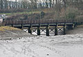
 Former railway bridge at Fremington Pill - geograph.org.uk - 1595890.jpg 640 × 480; 112 KB
-

-

-
 Fremington railway bridge.jpg 3,632 × 2,520; 4.54 MB
-
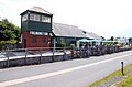 Fremington Station - geograph.org.uk - 1492724.jpg 640 × 419; 62 KB
-
 Fremington Station 1.jpg 3,740 × 2,700; 3.52 MB
-
 Fremington Station on the Tarka Trail - geograph.org.uk - 43082.jpg 640 × 427; 79 KB
-
 Gate on the Tarka Trail - geograph.org.uk - 1360737.jpg 640 × 480; 124 KB
-
 Georgeham, Morte Bay - geograph.org.uk - 39129.jpg 640 × 418; 105 KB
-
 Georgeham, towards Baggy Point - geograph.org.uk - 514163.jpg 640 × 427; 211 KB
-
 Goldburn Cross - geograph.org.uk - 80127.jpg 640 × 480; 30 KB
-

-
 Gradient Post on the Tarka Trail - geograph.org.uk - 1554129.jpg 640 × 480; 71 KB
-
 Graffiti - geograph.org.uk - 871090.jpg 640 × 427; 106 KB
-
 Great Torrington Station. - geograph.org.uk - 648115.jpg 640 × 480; 90 KB
-
 Haggington Point Viewpoint - geograph.org.uk - 1331177.jpg 640 × 480; 139 KB
-
 Hatherleigh Moor - geograph.org.uk - 80163.jpg 640 × 480; 19 KB
-
 Heading up Granville Road. - geograph.org.uk - 900269.jpg 480 × 640; 74 KB
-
 Hilly Mouth footbridge - geograph.org.uk - 880257.jpg 427 × 640; 105 KB
-
 Hoar Oak Tree - geograph.org.uk - 71264.jpg 640 × 480; 91 KB
-
 Holdstone Down - geograph.org.uk - 106550.jpg 480 × 640; 68 KB
-
 Holdstone Down - geograph.org.uk - 1597067.jpg 640 × 480; 100 KB
-
 House and lane, Lee Bay - geograph.org.uk - 1430138.jpg 640 × 480; 129 KB
-
 Houses at Yarde - geograph.org.uk - 1345592.jpg 640 × 480; 174 KB
-
 Approaching Instow on the Tarka Trail - geograph.org.uk - 43089.jpg 640 × 427; 89 KB
-
 Level crossing at Instow - geograph.org.uk - 1355633.jpg 640 × 480; 83 KB
-
 Instow, Devon - geograph.org.uk - 43093.jpg 640 × 427; 76 KB
-

-
 Iron Bridge Cross - geograph.org.uk - 1726848.jpg 640 × 480; 99 KB
-
 Kinevor footbridge - geograph.org.uk - 880244.jpg 640 × 427; 108 KB
-
 Landkey, ruin by Venn Quarry - geograph.org.uk - 555006.jpg 640 × 427; 281 KB
-
 Landkey, Tarka Trail - geograph.org.uk - 555012.jpg 640 × 427; 270 KB
-
 Lane at Cadham - geograph.org.uk - 1346589.jpg 640 × 480; 179 KB
-
 Lane at Cadham - geograph.org.uk - 1346593.jpg 640 × 480; 178 KB
-
 Lane near Taw Green - geograph.org.uk - 1618058.jpg 640 × 480; 120 KB
-
 Lane to North Wyke (2) - geograph.org.uk - 1618210.jpg 640 × 480; 135 KB
-
 Lane to North Wyke (3) - geograph.org.uk - 1618233.jpg 640 × 444; 102 KB
-
 Lane to North Wyke - geograph.org.uk - 1618154.jpg 640 × 480; 151 KB
-
 Lane to Taw Green - geograph.org.uk - 1618135.jpg 640 × 480; 126 KB
-
 Lane to Woodridge Cross - geograph.org.uk - 483754.jpg 640 × 480; 157 KB
-
 Lee Abbey viewed from the west - geograph.org.uk - 1472112.jpg 640 × 480; 62 KB
-
 Lee Bay - geograph.org.uk - 1356153.jpg 640 × 480; 96 KB
-

-
 Little Hangman - geograph.org.uk - 1604177.jpg 640 × 480; 69 KB
-

-
 Martinhoe, coast path - geograph.org.uk - 36586.jpg 640 × 423; 107 KB
-
 Martinhoe, near Heddon's Mouth Cleave - geograph.org.uk - 167409.jpg 427 × 640; 196 KB
-
 Martinhoe, West Woodybay Wood - geograph.org.uk - 167404.jpg 640 × 427; 235 KB
-
 Mature trees, near Groves Fishleigh - geograph.org.uk - 1133957.jpg 640 × 480; 104 KB
-

-
 Middleborough Hill - geograph.org.uk - 1325518.jpg 640 × 480; 78 KB
-
 Morte Point - geograph.org.uk - 874870.jpg 640 × 427; 65 KB
-
 Morte Point viewpoint - geograph.org.uk - 876110.jpg 640 × 427; 73 KB
-

-
 Mouth of Fremington Pill - geograph.org.uk - 1595881.jpg 640 × 480; 40 KB
-
 North Devon coast near Lee Bay - geograph.org.uk - 1421863.jpg 640 × 480; 98 KB
-
 North Regis Common - geograph.org.uk - 731682.jpg 640 × 454; 118 KB
-
 Oak leaves turning on the Tarka Trail - geograph.org.uk - 80133.jpg 480 × 640; 47 KB
-
 Oak tree in winter sunshine - geograph.org.uk - 1133936.jpg 640 × 480; 112 KB
-
 Old platform of Watergate Halt - geograph.org.uk - 101559.jpg 568 × 425; 144 KB
-
 On Girt Down - geograph.org.uk - 1597079.jpg 640 × 480; 73 KB
-
 On the Tarka Trail - geograph.org.uk - 1345469.jpg 640 × 480; 183 KB
-
 Otter seats, Tarka Trail - geograph.org.uk - 567526.jpg 640 × 467; 118 KB
-
 Parsonage Gate - geograph.org.uk - 1135208.jpg 640 × 480; 93 KB
-
 Path to the Valley of the Rocks - geograph.org.uk - 1471518.jpg 480 × 640; 87 KB
-
 Path towards Belstone - geograph.org.uk - 1092482.jpg 640 × 480; 153 KB
-
 Precipitous path - geograph.org.uk - 876093.jpg 427 × 640; 95 KB
-
 Putsborough to Baggy Point (6934872146).jpg 3,632 × 2,333; 3.33 MB
-
 River Caen - geograph.org.uk - 817804.jpg 640 × 425; 51 KB
-
 River Taw footbridge, Belstone - geograph.org.uk - 1517082.jpg 640 × 427; 116 KB
-

-

-
 Road bridge over the Tarka Trail - geograph.org.uk - 1359490.jpg 640 × 480; 110 KB
-
 Road junction above Woody Bay - geograph.org.uk - 1472139.jpg 640 × 480; 122 KB
-
 Road junction at Deckport Cross - geograph.org.uk - 1192564.jpg 640 × 360; 50 KB
-
 Road to Baggy Point - geograph.org.uk - 1342508.jpg 640 × 480; 92 KB
-
 Road to Woody Bay - geograph.org.uk - 1472154.jpg 640 × 480; 120 KB
-
 Rocky coastline at Ilfracombe - geograph.org.uk - 1430464.jpg 640 × 480; 106 KB
-
 Sanctuary Lane, Hatherleigh - geograph.org.uk - 1133757.jpg 640 × 480; 93 KB
-
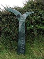
 Sculpture by Tarka Trail - geograph.org.uk - 37946.jpg 640 × 512; 98 KB
-
 Seat-sculpture beside Tarka Trail - geograph.org.uk - 37920.jpg 640 × 512; 158 KB
-
 Shelter on Lester Cliff - geograph.org.uk - 106470.jpg 640 × 480; 32 KB
-

-
 Sign on the South West Coast Path - geograph.org.uk - 1604220.jpg 480 × 640; 102 KB
-
 Signal box at Instow - geograph.org.uk - 1595978.jpg 640 × 438; 73 KB
-
 Sitting beside the Tarka Trail - geograph.org.uk - 895913.jpg 640 × 480; 461 KB
-
 South from Great Hangman-3313.jpg 8,470 × 1,345; 8.24 MB
-
 South Side of Morte Point Peninsula - geograph.org.uk - 5879.jpg 640 × 480; 81 KB
-
 South West Coast path - geograph.org.uk - 1717732.jpg 2,048 × 1,360; 1.91 MB
-
 South West Coast Path - geograph.org.uk - 874871.jpg 640 × 427; 59 KB
-
 South West Coast Path - geograph.org.uk - 874876.jpg 640 × 427; 66 KB
-
 South West Coast Path - geograph.org.uk - 884778.jpg 640 × 427; 94 KB
-
 South West Coast Path above Woody Bay - geograph.org.uk - 1472170.jpg 640 × 480; 140 KB
-
 South West Coast Path above Woody Bay - geograph.org.uk - 1601663.jpg 640 × 480; 137 KB
-


.jpg)


.jpg)


.jpg)


_-_geograph.org.uk_-_1618210.jpg)
_-_geograph.org.uk_-_1618233.jpg)


.jpg)


