Category:Sully, Vale of Glamorgan
Jump to navigation
Jump to search

village in the community of Sully and Lavernock  | |||||
| Upload media | |||||
| Instance of | |||||
|---|---|---|---|---|---|
| Location | Vale of Glamorgan, Wales | ||||
| Heritage designation | |||||
| Area |
| ||||
 | |||||
Cymraeg: Pentref bychan ger Penarth ar arfordir Bro Morgannwg yw'r Sili (Saesneg: Sully). Mae yno glwb rygbi ('Sully Sports', lle sefydlwyd yr hen glwb 'Barry Plastics') a chlwb criced. Mae'n debyg fod enw'r pentref yn tarddu o enw'r teulu Normannaidd de Sully. (→Sili)
English: Sully is a village in the Vale of Glamorgan, Wales lying on the northern coast of the Bristol Channel, midway between the towns of Penarth and Barry and 7 miles (11.3 kilometres) southwest of the Welsh capital city of Cardiff. (→Sully, Vale of Glamorgan)
Gaeilge: Baile i Bro Morgannwg, an Bhreatain Bheag, is ea Sili, 8.8 km ó Caerdydd agus 215 ó Londain. Tá daonra 4,445 ann, agus tá 385 (8.7%) in ann Breatnais a labhairt. (→Sili)
Subcategories
This category has the following 2 subcategories, out of 2 total.
B
- Barry power station (2 F)
C
Media in category "Sully, Vale of Glamorgan"
The following 31 files are in this category, out of 31 total.
-
360° View from Swanbridge, Vale of Glamorgan - January 2015.webm 52 s, 1,280 × 720; 13.14 MB
-
 A bike and a bus shelter, Sully - geograph.org.uk - 3258778.jpg 636 × 640; 86 KB
-
 Beach near Sully (26046391132).jpg 3,264 × 1,840; 2.88 MB
-

-
 Footpath beside Sully Bay - geograph.org.uk - 1480076.jpg 640 × 425; 91 KB
-
 Footpath beside the sailing club - Sully - geograph.org.uk - 1480647.jpg 640 × 425; 102 KB
-
 One Stop store, Sully - geograph.org.uk - 3263788.jpg 640 × 446; 59 KB
-
 Pebbles and boulders - Sully Bay - geograph.org.uk - 1480612.jpg 640 × 425; 125 KB
-
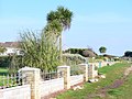
 Residential Sully - geograph.org.uk - 976376.jpg 640 × 480; 108 KB
-
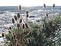
 Ripple marks (geograph 6588435).jpg 3,024 × 4,032; 6.76 MB
-
 Seafront Sully - geograph.org.uk - 975206.jpg 640 × 480; 93 KB
-
 Sedimentary rocks (geograph 6588434).jpg 2,048 × 1,536; 1.85 MB
-
 Sully 1949.jpg 2,191 × 3,596; 1.31 MB
-
 Sully Bay - geograph.org.uk - 975235.jpg 640 × 480; 102 KB
-
 Sully Bay Foreshore - geograph.org.uk - 976388.jpg 640 × 480; 125 KB
-
 Sully Beach - geograph.org.uk - 15177.jpg 640 × 425; 132 KB
-
 Sully High Street.jpg 640 × 480; 73 KB
-
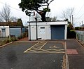 Sully Library (geograph 3263910).jpg 640 × 523; 84 KB
-
 Sully School - geograph.org.uk - 976367.jpg 480 × 640; 146 KB
-
 Sully Sound at Low Tide - geograph.org.uk - 975146.jpg 640 × 480; 125 KB
-
 Sully Sports FC - geograph.org.uk - 976381.jpg 640 × 480; 97 KB
-
 Sully, Vale of Glamorgan, Wales.jpg 4,096 × 3,072; 2.18 MB
-
 The beach at Sully - geograph.org.uk - 1971893.jpg 1,500 × 970; 184 KB
-
 The Sand Spit St Mary's Well Bay - geograph.org.uk - 289483.jpg 640 × 480; 40 KB
-

-
 The Sully Inn, Cog Road, Sully - geograph.org.uk - 1481148.jpg 640 × 425; 106 KB
-
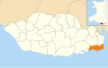
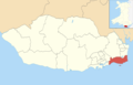 Vale of Glamorgan UK ward location - Sully.png 1,000 × 643; 122 KB
-
 Wales Vale of Glamorgan Community Sully map.svg 512 × 322; 401 KB
-
 Cog moors - Sully, Glamorgan - geograph.org.uk - 96985.jpg 640 × 480; 91 KB
-
 Sheep near Cog, Sully - geograph.org.uk - 96950.jpg 640 × 480; 66 KB
-
 The edge of Sully - geograph.org.uk - 96867.jpg 640 × 480; 54 KB

.jpg)


.jpg)

.jpg)


.jpg)


