Category:South Brent
Jump to navigation
Jump to search
village and civil parish in South Hams, Devon, UK  | |||||
| Upload media | |||||
| Instance of | |||||
|---|---|---|---|---|---|
| Location | South Hams, Devon, South West England, England | ||||
| Population |
| ||||
| Different from | |||||
| official website | |||||
 | |||||
Subcategories
This category has the following 12 subcategories, out of 12 total.
A
- Aish, South Brent (16 F)
- Anchor Hotel, South Brent (3 F)
- Avon Dam Reservoir (50 F)
B
- Brent railway station (14 F)
D
- Didworthy (11 F)
L
- Lutton, South Brent (16 F)
- Lydia Bridge (10 F)
R
- The Rock, South Brent (3 F)
S
- Shipley Bridge (4 F)
- South Brent Memorial Chapel (3 F)
Z
- Zeal Tor Tramway (17 F)
Media in category "South Brent"
The following 200 files are in this category, out of 1,282 total.
(previous page) (next page)-
 A barn - geograph.org.uk - 5709129.jpg 640 × 426; 59 KB
-
 A Country Lane in the Springtime - geograph.org.uk - 3138093.jpg 1,024 × 768; 440 KB
-
 A Lane, A Tree and Some Flowers - geograph.org.uk - 5110036.jpg 2,575 × 3,000; 2.37 MB
-
 A little bit of bog - geograph.org.uk - 5113952.jpg 1,600 × 1,067; 927 KB
-
 A quiet Saturday morning in South Brent - geograph.org.uk - 2228825.jpg 1,024 × 683; 124 KB
-
 A snowy Dartmoor panorama - geograph.org.uk - 1149226.jpg 640 × 427; 71 KB
-
 A snowy South Brent - geograph.org.uk - 2226537.jpg 1,024 × 683; 172 KB
-
 A Steep and Rocky Bridlepath - geograph.org.uk - 2905315.jpg 1,024 × 768; 393 KB
-
 A38 at Corn Park - geograph.org.uk - 6723801.jpg 1,200 × 800; 999 KB
-
 A38 at junction for South Brent - geograph.org.uk - 2633641.jpg 800 × 600; 334 KB
-
 A38 Dual Carriageway - geograph.org.uk - 3741895.jpg 640 × 428; 87 KB
-
 A38 Dual Carriageway - geograph.org.uk - 3741906.jpg 640 × 428; 102 KB
-
 A38 Dual Carriageway - geograph.org.uk - 6563754.jpg 768 × 1,024; 158 KB
-
 A38 near South Brent - geograph.org.uk - 2908957.jpg 640 × 480; 90 KB
-
 A38 near South Brent - geograph.org.uk - 2908978.jpg 640 × 469; 85 KB
-

-
 A38, eastbound - geograph.org.uk - 4765374.jpg 640 × 289; 24 KB
-
 A38, eastbound - geograph.org.uk - 4765378.jpg 640 × 382; 32 KB
-
 A38, South Brent - geograph.org.uk - 1367211.jpg 640 × 455; 72 KB
-
 A38, South Brent - geograph.org.uk - 1367215.jpg 640 × 455; 69 KB
-
 A38, South Brent - geograph.org.uk - 1367219.jpg 640 × 455; 86 KB
-
 A38, South Brent - geograph.org.uk - 1367224.jpg 640 × 455; 86 KB
-
 A38, Stidston - geograph.org.uk - 1367232.jpg 640 × 455; 75 KB
-
 A385 Bridge, A38 - geograph.org.uk - 4765385.jpg 640 × 331; 29 KB
-
 A385 joins A38 - geograph.org.uk - 1082603.jpg 640 × 480; 83 KB
-
 Abandoned Trailer - geograph.org.uk - 3136759.jpg 1,024 × 768; 423 KB
-
 Above Hickley Plain - geograph.org.uk - 3169577.jpg 640 × 427; 217 KB
-
 Above Hickley Plain - geograph.org.uk - 3169590.jpg 640 × 424; 206 KB
-
 Access road - geograph.org.uk - 3855704.jpg 800 × 532; 131 KB
-
 Access road - geograph.org.uk - 3855812.jpg 800 × 532; 127 KB
-
 Across the Avon valley - geograph.org.uk - 3170254.jpg 640 × 427; 186 KB
-
 Across the Avon valley - geograph.org.uk - 6754482.jpg 4,288 × 2,848; 2.33 MB
-
 Across the Avon valley - geograph.org.uk - 6754512.jpg 4,279 × 2,575; 1.45 MB
-
 Across the Avon valley - geograph.org.uk - 6754718.jpg 2,907 × 1,975; 1.14 MB
-
 Across to Lutton - geograph.org.uk - 3170261.jpg 640 × 480; 255 KB
-
 Aish Ridge - geograph.org.uk - 6610521.jpg 4,288 × 2,848; 2.16 MB
-

-
 An observant Pied Wagtail - geograph.org.uk - 1160338.jpg 640 × 427; 28 KB
-
 Approaching Ball Gate - geograph.org.uk - 3170103.jpg 640 × 416; 198 KB
-
 Approaching Ball Gate - geograph.org.uk - 6606051.jpg 4,288 × 2,848; 1.93 MB
-
 Approaching Dockwell Ridge - geograph.org.uk - 1469932.jpg 640 × 480; 109 KB
-
 Approaching East Moore Cross - geograph.org.uk - 3864794.jpg 1,920 × 1,440; 900 KB
-
 Approaching Lutton Ford - geograph.org.uk - 6754985.jpg 2,848 × 4,288; 2.67 MB
-
 Approaching South Brent - geograph.org.uk - 6533924.jpg 768 × 1,024; 283 KB
-
 Approaching the East Glaze Brook - geograph.org.uk - 2126427.jpg 640 × 466; 107 KB
-
 Approaching Zeal Bridge - geograph.org.uk - 6611846.jpg 4,189 × 2,738; 1.96 MB
-
 Arable field near Marley Head - geograph.org.uk - 3346810.jpg 640 × 480; 67 KB
-
 Ashwood sheltered housing complex - geograph.org.uk - 1225064.jpg 640 × 427; 77 KB
-

-
 Avon at Lydia Bridge - geograph.org.uk - 3964149.jpg 1,920 × 2,651; 1.53 MB
-
 Avon Dam - geograph.org.uk - 3855859.jpg 800 × 532; 104 KB
-
 Avon Dam access road - geograph.org.uk - 3855696.jpg 640 × 425; 77 KB
-
 Avon Dam Reservoir - geograph.org.uk - 5113876.jpg 4,912 × 3,240; 4.84 MB
-
 Avon Filtration Plant - geograph.org.uk - 2387765.jpg 640 × 433; 78 KB
-
 Avon Filtration Station - geograph.org.uk - 6751814.jpg 3,264 × 2,176; 1.12 MB
-
 Avon River Valleyside - geograph.org.uk - 2840614.jpg 1,024 × 768; 326 KB
-
 Avon valley - geograph.org.uk - 1088744.jpg 640 × 480; 104 KB
-
 Avon valley - geograph.org.uk - 2388404.jpg 477 × 640; 117 KB
-
 Avon valley - geograph.org.uk - 3965197.jpg 1,920 × 1,310; 746 KB
-
 Avon valley - geograph.org.uk - 6723913.jpg 3,715 × 2,486; 911 KB
-
 Avon valley - geograph.org.uk - 6754486.jpg 4,260 × 2,641; 1.39 MB
-
 Avon valley - geograph.org.uk - 6754699.jpg 4,171 × 2,658; 1.96 MB
-
 Avon valley above Shipley Bridge - geograph.org.uk - 1088855.jpg 640 × 396; 84 KB
-
 Avon valley above Shipley Bridge - geograph.org.uk - 1088865.jpg 521 × 640; 131 KB
-
 Avon Valley and Ugborough Beacon - geograph.org.uk - 2228250.jpg 1,024 × 683; 244 KB
-
 Avon valley at Long-a-Traw (1752).jpg 4,288 × 2,848; 6.47 MB
-
 Avon valley at Long-a-Traw (1753).jpg 4,288 × 2,848; 6.45 MB
-
 Avon valley at Long-a-Traw (1754).jpg 4,288 × 2,848; 6.59 MB
-
 Avon Valley at Shipley Bridge - geograph.org.uk - 1139122.jpg 640 × 427; 99 KB
-
 Avon valley below Dockwell Ridge (1745).jpg 4,288 × 2,848; 6.27 MB
-
 Avon valley below Ryder's Rings (1749).jpg 4,288 × 2,848; 6.99 MB
-
 Avon valley below Ryder's Rings (1750).jpg 4,288 × 2,848; 6.43 MB
-
 Avon valley from Zeal - geograph.org.uk - 6752047.jpg 4,210 × 2,579; 1.89 MB
-
 Avon valley near Aish - geograph.org.uk - 6755133.jpg 4,288 × 2,848; 1.91 MB
-
 Avon valley near Lutton - geograph.org.uk - 3964599.jpg 1,920 × 1,041; 396 KB
-
 Avon valley near Lutton - geograph.org.uk - 3964710.jpg 1,920 × 1,300; 691 KB
-
 Avon valley near Lutton - geograph.org.uk - 6755138.jpg 3,964 × 2,344; 1.29 MB
-
 Avon Valley, near Shipley Bridge - geograph.org.uk - 65027.jpg 640 × 409; 156 KB
-
 Avon Valley, Shipley Bridge - geograph.org.uk - 829590.jpg 640 × 424; 145 KB
-
 Avon Water Filtration Plant - geograph.org.uk - 1415223.jpg 640 × 428; 71 KB
-
 B3372 at Stidston - geograph.org.uk - 1826542.jpg 640 × 480; 63 KB
-
 B3372 bridge over River Avon - geograph.org.uk - 2828325.jpg 800 × 600; 386 KB
-
 B3372 Exeter Road - geograph.org.uk - 6536757.jpg 768 × 1,024; 207 KB
-
 B3372 old Exeter road - geograph.org.uk - 1424889.jpg 640 × 428; 73 KB
-
 Badworthy - geograph.org.uk - 169200.jpg 640 × 480; 92 KB
-
 Badworthy Brook valley - geograph.org.uk - 169781.jpg 640 × 480; 100 KB
-
 Bala Brook - Dartmoor - geograph.org.uk - 116599.jpg 640 × 480; 131 KB
-
 Bala Brook - geograph.org.uk - 1087537.jpg 640 × 480; 148 KB
-
 Bala Brook - geograph.org.uk - 1600552.jpg 640 × 427; 124 KB
-
 Bala Brook - geograph.org.uk - 6751921.jpg 2,848 × 4,288; 2.5 MB
-
 Bala Brook - geograph.org.uk - 6751933.jpg 2,848 × 4,288; 2.46 MB
-
 Bala Brook valley - geograph.org.uk - 1052315.jpg 640 × 427; 81 KB
-
 Bala Brook valley - geograph.org.uk - 1087541.jpg 640 × 381; 75 KB
-
 Bala Brook valley - geograph.org.uk - 1261710.jpg 640 × 427; 72 KB
-
 Ball Gate - geograph.org.uk - 1052290.jpg 640 × 427; 84 KB
-
 Ball Gate - geograph.org.uk - 1052372.jpg 640 × 427; 77 KB
-
 Ball Gate - geograph.org.uk - 1297627.jpg 640 × 480; 81 KB
-
 Ball Gate - geograph.org.uk - 2125771.jpg 480 × 640; 78 KB
-
 Ball Gate - geograph.org.uk - 2386971.jpg 514 × 640; 91 KB
-
 Ball Gate - geograph.org.uk - 3170118.jpg 640 × 427; 204 KB
-
 Ball Gate - geograph.org.uk - 3951911.jpg 640 × 425; 77 KB
-
 Ball Gate - geograph.org.uk - 6750807.jpg 4,288 × 2,848; 1.69 MB
-
 Barn - geograph.org.uk - 5683072.jpg 640 × 426; 61 KB
-
 Barn at Bullhornstone Farm - geograph.org.uk - 2906264.jpg 1,024 × 768; 242 KB
-
 Barn at Palstone - geograph.org.uk - 5797470.jpg 640 × 343; 32 KB
-
 Barn in a field - geograph.org.uk - 5763829.jpg 640 × 426; 59 KB
-
 Barn in field - geograph.org.uk - 5888796.jpg 1,024 × 681; 126 KB
-
 Barn, Palstone - geograph.org.uk - 5976338.jpg 1,024 × 681; 148 KB
-
 Barn, Palstone - geograph.org.uk - 6435387.jpg 1,024 × 681; 120 KB
-
 Barn, Zeal - geograph.org.uk - 6751974.jpg 3,813 × 2,588; 1.48 MB
-
 Barn, Zeal - geograph.org.uk - 6751980.jpg 4,257 × 2,711; 1.46 MB
-
 Beard lichen near Aishridge Plantation - geograph.org.uk - 6611610.jpg 2,586 × 3,683; 1.55 MB
-
 Beard lichen, Brent Fore Hill - geograph.org.uk - 6751016.jpg 2,946 × 2,126; 1.28 MB
-
 Beech and fern by the Avon - geograph.org.uk - 3965303.jpg 1,920 × 2,407; 1.38 MB
-
 Beech by the Avon - geograph.org.uk - 3965301.jpg 1,920 × 1,440; 1,002 KB
-
 Beech leaves, Penstave Copse - geograph.org.uk - 3965310.jpg 1,920 × 1,483; 1.07 MB
-
 Beech tree near Harbourneford Cross - geograph.org.uk - 1159984.jpg 640 × 427; 99 KB
-
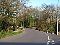
 Bend in the road, north of Kerswill Cross - geograph.org.uk - 4258093.jpg 2,560 × 1,920; 2.11 MB
-
 Berries and haws, Diamond Lane - geograph.org.uk - 6751880.jpg 4,288 × 2,848; 2.18 MB
-
 Beside the Avon - geograph.org.uk - 1507200.jpg 640 × 480; 135 KB
-
-
 Between Higher and Lower Bera - geograph.org.uk - 2903354.jpg 1,024 × 768; 285 KB
-
 Bishop's Meads - geograph.org.uk - 1471245.jpg 640 × 480; 100 KB
-
 Bishops Mead - geograph.org.uk - 1826469.jpg 640 × 480; 66 KB
-
 Black Tor - geograph.org.uk - 1765042.jpg 1,024 × 768; 206 KB
-
 Black Tor prehistoric stone row - geograph.org.uk - 6403303.jpg 1,024 × 768; 306 KB
-
 Bloody Pool Cross - geograph.org.uk - 1052350.jpg 640 × 427; 122 KB
-
 Bloody Pool Cross - geograph.org.uk - 1415399.jpg 640 × 428; 117 KB
-
 Bloody Pool Cross - geograph.org.uk - 1756209.jpg 2,249 × 2,444; 3.45 MB
-
 Bloody Pool Signpost - geograph.org.uk - 5109982.jpg 3,779 × 2,809; 3.1 MB
-
 Blue tit - geograph.org.uk - 1160331.jpg 640 × 427; 53 KB
-
 Blue Tit on a peanut feeder - geograph.org.uk - 1160342.jpg 640 × 427; 44 KB
-
 Bluebells above Overbrent Wood - geograph.org.uk - 2388155.jpg 640 × 480; 123 KB
-
 Bluebells above Overbrent Wood - geograph.org.uk - 2388265.jpg 640 × 450; 135 KB
-
 Bluebells above the Avon - geograph.org.uk - 3964510.jpg 1,920 × 1,341; 950 KB
-
 Bluebells by the bridleway - geograph.org.uk - 2388427.jpg 480 × 640; 138 KB
-
 Bluebells in Overbrent Wood - geograph.org.uk - 2388108.jpg 640 × 437; 126 KB
-
 Bluebells in Overbrent Wood - geograph.org.uk - 2388137.jpg 640 × 456; 131 KB
-
 Bluebells off the path - geograph.org.uk - 3170233.jpg 640 × 427; 229 KB
-
 Bluebells, Penstave Copse - geograph.org.uk - 3964805.jpg 1,920 × 1,440; 808 KB
-
 Bluebells, Penstave Copse - geograph.org.uk - 3964821.jpg 1,920 × 1,440; 620 KB
-
 Bluebells, Penstave Copse - geograph.org.uk - 3964843.jpg 1,920 × 1,298; 966 KB
-
 Bluebells, Penstave Copse - geograph.org.uk - 3964857.jpg 1,920 × 2,560; 1.44 MB
-
 Bluebells, Penstave Copse - geograph.org.uk - 3964869.jpg 1,920 × 1,402; 1 MB
-
 Bluebells, Penstave Copse - geograph.org.uk - 3964918.jpg 1,920 × 1,362; 974 KB
-
 Bluebells, Penstave Copse - geograph.org.uk - 3964937.jpg 1,920 × 1,411; 858 KB
-
 Bluebells, Penstave Copse - geograph.org.uk - 3964969.jpg 1,920 × 1,266; 646 KB
-
 Bluebells, Penstave Copse - geograph.org.uk - 3965214.jpg 3,638 × 2,521; 1.31 MB
-
 Boulder field near East Glaze Brook - geograph.org.uk - 1088327.jpg 640 × 480; 128 KB
-
 Boulder field, Brent Fore Hill - geograph.org.uk - 6750909.jpg 4,288 × 2,848; 2.12 MB
-
 Boulder field, Brent Fore Hill - geograph.org.uk - 6751004.jpg 4,288 × 2,848; 2.52 MB
-
 Boundary marker, Glazebrook - geograph.org.uk - 2586710.jpg 683 × 1,024; 185 KB
-
 Boundary stone on Peathy's Path - geograph.org.uk - 1043502.jpg 640 × 427; 113 KB
-
 Boundary stone, Cumston Track - geograph.org.uk - 6425732.jpg 2,835 × 4,204; 1.78 MB
-
 Bowling House, South Brent - geograph.org.uk - 2388591.jpg 640 × 478; 53 KB
-
 Brent Fore Hill - geograph.org.uk - 1052380.jpg 640 × 427; 67 KB
-
 Brent Fore Hill - geograph.org.uk - 2387017.jpg 640 × 453; 91 KB
-
 Brent Fore Hill - geograph.org.uk - 6750874.jpg 4,288 × 2,848; 2.13 MB
-
 Brent Fore Hill prehistoric stone row - geograph.org.uk - 6403357.jpg 1,024 × 701; 292 KB
-
 Brent Hill - geograph.org.uk - 1106199.jpg 640 × 427; 66 KB
-
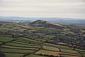 Brent Hill - geograph.org.uk - 1182028.jpg 640 × 427; 52 KB
-
 Brent Hill - geograph.org.uk - 165845.jpg 640 × 480; 130 KB
-
 Brent Hill - geograph.org.uk - 2208268.jpg 683 × 1,024; 195 KB
-
 Brent Hill - geograph.org.uk - 3398203.jpg 1,600 × 1,067; 517 KB
-
 Brent Hill and Beara Common - geograph.org.uk - 1149332.jpg 640 × 427; 58 KB
-
 Brent Hill from Ugborough Moor.jpg 3,708 × 2,733; 3.8 MB
-
 Brent Hill hillfort - geograph.org.uk - 3398072.jpg 1,600 × 1,067; 425 KB
-
 Brent Hill, from South Brent - geograph.org.uk - 830627.jpg 640 × 480; 62 KB
-
 Brent Mill Bridge - geograph.org.uk - 1277568.jpg 640 × 480; 119 KB
-
 Brent Mill Business Park - geograph.org.uk - 3984984.jpg 1,024 × 768; 425 KB
-
 Brent Mill Industrial Estate - geograph.org.uk - 1112469.jpg 640 × 427; 64 KB
-
 Brent Mill Industrial Estate - geograph.org.uk - 1112482.jpg 640 × 427; 63 KB
-
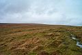 Brent moor - Dartmoor - geograph.org.uk - 116621.jpg 640 × 425; 46 KB
-
 Brent Moor - geograph.org.uk - 1086787.jpg 640 × 480; 111 KB
-
 Brent Moor - geograph.org.uk - 2840466.jpg 1,024 × 768; 242 KB
-
 Bridge and Toll House at Brent Mill - geograph.org.uk - 1112425.jpg 640 × 427; 81 KB
-
 Bridge at South Brent - geograph.org.uk - 4412033.jpg 640 × 480; 128 KB
-
 Bridge on the Island, South Brent - geograph.org.uk - 2760556.jpg 1,024 × 683; 310 KB
-
 Bridge over A38 at Marley Head - geograph.org.uk - 3909825.jpg 1,536 × 1,152; 1.01 MB
-
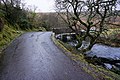 Bridge over the Avon - geograph.org.uk - 3855699.jpg 800 × 532; 172 KB
-
 Bridge over the Avon - geograph.org.uk - 3855849.jpg 800 × 532; 159 KB
-
 Bridge over the Glaze Brook, Pennaton, near South Brent - geograph.org.uk - 4221646.jpg 2,560 × 1,920; 2.05 MB
-
 Bridge over the main railway line, Stidson, South Brent - geograph.org.uk - 4166992.jpg 2,048 × 1,536; 843 KB
-
 Bridleway - geograph.org.uk - 4281123.jpg 800 × 532; 210 KB
-
 Bridleway above the Avon valley - geograph.org.uk - 2388445.jpg 640 × 480; 153 KB
-
 Bridleway above the Avon valley - geograph.org.uk - 2388460.jpg 480 × 640; 142 KB
-
 Bridleway at Brent Moor House - geograph.org.uk - 2272028.jpg 1,024 × 683; 273 KB
-
 Bridleway at Didworthy - geograph.org.uk - 3170210.jpg 640 × 427; 218 KB
-
 Bridleway at Merrifield Plantation - geograph.org.uk - 3170164.jpg 640 × 424; 270 KB
-
 Bridleway by Aishridge Plantation - geograph.org.uk - 6610566.jpg 4,288 × 2,848; 2.11 MB
-
 Bridleway from Ball Gate - geograph.org.uk - 4281126.jpg 800 × 532; 136 KB
-
 Bridleway from Didworthy to Lutton - geograph.org.uk - 3952037.jpg 640 × 425; 113 KB
-
 Bridleway from Didworthy to Lutton - geograph.org.uk - 3952054.jpg 640 × 425; 141 KB
-
 Bridleway from Didworthy to Lutton - geograph.org.uk - 3952080.jpg 640 × 425; 132 KB
-
 Bridleway from Didworthy to Lutton - geograph.org.uk - 3952093.jpg 640 × 425; 127 KB
-
 Bridleway from Didworthy to Lutton - geograph.org.uk - 3952125.jpg 640 × 425; 131 KB
-

-
 Bridleway heading towards Gribblesdown - geograph.org.uk - 4281129.jpg 800 × 532; 108 KB
-
 Bridleway into Overbrent Wood - geograph.org.uk - 6754489.jpg 4,288 × 2,848; 2.31 MB
-
 Bridleway near Corringdon Ball - geograph.org.uk - 6750630.jpg 4,288 × 2,848; 2.36 MB


.jpg)
.jpg)
.jpg)

.jpg)
.jpg)
.jpg)


