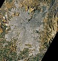
Category:Satellite pictures of Santiago de Chile
Jump to navigation
Jump to search
Media in category "Satellite pictures of Santiago de Chile"
The following 15 files are in this category, out of 15 total.
-
AMAZONIA 1 WFI 20220810 038 021 L4 BANDS321 ClipSantiagoChile LinearContrast.jpg 1,414 × 1,307; 387 KB
-
Emergência em Santiago - Chile.png 983 × 916; 2.13 MB
-
Establishment of the new National Glacier Park in Chile.jpg 4,289 × 4,060; 12.47 MB
-
ISS015-E-33248 - View of Earth.jpg 3,032 × 2,008; 1.34 MB
-
ISS038-E-8227 - View of Chile.jpg 4,256 × 2,832; 1.6 MB
-
ISS055-E-7400 - View of Earth.jpg 5,568 × 3,712; 4 MB
-
Iss070e093399.jpg 5,568 × 3,712; 2.52 MB
-
Santiago, Chile (5461527006).jpg 2,000 × 2,000; 948 KB
-
Santiago, Chile ESA24566128.jpeg 9,462 × 8,118; 32.81 MB
-
Santiago, Chile ESA24566128.tiff 9,462 × 8,118; 180.17 MB
-
SantiagoEmergenciaCBERS4 PAN10m5M 20170120 176 138 432R.jpg 980 × 862; 529 KB
-
SantiagoEmergenciaCBERS4 PAN10m5M 20170120 176 138 432R.png 983 × 927; 2.15 MB
-
SantiagoSatellite.jpg 640 × 677; 206 KB
-
SantiagoSatellite2006.jpg 1,902 × 1,985; 974 KB
-
Satellite image of Santiago, Chile - October 24, 2014.jpg 1,935 × 1,778; 1.1 MB


