Category:Road maps of Oregon
Jump to navigation
Jump to search
States of the United States: Alabama · Alaska · Arizona · Arkansas · California · Colorado · Connecticut · Delaware · Florida · Georgia · Hawaii · Idaho · Illinois · Indiana · Iowa · Kansas · Kentucky · Louisiana · Maine · Maryland · Massachusetts · Michigan · Minnesota · Mississippi · Missouri · Montana · Nebraska · Nevada · New Hampshire · New Jersey · New Mexico · New York · North Carolina · North Dakota · Ohio · Oklahoma · Oregon · Pennsylvania · Rhode Island · South Carolina · South Dakota · Tennessee · Texas · Utah · Vermont · Virginia · Washington · West Virginia · Wisconsin · Wyoming – Washington, D.C.
Puerto Rico
Puerto Rico
Subcategories
This category has the following 3 subcategories, out of 3 total.
Media in category "Road maps of Oregon"
The following 17 files are in this category, out of 17 total.
-
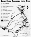
Butte Falls Discovery Loop.gif 548 × 656; 298 KB
-
Delta Highway map.svg 1,442 × 867; 95 KB
-
Franklin Boulevard closure detour routes (4120774684).jpg 2,365 × 3,005; 633 KB
-
High Desert Discovery Scenic Byway map.jpg 593 × 469; 128 KB
-
I-5 Exit 30 IAMP Study Area (50642199448).jpg 1,894 × 1,056; 522 KB
-
Map of Oregon NA.png 1,967 × 1,331; 2.15 MB
-
Old Youngs Bay Bridge Location Map (3990715686).jpg 2,200 × 1,700; 975 KB
-
OR18B Aug 1-4 Closure map (2680504938).jpg 1,700 × 900; 143 KB
-
Oregon 22 paving project (3617287463).jpg 480 × 360; 36 KB
-
Oregon Outback Scenic Byway map.jpg 590 × 473; 123 KB
-
Oregon Route 140.png 783 × 565; 18 KB
-
Oregon State Highways 1918.jpg 3,300 × 2,552; 999 KB
-
Oregon State Highways 1920.jpg 3,300 × 2,552; 896 KB
-
Small-Oregon-Map.png 546 × 696; 558 KB
-
Speed limit increases in Oregon, March 2016 (2).jpg 1,166 × 1,800; 730 KB
-
Speed limit increases in Oregon, March 2016.jpg 2,000 × 1,265; 770 KB
-
Wpdms na-or wcascadesbyway.png 588 × 491; 377 KB


