Category:Public transport maps of Amsterdam
Jump to navigation
Jump to search
Maps of the Amsterdam public transport system
Subcategories
This category has the following 2 subcategories, out of 2 total.
S
- Amsterdam subway maps (29 F)
T
Media in category "Public transport maps of Amsterdam"
The following 13 files are in this category, out of 13 total.
-
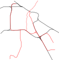
Amsterdam metro and raillines.svg 1,530 × 1,550; 11 KB
-
Amsterdam public transport via rails.png 1,671 × 1,353; 2.94 MB
-
Amsterdam train map.png 2,116 × 2,142; 388 KB
-
Amsterdam, Den Haag, Rotterdam and Utrecht public transport system map (with stations).jpg 18,024 × 17,939; 80.28 MB
-
AmsterdamTram+Metro.png 3,152 × 2,169; 667 KB
-
Metro & Tram Network of Amsterdam in 2018.png 3,497 × 2,779; 1.19 MB
-
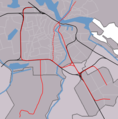
Outline map Amsterdam metro 2.PNG 952 × 964; 136 KB
-
Outline map Amsterdam metro.PNG 952 × 952; 127 KB
-
Spoorlijn Amsterdam-Schiphol.png 774 × 645; 38 KB
-
Tram & Metro Amsterdam 2016.png 1,749 × 1,390; 543 KB
-
Tram & Metro Amsterdam 2016.svg 839 × 678; 239 KB
-
Tram & Metro Map of Amsterdam 2016.svg 839 × 678; 2.6 MB
-
U-UndTrambahnGleisplanAmsterdam2019.png 10,267 × 8,128; 3.41 MB


