Category:Pentyrch
Jump to navigation
Jump to search
Cymraeg: Pentref a chymuned yng ngorllewin dinas Caerdydd yw Pentyrch, weithiau Pen-tyrch. Roedd y boblogaeth yn 2001 yn 6,297.
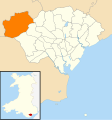
English: Pentyrch is a suburban community located on the western outskirts of Cardiff, the capital city of Wales. The village gives its name to a Cardiff local authority electoral ward, which covers the village and surrounding area.
village and community in Cardiff, Wales  .svg) | |||||
| Upload media | |||||
| Instance of | |||||
|---|---|---|---|---|---|
| Location | Cardiff, Wales | ||||
| Population |
| ||||
| Different from | |||||
 | |||||
Subcategories
This category has the following 11 subcategories, out of 11 total.
C
- Cardiff West services (11 F)
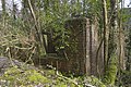
- Craig-y-parc House (1 F)
F
G
- Garth Hill (1 P, 19 F)
K
- Kings Arms, Pentyrch (2 F)
L
- Lewis Arms, Pentyrch (6 F)
P
- Pentyrch War Memorial (6 F)
S
- St Catwg's Church, Pentyrch (6 F)
Media in category "Pentyrch"
The following 200 files are in this category, out of 376 total.
(previous page) (next page)-
 2010 Wales Cardiff Community Pentyrch map.svg 512 × 546; 341 KB
-
 2024 Wales Cardiff Community Pentyrch map.svg 512 × 546; 319 KB
-

-
 A hole in the clouds - geograph.org.uk - 6390332.jpg 3,275 × 2,389; 1.85 MB
-

-
 A4119 near Capel Llanilltern - geograph.org.uk - 2449927.jpg 640 × 480; 89 KB
-
 Acapela in Pentyrch - geograph.org.uk - 5553453.jpg 800 × 516; 79 KB
-
 Acapela Recording Studio (geograph 5460330).jpg 2,365 × 3,156; 1.35 MB
-

-
 Alfreds Terrace, Taffs Well - geograph.org.uk - 2729044.jpg 640 × 476; 75 KB
-

-
 Arches at Taff's Well - Morganstown - geograph.org.uk - 1276042.jpg 640 × 425; 114 KB
-
 Awel y Garth sales centre, Pentyrch - geograph.org.uk - 5548704.jpg 800 × 694; 133 KB
-
 Backlit catkins - geograph.org.uk - 6390337.jpg 1,536 × 2,048; 524 KB
-
 Barry Railway bridge Creigiau - geograph.org.uk - 1885022.jpg 3,648 × 2,736; 4.34 MB
-
 Barry Railway Tunnel South Entrance - geograph.org.uk - 3926603.jpg 2,400 × 1,594; 5.11 MB
-
 Barry Railway Tunnel South Entrance - geograph.org.uk - 3926615.jpg 2,400 × 1,592; 5.55 MB
-
 Bench with a view in Pentyrch - geograph.org.uk - 5618891.jpg 800 × 578; 146 KB
-
 Benedict Court, Bronllwyn, Pentyrch - geograph.org.uk - 5559528.jpg 800 × 621; 98 KB
-
 Bethan Kate's Tearoom - geograph.org.uk - 5460426.jpg 3,264 × 2,448; 1.16 MB
-
 Bethan Kate's Tearoom, Pentyrch - geograph.org.uk - 5546040.jpg 718 × 800; 150 KB
-
 Bilingual distances sign in Pentyrch - geograph.org.uk - 5559551.jpg 700 × 800; 148 KB
-

-
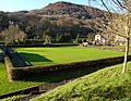 Bowling green, Taffs Well Park - geograph.org.uk - 2730462.jpg 640 × 495; 111 KB
-
 Bridleway at Craig-y-Parc - Pentyrch - geograph.org.uk - 1735765.jpg 1,200 × 797; 1.41 MB
-

-
 Bronllwyn, Pentyrch - geograph.org.uk - 2486756.jpg 2,816 × 2,112; 1.73 MB
-
 Bronze Age barrow - geograph.org.uk - 6242467.jpg 2,048 × 1,536; 607 KB
-
 BT telecoms cabinet, Bronllwyn, Pentyrch - geograph.org.uk - 5624860.jpg 800 × 600; 135 KB
-
 Burial mound - geograph.org.uk - 6242098.jpg 5,898 × 2,777; 4.09 MB
-

-
 Bus to Cardiff, Heol y Pentre, Pentyrch - geograph.org.uk - 5618895.jpg 800 × 608; 108 KB
-
 Caesars Arms - geograph.org.uk - 2053241.jpg 640 × 480; 76 KB
-
 Canada Lake - geograph.org.uk - 2909972.jpg 4,000 × 3,000; 3 MB
-
 Canada Lake and Craig-y-parc - geograph.org.uk - 2910009.jpg 4,000 × 3,000; 4.59 MB
-
 Canada Lodge - geograph.org.uk - 2909986.jpg 4,000 × 3,000; 3.71 MB
-
 Canada Lodge and Lake - geograph.org.uk - 2909977.jpg 4,000 × 3,000; 3.85 MB
-
 Capel House - geograph.org.uk - 5411248.jpg 3,264 × 2,448; 2.19 MB
-
 Capel Llanilltern - geograph.org.uk - 5412076.jpg 3,264 × 2,448; 2.65 MB
-
 Cardiff , Cardiff West Services - geograph.org.uk - 3917417.jpg 4,608 × 3,456; 7.35 MB
-
 Cardiff Road - geograph.org.uk - 2613110.jpg 640 × 480; 56 KB
-
 Cardiff Road houses, Creigiau - geograph.org.uk - 5543595.jpg 800 × 629; 130 KB
-
 Cardiff Road houses, Creigiau - geograph.org.uk - 5543602.jpg 800 × 567; 112 KB
-
 Cardiff UK community map (Pentyrch).svg 1,187 × 1,266; 438 KB
-
 Cardiff ward location - Pentyrch.png 800 × 570; 116 KB
-
 Cardiff West Services - geograph.org.uk - 4725224.jpg 1,600 × 1,064; 486 KB
-
 Cefn Bychan houses, Pentyrch - geograph.org.uk - 5548572.jpg 800 × 543; 96 KB
-
 Children's Play Area Cardiff West - geograph.org.uk - 6194013.jpg 4,032 × 1,908; 2.6 MB
-
 Children's play area,Taffs Well Park - geograph.org.uk - 2730455.jpg 640 × 427; 82 KB
-
 Children's playground in Pentyrch - geograph.org.uk - 5553468.jpg 800 × 751; 202 KB
-
 City and County of Cardiff boundary sign - geograph.org.uk - 5525000.jpg 767 × 800; 138 KB
-
 Clos Goch, Pentyrch - geograph.org.uk - 5548654.jpg 800 × 623; 110 KB
-
 Co-operative Food store, Taffs Well - geograph.org.uk - 2729370.jpg 640 × 390; 56 KB
-
 Coach Park at Cardiff West Services - geograph.org.uk - 4138280.jpg 800 × 538; 94 KB
-
 Coal train near Taff's Well - geograph.org.uk - 5259442.jpg 3,421 × 2,565; 4.28 MB
-
 Coal train seen from Garth Hill - geograph.org.uk - 5259434.jpg 3,606 × 2,704; 5.37 MB
-
 Coed y Bedw Nature Reserve - geograph.org.uk - 4990930.jpg 3,264 × 2,448; 3.82 MB
-
 Concrete posts on a Creigiau corner - geograph.org.uk - 5858075.jpg 1,024 × 760; 124 KB
-

-

-
 Craig Gwilym - geograph.org.uk - 5757700.jpg 6,070 × 3,144; 5.56 MB
-
-
 Creigiau name sign - geograph.org.uk - 5542418.jpg 799 × 800; 325 KB
-
 Crossing the former Taff Vale Railway - geograph.org.uk - 4858625.jpg 640 × 480; 167 KB
-
 Cwtch Therapy, Pentyrch - geograph.org.uk - 5559460.jpg 800 × 728; 163 KB
-
 De Courcey's Manor - geograph.org.uk - 5755892.jpg 3,264 × 2,448; 3.25 MB
-
 Deciduous Woodland - geograph.org.uk - 4829698.jpg 5,472 × 3,648; 5.95 MB
-

-
 Descent from Garth Hill - geograph.org.uk - 4843583.jpg 4,000 × 3,000; 3.21 MB
-
-

-

-

-
 Dol-y-Felin, Creigiau - geograph.org.uk - 5535622.jpg 800 × 610; 116 KB
-

-

-

-
 Electric Car Chargers at Cardiff West Service Station - geograph.org.uk - 4486961.jpg 1,600 × 1,200; 370 KB
-
 Entering Rhiwsaeson from the south - geograph.org.uk - 5590368.jpg 4,608 × 3,456; 3.82 MB
-
 Entrance to Canada Lake and Lodge - Creigiau - geograph.org.uk - 1736052.jpg 1,200 × 797; 914 KB
-
 Entrance to Robin Hill House, Creigiau - geograph.org.uk - 5542324.jpg 800 × 700; 203 KB
-
 Entrance to sewage works, Rhiwsaeson - geograph.org.uk - 5590359.jpg 4,608 × 3,456; 4.03 MB
-
 Erw Wen cottages, Pentyrch - geograph.org.uk - 5553493.jpg 800 × 520; 82 KB
-
 Farm Buildings - geograph.org.uk - 4829594.jpg 5,472 × 3,648; 7.09 MB
-
 Farm Track - geograph.org.uk - 388076.jpg 640 × 467; 100 KB
-
 Farmland and abandoned building below Garth Hill - geograph.org.uk - 4843547.jpg 4,000 × 3,000; 4.01 MB
-
 Farmland near Capel Llanilltern - geograph.org.uk - 2948394.jpg 640 × 480; 68 KB
-
 Ffordd-y-Bryniau - Ridgeway Walk - geograph.org.uk - 401874.jpg 640 × 480; 83 KB
-
 Field near Capel Llanilltern - geograph.org.uk - 2441664.jpg 2,816 × 2,112; 2.29 MB
-

-
 Fields and footpath in Creigiau - geograph.org.uk - 2486736.jpg 2,816 × 2,112; 1.93 MB
-
 Fields and footpaths, Pentyrch - geograph.org.uk - 2486752.jpg 2,112 × 2,816; 2.16 MB
-

-
 Fields near Capel Llanilltern - geograph.org.uk - 2441653.jpg 2,816 × 2,112; 1.99 MB
-
 Fields near Pentyrch - geograph.org.uk - 2486706.jpg 2,816 × 2,112; 2.07 MB
-

-
 Football Terrace, Greigiau. - geograph.org.uk - 388097.jpg 640 × 476; 108 KB
-
 Footbridge across the Taff - geograph.org.uk - 2329463.jpg 3,000 × 4,000; 3.78 MB
-
 Footbridge across the Taff, Gwaelod-y-garth - geograph.org.uk - 2329478.jpg 4,000 × 3,000; 2.03 MB
-
 Footpath and Steps within Housing Estate - geograph.org.uk - 5460297.jpg 2,303 × 3,068; 2.33 MB
-
 Footpath near Radyr - geograph.org.uk - 2441635.jpg 2,816 × 2,112; 2.82 MB
-
 Footpath on Garth Hill - geograph.org.uk - 6014130.jpg 5,184 × 3,888; 7.14 MB
-
 Footpath through Garth Wood - geograph.org.uk - 5460435.jpg 2,378 × 3,172; 2.59 MB
-
 Footpath to Garth Hill - geograph.org.uk - 4843553.jpg 4,000 × 3,000; 4.32 MB
-
 Footpath to Tre-Wern - geograph.org.uk - 2441647.jpg 2,816 × 2,112; 1.79 MB
-
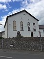
 Former Horeb chapel, Pentyrch - geograph.org.uk - 5553455.jpg 800 × 630; 97 KB
-

-
 Former quarry structure off Heol Goch - geograph.org.uk - 2486696.jpg 2,112 × 2,816; 2.32 MB
-
 From 20 to 30 on Mountain Road, Pentyrch - geograph.org.uk - 5559580.jpg 800 × 606; 129 KB
-
-
 From Pant Tawel to Pentyrch - geograph.org.uk - 6398260.jpg 2,048 × 1,536; 1.34 MB
-
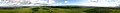 Garth Hill Panoramic View.jpg 6,708 × 700; 899 KB
-
 Gate and stile to footpath near Llwynmilwas Farm - geograph.org.uk - 5590316.jpg 4,608 × 3,456; 4.03 MB
-
 George's Corner flats, Bronllwyn, Pentyrch - geograph.org.uk - 5887336.jpg 1,024 × 708; 248 KB
-
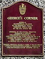 George's Corner plaque, Pentyrch - geograph.org.uk - 5887337.jpg 781 × 1,024; 241 KB
-
 George's Corner, Pentyrch - geograph.org.uk - 5618896.jpg 800 × 600; 130 KB
-
 Georgetown Playing Field - geograph.org.uk - 5460321.jpg 6,060 × 3,214; 4.77 MB
-
 Glamorgan Ridgeway Walk near Soar - geograph.org.uk - 4741884.jpg 640 × 360; 51 KB
-
 Glowing in the setting sun, Pentyrch - geograph.org.uk - 961752.jpg 640 × 480; 70 KB
-
 Go home^ - geograph.org.uk - 6390333.jpg 2,048 × 1,536; 1.27 MB
-
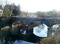 Grade II listed Ynys Bridge - geograph.org.uk - 2180386.jpg 640 × 471; 81 KB
-
 Green Acre, Creigiau - geograph.org.uk - 5543483.jpg 800 × 621; 137 KB
-

-
 Hedge-lined Llantwit Road north of Creigiau - geograph.org.uk - 5858063.jpg 1,024 × 768; 177 KB
-
 Heol Berry - geograph.org.uk - 5460447.jpg 3,264 × 2,448; 1.16 MB
-
 Heol Berry -Taff's Well - geograph.org.uk - 1814876.jpg 1,200 × 786; 908 KB
-
 Heol Creigiau semis, Creigiau - geograph.org.uk - 5858004.jpg 1,024 × 715; 182 KB
-
 Heol Creigiau-Tynant Road junction - geograph.org.uk - 2613028.jpg 640 × 480; 57 KB
-
 Heol Goch - Pentyrch - geograph.org.uk - 1735624.jpg 1,200 × 797; 826 KB
-
 Heol Goch - Pentyrch - geograph.org.uk - 1735640.jpg 1,200 × 797; 1 MB
-
 Heol Goch - Pentyrch - geograph.org.uk - 1814895.jpg 1,200 × 797; 1.08 MB
-
 Heol Goch beyond Pentyrch - geograph.org.uk - 5548643.jpg 800 × 708; 183 KB
-
 Heol Goch houses, Pentyrch - geograph.org.uk - 5553429.jpg 800 × 529; 125 KB
-

-
 Heol Pant y Gored near Creigiau - geograph.org.uk - 5542353.jpg 610 × 800; 187 KB
-
 Heol-y-Parc - Pentyrch - geograph.org.uk - 1735719.jpg 1,200 × 801; 728 KB
-
 Heol-yr-Ynys crosses the Taff - geograph.org.uk - 1872333.jpg 3,296 × 2,472; 1.9 MB
-

-
 Houses in the north of Creigiau - geograph.org.uk - 5858025.jpg 1,024 × 870; 217 KB
-
 Houses in Troed-y-Garth, Pentyrch - geograph.org.uk - 5631334.jpg 800 × 682; 110 KB
-
 Houses on the east side of Bronllwyn, Pentyrch - geograph.org.uk - 5887995.jpg 1,024 × 788; 153 KB
-

-
-

-

-

-

-

-

-

-

-
 Lane near Rhiwsaeson - geograph.org.uk - 5590349.jpg 4,608 × 3,456; 3.99 MB
-
 Lane ^ bridge over former railway, Creigiau - geograph.org.uk - 2486743.jpg 2,112 × 2,816; 2.46 MB
-
 Lane ^ bridge over former railway, near Creigiau Farm - geograph.org.uk - 2486747.jpg 2,816 × 2,112; 2.29 MB
-
 Lineside Building, Barry Railway - geograph.org.uk - 2747127.jpg 2,500 × 1,662; 4.41 MB
-
 Llwyn-y-brain Farm, near Rhiwsaeson - geograph.org.uk - 5590513.jpg 4,320 × 3,240; 2.92 MB
-
 Long grass strip, Penuel Road, Pentyrch - geograph.org.uk - 5624784.jpg 800 × 739; 132 KB
-

-

-
 M4 Motorway Junction 33 - geograph.org.uk - 2455861.jpg 640 × 480; 85 KB
-
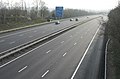 M4 Motorway, East of Junction 33. - geograph.org.uk - 380287.jpg 640 × 423; 85 KB
-
 Maes y Sarn houses, Pentyrch - geograph.org.uk - 5546147.jpg 800 × 581; 84 KB
-
 Main Road, Gwaelod y Garth - geograph.org.uk - 1225572.jpg 640 × 480; 60 KB
-
 Maison de Beauté, Pentyrch - geograph.org.uk - 5559507.jpg 800 × 744; 110 KB
-
 Millennium Mosaic, Pentyrch - geograph.org.uk - 5559557.jpg 800 × 377; 175 KB
-
 Mountain Road near Garth Hill - geograph.org.uk - 6014159.jpg 4,722 × 3,541; 7.42 MB
-
 Mountain Road, Pentyrch - geograph.org.uk - 5559592.jpg 676 × 800; 142 KB
-
 Mountain Road, Pentyrch - geograph.org.uk - 5631314.jpg 800 × 781; 168 KB
-
 Mynydd y Garth Hill - geograph.org.uk - 2710539.jpg 690 × 518; 177 KB
-
 Mynydd y Garth.JPG 2,080 × 681; 288 KB
-
 Neuadd y Pentref, Pentyrch - geograph.org.uk - 426113.jpg 640 × 455; 94 KB
-
 New road, Georgetown - geograph.org.uk - 2525226.jpg 640 × 384; 73 KB
-
 North along Bronllwyn, Pentyrch - geograph.org.uk - 5624814.jpg 800 × 663; 99 KB
-
 North along Mountain Road Pentyrch - geograph.org.uk - 5631327.jpg 800 × 568; 106 KB
-
 Northern approach to Creigiau - geograph.org.uk - 5858084.jpg 1,024 × 1,021; 197 KB
-
 Northern end of Tynant Road, Creigiau - geograph.org.uk - 5858041.jpg 1,024 × 729; 132 KB
-

-
 Oaklands, Cardiff Road, Creigiau - geograph.org.uk - 5543535.jpg 800 × 614; 160 KB
-

-
 Old Bakery Court flats in Pentyrch - geograph.org.uk - 5618876.jpg 800 × 755; 209 KB
-
 Old Bakery Court, Pentyrch - geograph.org.uk - 5618874.jpg 800 × 594; 106 KB
-
 Old Railway Bridge - geograph.org.uk - 4593284.jpg 3,554 × 2,606; 3.87 MB
-
 Old Station Yard, Creigiau - geograph.org.uk - 5544084.jpg 800 × 578; 148 KB
-
 Old track - geograph.org.uk - 6241883.jpg 1,536 × 2,048; 1.07 MB
-
 Old walls alone remain - Soar - geograph.org.uk - 1814940.jpg 1,200 × 797; 906 KB
-
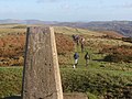
 Ordnance Survey Cut Mark - geograph.org.uk - 6308249.jpg 1,024 × 787; 158 KB
-
 Ordnance Survey Cut Mark - geograph.org.uk - 6308250.jpg 1,024 × 816; 262 KB
-
 Ordnance Survey Rivet - geograph.org.uk - 6308251.jpg 746 × 1,024; 279 KB
-

-
 Parc Castell y Mynach, Creigiau - geograph.org.uk - 5537469.jpg 800 × 620; 124 KB
-

-
 Parc-y-Coed, Creigiau - geograph.org.uk - 5543515.jpg 800 × 541; 132 KB
-
 Pasture at Capel Llanilltern - geograph.org.uk - 5737513.jpg 3,264 × 2,448; 4.82 MB
-
 Pen-y-cwm houses, Pentyrch - geograph.org.uk - 5631289.jpg 800 × 480; 98 KB
-
 Pen-y-cwm name sign, Pentyrch - geograph.org.uk - 5631285.jpg 800 × 514; 105 KB
-
 Pen-y-Waun, Pentyrch - geograph.org.uk - 5559666.jpg 800 × 521; 97 KB
-
 Pentwyn, near Pentyrch. - geograph.org.uk - 380543.jpg 640 × 480; 100 KB
-
 Pentyrch - Route des Alpes road near the Garth Nov 2023.jpg 6,000 × 4,000; 12.08 MB
-
 Pentyrch Boarding Kennels - geograph.org.uk - 5460429.jpg 3,264 × 2,448; 3.66 MB
-
 Pentyrch children's playground - geograph.org.uk - 5553473.jpg 800 × 507; 130 KB


.jpg)


