Category:PEF map of Western Palestine (details of sheet 17)
Jump to navigation
Jump to search
Media in category "PEF map of Western Palestine (details of sheet 17)"
The following 59 files are in this category, out of 59 total.
-
Historical map series for the area of Ajanjul (1870s).jpg 739 × 742; 195 KB
-
Historical map series for the area of al-Burj, Ramle (1870s).jpg 739 × 743; 185 KB
-
Historical map series for the area of al-Jura, Jerusalem (1870s).jpg 738 × 741; 239 KB
-
Historical map series for the area of al-Kunayyisa (1870s).jpg 739 × 742; 221 KB
-
Historical map series for the area of al-Qabu (1870s).jpg 738 × 741; 212 KB
-
Historical map series for the area of Al-Qastal, Jerusalem (1870s).jpg 738 × 742; 230 KB
-
Historical map series for the area of al-Qubab (1870s).jpg 739 × 742; 202 KB
-
Historical map series for the area of Allar, Jerusalem (1870s).jpg 738 × 741; 231 KB
-
Historical map series for the area of Aqqur (1870s).jpg 738 × 741; 246 KB
-
Historical map series for the area of Artuf (1870s).jpg 738 × 742; 220 KB
-
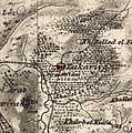
Historical map series for the area of az-Zakariyya (1870s).jpg 737 × 741; 256 KB
-
Historical map series for the area of Barfiliya (1870s).jpg 739 × 743; 211 KB
-
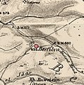
Historical map series for the area of Bayt 'Itab (1870s).jpg 738 × 741; 226 KB
-
Historical map series for the area of Bayt Jiz (1870s).jpg 738 × 742; 233 KB
-
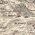
Historical map series for the area of Bayt Mahsir (1870s).jpg 738 × 742; 245 KB
-
Historical map series for the area of Bayt Naqquba (1870s).jpg 738 × 742; 234 KB
-
Historical map series for the area of Bayt Nattif (1870s).jpg 737 × 741; 235 KB
-
Historical map series for the area of Bayt Nuba (1870s).jpg 739 × 742; 180 KB
-
Historical map series for the area of Bayt Shanna (1870s).jpg 739 × 742; 219 KB
-
Historical map series for the area of Bayt Susin (1870s).jpg 738 × 742; 232 KB
-
Historical map series for the area of Bayt Thul (1870s).jpg 738 × 742; 226 KB
-
Historical map series for the area of Bayt Umm al-Mays (1870s).jpg 738 × 742; 235 KB
-
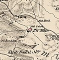
Historical map series for the area of Bir Ma'in (1870s).jpg 739 × 743; 201 KB
-
Historical map series for the area of Dayr 'Amr (1870s).jpg 738 × 742; 249 KB
-
Historical map series for the area of Dayr Aban (1870s).jpg 738 × 741; 231 KB
-
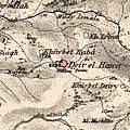
Historical map series for the area of Dayr al-Hawa (1870s).jpg 738 × 741; 235 KB
-
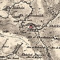
Historical map series for the area of Dayr al-Shaykh (1870s).jpg 738 × 741; 248 KB
-
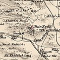
Historical map series for the area of Dayr Ayyub (1870s).jpg 738 × 742; 224 KB
-
Historical map series for the area of Dayr Rafat (1870s).jpg 738 × 742; 219 KB
-
Historical map series for the area of Deir Yassin (1870s).jpg 738 × 742; 229 KB
-
Historical map series for the area of Innaba (1870s).jpg 739 × 743; 222 KB
-
Historical map series for the area of Ishwa (1870s).jpg 738 × 742; 228 KB
-
Historical map series for the area of Islin (1870s).jpg 738 × 742; 233 KB
-
Historical map series for the area of Jarash, Jerusalem (1870s).jpg 738 × 741; 218 KB
-
Historical map series for the area of Kasla, Jerusalem (1870s).jpg 738 × 742; 235 KB
-
Historical map series for the area of Kharruba (1870s).jpg 739 × 743; 225 KB
-
Historical map series for the area of Khirbat al-'Umur (1870s).jpg 738 × 742; 250 KB
-
Historical map series for the area of Khirbat al-Buwayra (1870s).jpg 739 × 742; 208 KB
-
Historical map series for the area of Khirbat Al-Lawz (1870s).jpg 738 × 742; 241 KB
-
Historical map series for the area of Khirbat al-Tannur (1870s).jpg 737 × 741; 225 KB
-
Historical map series for the area of Khirbat Ism Allah (1870s).jpg 738 × 742; 232 KB
-
Historical map series for the area of Lifta (1870s).jpg 738 × 742; 229 KB
-
Historical map series for the area of Nitaf (1870s).jpg 738 × 742; 218 KB
-
Historical map series for the area of Qalunya (1870s).jpg 738 × 742; 220 KB
-
Historical map series for the area of Ras Abu 'Ammar (1870s).jpg 738 × 741; 232 KB
-
Historical map series for the area of Sar'a (1870s).jpg 738 × 742; 229 KB
-
Historical map series for the area of Saris, Jerusalem (1870s).jpg 738 × 742; 229 KB
-
Historical map series for the area of Sataf (1870s).jpg 738 × 742; 243 KB
-
Historical map series for the area of Sheikh Badr (1870s).jpg 738 × 742; 231 KB
-
Historical map series for the area of Suba, Jerusalem (1870s).jpg 738 × 742; 236 KB
-
Historical map series for the area of Sufla (1870s).jpg 738 × 741; 225 KB
-
JerusalemFarWest1870s.jpg 1,200 × 898; 441 KB
-
JerusalemWest1870s.jpg 800 × 499; 127 KB
-
Modiin1870s.jpg 1,094 × 1,046; 245 KB
-
PEF map -BEIT MAHSIR.jpg 920 × 513; 163 KB

