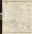
Category:Old maps of Ritzebüttel
Jump to navigation
Jump to search
Use the appropriate category for maps showing all or a large part of Ritzebüttel. See subcategories for smaller areas:
| If the map shows | Category to use |
|---|---|
| Ritzebüttel on a recently created map | Category:Maps of Ritzebüttel or its subcategories |
| Ritzebüttel on a map created more than 70 years ago | Category:Old maps of Ritzebüttel or its subcategories |
| the history of Ritzebüttel on a recently created map | Category:Maps of the history of Ritzebüttel or its subcategories |
| the history of Ritzebüttel on a map created more than 70 years ago | Category:Old maps of the history of Ritzebüttel or its subcategories |
Media in category "Old maps of Ritzebüttel"
The following 15 files are in this category, out of 15 total.
-
De Nordseeküste (Karten) 05.jpg 6,182 × 4,412; 3.88 MB
-
Reilly 303.jpg 1,540 × 832; 524 KB
-
PPN612024377 Das Gebieth Der Stadt Hamburg Mit Den Angrenzenden Landen (1811).jpg 6,429 × 7,219; 7.74 MB
-
PPN612024377 Das Gebieth Der Stadt Hamburg Mit Den Angrenzenden Landen (1811).tif 6,948 × 7,253; 20.31 MB
-
59 of 'Brockes und das Amt Ritzebüttel, 1735-1741, etc' (11243813013).jpg 3,088 × 2,209; 606 KB
-
PPN611998394 Karte für die Einsegelung in die Elbe (1868).jpg 9,726 × 7,948; 13.9 MB
-
PPN611998394 Karte für die Einsegelung in die Elbe (1868).tif 10,308 × 8,128; 30.47 MB
-
PPN612044777 Das Hamburger Gebiet und dessen Umgegend (1871).jpg 10,170 × 7,883; 18.81 MB
-
PPN612044777 Das Hamburger Gebiet und dessen Umgegend (1871).tif 10,562 × 7,961; 45.68 MB
-
Elbkarte Melchior Lorichs 1568 Repro Schuback 1842.jpg 9,775 × 880; 3.67 MB
-
Pincerno - Niederelbe 1860.jpg 1,191 × 842; 315 KB
-
PPN610755056 Wandkarte des Hamburger Gebietes nebst Umgegend (1866).jpg 6,851 × 5,791; 8.2 MB
-
PPN610755056 Wandkarte des Hamburger Gebietes nebst Umgegend (1866).tiff 6,939 × 5,982; 17.64 MB


