Category:Old maps of Dublin
Jump to navigation
Jump to search
wikimedia list article of historical maps of Dublin, Ireland | |||||
| Upload media | |||||
| Instance of | |||||
|---|---|---|---|---|---|
| Main subject | |||||
| |||||
Subcategories
This category has the following 5 subcategories, out of 5 total.
1
- 1798 map of Dublin (2 F)
G
Media in category "Old maps of Dublin"
The following 78 files are in this category, out of 78 total.
-
1606 map.jpg 1,525 × 907; 627 KB
-
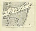
Survey of Dublin, Co. Dublin (25038254303).jpg 2,000 × 1,346; 1.78 MB
-
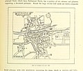
257 of '(Our own country. Descriptive, historical, pictorial.)' (11177481016).jpg 1,954 × 1,675; 721 KB
-
259 of '(Our own country. Descriptive, historical, pictorial.)' (11248170425).jpg 1,916 × 1,681; 814 KB
-
Dublin hand drawn survey, St. Andrew's Church (25419849663).jpg 1,675 × 2,000; 1.33 MB
-
Dublin 1714 (Moll).jpg 1,538 × 1,143; 475 KB
-
1757 map Post Office in Cope Street Dublin.jpg 2,236 × 1,596; 797 KB
-
AusschnittKarte1797CustomHouse StMarksChurch.jpg 1,040 × 687; 193 KB
-
1797 map of Dublin, Ireland.jpg 1,024 × 684; 262 KB
-
1797-map-of-Dublin.jpg 9,945 × 6,846; 16.01 MB
-
DUBLIN(1811) p010 A PLAN OF THE CITY OF DUBLIN.jpg 4,398 × 3,408; 8.54 MB
-
St-PetersChurch-1829-red.jpg 587 × 435; 175 KB
-
Map of Dublin – The Gentleman's and citizen's almanack for the year (1830) (14796769703).jpg 3,930 × 3,248; 3.08 MB
-
1836 map of Dublin.jpg 9,695 × 7,545; 15.14 MB
-
Dublin 1836.jpg 6,336 × 5,135; 4.25 MB
-
1836 SDUK map-of-Dublin.jpg 7,150 × 6,225; 9.13 MB
-
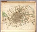
City of Dublin 1837 map.jpg 2,934 × 2,028; 3.36 MB
-
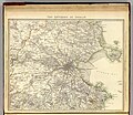
County of the City of Dublin 1837 map.jpg 4,855 × 3,450; 2.36 MB
-
1837 SDUK map-of-Dublin-environs.jpg 7,150 × 6,225; 10.27 MB
-
CHQ TobaccoStore Map1840.jpg 611 × 407; 76 KB
-
Richmond District Asylum and North Dublin Union.png 843 × 1,256; 454 KB
-
Admiralty Chart No 1415 Dublin Bay, Published 1875.jpg 12,151 × 8,213; 12.67 MB
-
EB9 Dublin Plan.png 4,000 × 2,571; 11.21 MB
-
The earth and its inhabitants (1881) (14804268523).jpg 2,800 × 1,998; 984 KB
-
351 of '(Our own country. Descriptive, historical, pictorial.)' (11179615115).jpg 1,954 × 1,513; 935 KB
-
Meyers b5 s0183 b1.png 766 × 513; 262 KB
-
Karte Dublin MKL1888.png 749 × 497; 129 KB
-
SULLIVAN(1888) p039 Map of the City of Dublin.jpg 2,077 × 1,699; 2.48 MB
-
SULLIVAN(1888) p139 Prospect of the Cemetery.jpg 3,298 × 2,024; 2.5 MB
-
19 of 'Dignam's Dublin Guide. With a handy map, etc' (11209516723).jpg 3,401 × 2,690; 2.11 MB
-
349 of '(Our own country. Descriptive, historical, pictorial.)' (11213203843).jpg 1,910 × 1,483; 915 KB
-
DINGNAM(1891) p019 MAP OF DUBLIN.jpg 2,781 × 2,272; 3.53 MB
-
353 of '(Our own country. Descriptive, historical, pictorial.)' (11248124334).jpg 1,916 × 1,508; 953 KB
-
97 of 'A School Geography' (11159103064).jpg 947 × 852; 148 KB
-
216 of 'The International Geography. ... Edited by H. R. Mill' (11288010585).jpg 1,226 × 564; 281 KB
-
Dublin area (Ireland) map from late 19th century postcard.jpg 778 × 1,040; 654 KB
-
Dublin 1901 NE B.png 876 × 640; 369 KB
-
Walls of Dublin with Bridge, R Poddle and other waterways.jpg 956 × 563; 260 KB
-
Nord Ostsee Hafen.jpg 4,563 × 3,956; 6.89 MB
-
Black's guide to Ireland (1912) (14761437124).jpg 2,376 × 3,648; 1.52 MB
-
A pictorial and descriptive guide to Dublin and the Wicklow tours (1919) (14580181258).jpg 3,414 × 2,544; 1.19 MB
-
Dublin 1922-23 Map Suburbs MatureTrams wFaresTimes Trains EarlyBus Canals pubv2.jpg 3,976 × 3,000; 2.11 MB
-
Dublin, Pergamon World Atlas 1967.jpg 775 × 550; 128 KB
-
479 of 'Die Erde. Eine allgemeine Erd- und Länderkunde, etc' (11238152685).jpg 1,685 × 1,320; 613 KB
-
Admiralty Chart No 1825a The Irish Sea, Published 1925.jpg 16,412 × 15,521; 22.26 MB
-
Halle (Saale), Händelhaus, Stadtplan von Dublin.jpg 3,703 × 2,716; 3.72 MB
-
Ulster Transport Museum, Cultra, historic drawings 04.jpg 1,759 × 1,031; 177 KB


