Category:Maps showing 1914
Jump to navigation
Jump to search
| ← 1910 1911 1912 1913 1914 1915 1916 1917 1918 1919→ |
English: Maps showing the year 1914 (i.e. history maps)
See also category: 1914 maps. and 1910s maps for more maps showing this year usually created not long after the given year.
See also category: 1914 maps. and 1910s maps for more maps showing this year usually created not long after the given year.
Subcategories
This category has only the following subcategory.
U
Media in category "Maps showing 1914"
The following 51 files are in this category, out of 51 total.
-
1914 map of Afghanistan.png 347 × 201; 15 KB
-
1914 Yılında Osmanlı İmparatorluğu'nda Kara ve Demiryolu Ağı Durumu.jpg 1,541 × 1,096; 411 KB
-
1914 Екатеринославская губерния.jpg 1,571 × 1,181; 267 KB
-
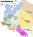
1914-Militärbezirke Russland-03.png 761 × 828; 114 KB
-
Austro-Hungarian Monarchy (1914).svg 450 × 456; 456 KB
-
BritishEmpire1914.png 8,192 × 4,096; 511 KB
-
Colonies in Africa in 1914.jpg 2,203 × 2,080; 515 KB
-
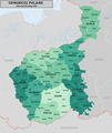
CongressPoland1914Map.png 2,125 × 2,524; 1.13 MB
-
Europa 1914-es.svg 1,363 × 1,363; 490 KB
-
Europa 1914.svg 1,363 × 1,363; 353 KB
-
Europe 1914 (pre-WW1), coloured and labelled-es.svg 450 × 456; 661 KB
-
Europe 1914 (pre-WW1), coloured and labelled.svg 450 × 456; 555 KB
-
Europe 1914 monarchies versus republics.png 2,000 × 2,027; 353 KB
-
Europe 1914.jpg 1,198 × 863; 110 KB
-
Flag map of Bulgaria (1914).svg 1,100 × 871; 22 KB
-
Flag Map of Europe (1914).png 890 × 595; 46 KB
-
Flag Map of the world (1914 handrawn).png 1,500 × 636; 73 KB
-
Flag Map of The World (1914).png 4,974 × 2,519; 821 KB
-
French Republic 1914.svg 928 × 911; 432 KB
-
German Empire 1914.svg 450 × 456; 466 KB
-
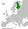
Grand Principality of Finland (1914).svg 450 × 456; 456 KB
-
Indian Empire in 1914 orthographic.png 550 × 550; 79 KB
-
Indian Empire in 1914.png 1,425 × 625; 29 KB
-
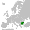
Kingdom of Bulgaria (1914).svg 450 × 456; 456 KB
-
Kingdom of Greece (1914).svg 450 × 456; 456 KB
-
Kingdom of Italy (1914).svg 450 × 456; 468 KB
-
Kingdom of Montenegro (1914).svg 450 × 456; 441 KB
-
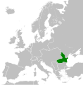
Kingdom of Romania (1914).svg 450 × 456; 441 KB
-
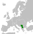
Kingdom of Serbia (1914).svg 450 × 456; 456 KB
-
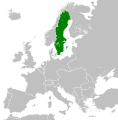
Kingdom of Sweden (1914).svg 450 × 456; 468 KB
-
Life-expectancy,World,1914.svg 850 × 691; 13 KB
-
Localisation Haut-Sénégal et Niger 1914.svg 531 × 443; 1.71 MB
-
Map Europe alliances 1914-bg.svg 1,002 × 593; 73 KB
-
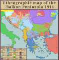
Map of the balkan region in 1914.png 1,121 × 585; 59 KB
-
Map of the World (1914)-1.png 4,974 × 2,519; 325 KB
-
Map of the World (1914).PNG 1,500 × 830; 92 KB
-
Nigeria1914.jpg 1,153 × 957; 384 KB
-
Nigeria1914b.jpg 1,537 × 1,276; 566 KB
-
Nigeria1914gbr.jpg 1,153 × 957; 390 KB
-
Pomerania 1914.svg 450 × 456; 518 KB
-
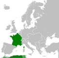
Republic of France (1914).svg 450 × 456; 468 KB
-
Russian Empire (1914).svg 450 × 456; 644 KB
-
Silésie Autrichienne au sein de la double monarchie en 1914-es.svg 3,507 × 2,657; 1.13 MB
-
Silésie Autrichienne au sein de la double monarchie en 1914.svg 3,507 × 2,657; 691 KB
-
UK 1914.svg 450 × 456; 477 KB
-
Untitled27 Restored 20240217195451.png 4,960 × 5,060; 5.01 MB
-
Wolrd Map 1914.png 1,025 × 558; 65 KB
-
World map 1914.jpg 5,000 × 2,605; 829 KB
-
Եվրոպան 1914 թվական.png 1,821 × 1,149; 105 KB
-
Ⲉⲩⲣⲱⲡⲏ ϩⲉⲛ 1914.png 2,000 × 1,184; 313 KB


