Category:Maps of travel regions
Jump to navigation
Jump to search
This category contains maps showing areas divided in regions that are useful especially for travel. Many follow the Wikivoyage style.
Media in category "Maps of travel regions"
The following 15 files are in this category, out of 15 total.
-
Cook islands map.png 1,253 × 1,780; 352 KB
-
Cook islands map.svg 1,253 × 1,780; 437 KB
-
Greensparuraltourism1.jpg 688 × 310; 231 KB
-
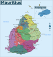
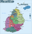
Map of Mauritius mk.svg 1,049 × 1,130; 1.43 MB
-
Map of Mauritius.png 2,332 × 2,510; 1.23 MB
-
Map of Mauritius.svg 1,049 × 1,130; 1.43 MB
-
NZ north island regions.png 1,349 × 2,044; 703 KB
-
NZ regions (fr).png 1,349 × 1,752; 509 KB
-
NZ regions map (ru).png 1,349 × 1,752; 470 KB
-
NZ regions.png 1,500 × 1,948; 1.1 MB
-
NZ regions.svg 1,349 × 1,752; 881 KB
-
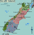
South island map.png 1,500 × 1,537; 642 KB
-
South island regions.svg 1,123 × 1,150; 1.03 MB
-
Southern Cook islands map IT.png 9,136 × 6,090; 1.96 MB
-
Southern Cook islands map IT.svg 900 × 600; 439 KB


