Category:Maps of the Third Battle of Ypres
Jump to navigation
Jump to search
Subcategories
This category has the following 5 subcategories, out of 5 total.
Media in category "Maps of the Third Battle of Ypres"
The following 62 files are in this category, out of 62 total.
-
 204. I.D. Ypern.jpg 354 × 703; 114 KB
-
 38th Division, Battle of Pilckem Ridge 31 July 1917.png 702 × 530; 556 KB
-
 Amarck.jpg 612 × 703; 200 KB
-
 British advances in September 1917, during the Battles of Ypres..jpg 490 × 515; 81 KB
-
 Chalk areas, northern France.jpg 646 × 629; 228 KB
-
 Cockcroft 19 Aug 1917.png 226 × 369; 98 KB
-

-
 Deutsche Verteidigungsstellungen östlich von Ypern (Mitte 1917).jpg 907 × 498; 101 KB
-
 Diagram Flanders offensive 1917.png 860 × 1,040; 635 KB
-
 Flanders front, June 1917.jpg 460 × 664; 108 KB
-
 Flanders plain.jpg 900 × 721; 387 KB
-
 Flanders, June 1917.jpg 402 × 616; 101 KB
-
 Front line 22 October - 6 November.jpg 863 × 925; 243 KB
-
 Front line after Battle of Langemarck, 16-18 August 1917.jpg 863 × 1,138; 217 KB
-
 Front line after Poelcapelle and 1st Passchendaele 9-12 October 1917.jpg 989 × 1,252; 333 KB
-
 Front line Menin road, Polderhoek, Reutel, 5 December 1917.png 755 × 561; 482 KB
-
 German defences east of Ypres mid-1917 (black & white).jpg 907 × 498; 77 KB
-
 German defences east of Ypres mid-1917.jpg 907 × 498; 130 KB
-
 German defensive fortifications, Flanders 1917.jpg 289 × 496; 65 KB
-
 German defensive organisation, Flanders 1917.jpg 451 × 764; 118 KB
-
 German defensive system, Flanders, mid-1917.jpg 401 × 720; 141 KB
-
 German spoiling attack on the Yser, 8 July 1917.jpg 462 × 563; 91 KB
-
 German troop disposition opposite 1 ANZAC Corps on 1 Sept 1917.jpg 2,768 × 2,473; 957 KB
-
 Gravenstafel Ridge-Wurst Farm.png 711 × 597; 774 KB
-
 Guards Division, 31 July 1917 png.png 657 × 530; 392 KB
-
 Guards Division, Broembeek, 10 October 1917.jpg 1,037 × 675; 341 KB
-
 Guards Division, Pilckem Ridge, 31 July 1917.jpg 1,136 × 928; 378 KB
-
 Hill 60, 1915a.png 764 × 899; 759 KB
-
 Hooge and Westhoek, August–September 1917.png 814 × 628; 316 KB
-
 Inundations at Drei Grachten, Flanders, 1917.jpg 403 × 322; 82 KB
-
 Map of 8th Div Ypres July 1917.svg 953 × 630; 144 KB
-
 Map of the Ypres district.png 857 × 1,391; 792 KB
-
 Merckem Peninsula, 1917.jpg 482 × 593; 92 KB
-
 Merckem peninsula, Flanders, 1917(2).jpg 408 × 522; 86 KB
-
 Merckem peninsula, Flanders, 1917.jpg 408 × 522; 78 KB
-

-
 Passchendaele ridge, 1917.jpg 878 × 1,462; 554 KB
-
 Passchendaele ridge, 1917a.jpg 360 × 599; 145 KB
-
 Polygon Wood, September 1917.png 696 × 601; 464 KB
-

-
 Reproduction of captured German trench map (20 Sept 1917).jpg 2,761 × 2,428; 1.82 MB
-

-
 St Julien and the Vancouver, Springfield and Winnipeg blockhouses.png 803 × 764; 514 KB
-
 Tank action 28 August 1917 png.png 1,194 × 803; 702 KB
-
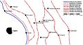
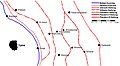
 The Drie Grachten (Three Canals) bridgehead, 1917.png 335 × 324; 164 KB
-
 The German L'eclusette blockhouse at Drie Grachten, 1917.png 464 × 261; 214 KB
-
 Third Battle of Ypres - German trench lines (Sept 1917).jpg 2,653 × 2,333; 1.52 MB
-
 Third Ypres - Map Showing Progress in the Ypres Area..jpg 2,566 × 4,400; 4.63 MB
-
 Topographic belts, Flanders.jpg 372 × 513; 77 KB
-
 Topography, Flanders and Artois.jpg 908 × 1,036; 351 KB
-
 USMA - Third Battle of Ypres.jpg 1,938 × 2,992; 1.17 MB
-
 Wurst Farm area, 1917.png 506 × 261; 130 KB
-
 Württ. Div. Flandern-Schlacht 1917 1.jpg 1,095 × 1,067; 446 KB
-
 Württ. Div. Flandern-Schlacht 1917 2.jpg 1,003 × 636; 191 KB
-
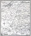
 Ypres and Langemarck, 1917.jpg 612 × 703; 201 KB
-
 Ypres area, Autumn, 1917.jpg 900 × 1,461; 550 KB
-
 Ypres area,1917.jpg 628 × 955; 244 KB
-
 Ypres area,1917a.jpg 354 × 571; 126 KB
-
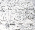
 Ypres district, 1917.jpg 959 × 1,462; 492 KB
-
 Dritte Flandernschlacht - Karte-2.png 1,040 × 1,599; 254 KB
-
 Dritte Flandernschlacht - Karte.png 1,040 × 1,599; 256 KB
-
 MapThirdYpresFrezenbergSeptemberOctober1917.jpg 800 × 577; 158 KB


_schwarzweiss.jpg)
.jpg)


.jpg)


.jpg)


_Division_during_the_Battle_of_Pilckem_Ridge.jpg)
.jpg)


_bridgehead,_1917.png)

.jpg)


