Category:Maps of the Egyptian third intermediate period
Jump to navigation
Jump to search
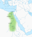
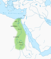
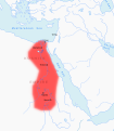
This category contains Maps of the Egyptian third intermediate period, covering the time between circa 1069 BCE and circa 664 BC in Ancient Egypt, namely the 21st to 25th dynasty.
Media in category "Maps of the Egyptian third intermediate period"
The following 21 files are in this category, out of 21 total.
-
Alter Orient 0700BC.svg 2,102 × 1,510; 4.7 MB
-
Alter Orient 0800BC-es.svg 2,102 × 1,510; 3.54 MB
-
Alter Orient 0800BC.svg 2,102 × 1,510; 4.81 MB
-
Alter Orient 0900BC.svg 2,102 × 1,510; 4.93 MB
-
Alter Orient 1000BC.svg 2,102 × 1,510; 4.69 MB
-
Ancient Near East 0700BC.svg 2,102 × 1,510; 4.7 MB
-
Ancient Near East 0800BC.svg 2,102 × 1,510; 4.81 MB
-
Ancient Near East 0900BC.svg 2,102 × 1,510; 4.92 MB
-
Ancient Near East 1000BC.svg 2,102 × 1,510; 4.69 MB
-
Egypt kush-es.svg 1,265 × 1,451; 251 KB
-
Egypt kush-pt.svg 1,265 × 1,451; 255 KB
-
Egypt kush.svg 1,265 × 1,451; 191 KB
-
Kushite heartland and Kushite Empire of the 25th dynasty circa 700 BCE.jpg 2,000 × 2,294; 1.17 MB
-
Third Intermediate Period map sk.svg 1,002 × 1,895; 631 KB
-
Third Intermediate Period map-ar.svg 1,002 × 1,891; 273 KB
-
Third Intermediate Period map-ca.svg 1,002 × 1,895; 218 KB
-
Third Intermediate Period map-es.svg 1,069 × 2,021; 674 KB
-
Third Intermediate Period map-id.svg 1,002 × 1,895; 308 KB
-
Third Intermediate Period map-pt.svg 1,002 × 1,895; 171 KB
-
Third Intermediate Period map-sr.svg 1,002 × 1,895; 308 KB
-
Third Intermediate Period map.svg 1,002 × 1,895; 755 KB


