Category:Maps of terrorism
Jump to navigation
Jump to search
See also : Category:Terrorism by country
Ongoing armed conflicts ( Countries Maps )
|
|---|
|
National or regional Maps of ongoing insurgencies, armed conflicts, disputes of territories, military conflicts, and also current civil or international wars : Overview Maps:
National-wide Maps:
National-wide Maps of areas of activity:
Sub-national-wide Maps:
See also:
Category:Conflicts in 2024 (with list of countries in ongoing armed conflicts) Template:City maps of ongoing civil wars (Local maps) |
Note: Comments "areas of activity" means that this is not territorial control is shown.
Subcategories
This category has the following 2 subcategories, out of 2 total.
S
W
- World maps about terrorism (27 F)
Media in category "Maps of terrorism"
The following 18 files are in this category, out of 18 total.
-
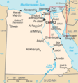
Sinai insurgency.svg 499 × 796; 246 KB
-
Sinai map.PNG 327 × 350; 30 KB
-
Iraqi Civil War map (2014–present).png 3,360 × 3,436; 821 KB
-
Iraqi Civil War map (2014–present).svg 1,241 × 1,264; 775 KB
-
ISIS (Grey) Territory Change 2014-2016.gif 1,171 × 895; 3.26 MB
-
Islamic terrorism in Europe.svg 850 × 650; 969 KB
-
Jihadist groups overview.png 10,011 × 5,676; 19.84 MB
-
Mexico states map small war.PNG 442 × 306; 51 KB
-
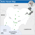
Boko Haram insurgency map.svg 954 × 734; 399 KB
-
Islamist insurgency in Nigeria-es.svg 600 × 600; 921 KB
-
Islamist insurgency in Nigeria.svg 254 × 254; 412 KB
-
Pakistan-Waziristan-Map.png 700 × 692; 96 KB
-
Somali Civil War (2009-present).svg 512 × 650; 199 KB
-
Somali Civil War 22 May 2024.svg 512 × 650; 202 KB
-
Terror-attack-brussels-03-2016-map-GER.svg 977 × 746; 5.25 MB
-
Terrorist.incidents.January–June 2015.jpg 1,800 × 820; 127 KB
-
The activity area of the ISGS.png 676 × 473; 45 KB
-
Yemen crackdown.png 1,600 × 1,026; 51 KB


