Category:Maps of ancient Attica
Jump to navigation
Jump to search
Subcategories
This category has the following 2 subcategories, out of 2 total.
A
O
Media in category "Maps of ancient Attica"
The following 19 files are in this category, out of 19 total.
-
Attica-ua.png 334 × 346; 28 KB
-
BatallaDeFilé.svg 506 × 372; 8.84 MB
-
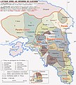
CarteAttiqueApresClisthene.jpg 461 × 600; 33 KB
-
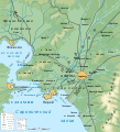
Environs of Athens-be.svg 910 × 1,000; 553 KB
-
Environs of Athens-ru.svg 910 × 1,000; 553 KB
-
Greece (ancient) Attica Demos II-de.svg 677 × 872; 2.06 MB
-
Greece (ancient) Attica Demos II-el.svg 635 × 818; 1.94 MB
-
Greece (ancient) Attica Demos II-it.svg 635 × 818; 1.96 MB
-
Greece (ancient) Attica Demos II.es.svg 635 × 818; 1.95 MB
-
Greece (ancient) Attica Demos.svg 635 × 818; 1.68 MB
-
L'Attique après Clisthene.jpg 5,896 × 6,526; 11.93 MB
-
Map of Attika.png 623 × 564; 20 KB
-
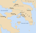
Map of Boeotia, Attica, and Phocis.jpg 2,877 × 2,719; 1.9 MB
-
Map of the tribes.png 1,920 × 1,080; 739 KB
-
Pauly-Wissowa II,2, 2204adjunct - map of Attica (demes).jpg 2,482 × 2,496; 3.03 MB
-
Phyle map-en.svg 1,200 × 900; 488 KB
-
Phyle map-it.svg 1,200 × 900; 846 KB
-
RegiónDeÁtica.svg 502 × 497; 8.6 MB


