Category:Maps of Sutherland
Jump to navigation
Jump to search
Traditional counties (shires) of Scotland: Aberdeenshire · Angus · Argyll ≈ Argyllshire · Ayrshire · Banffshire · Berwickshire · Buteshire · Caithness · Clackmannanshire · Cromartyshire · Dumbartonshire · Dumfriesshire · East Lothian · Fife · Inverness-shire · Kincardineshire · Kinross-shire · Kirkcudbrightshire · Lanarkshire · Midlothian · Moray · Nairnshire · the Orkney Islands ≈ Orkney Islands · Peeblesshire · Perthshire · Renfrewshire · Ross-shire · Roxburghshire · Selkirkshire · the Shetland Islands ≈ Shetland Islands · Stirlingshire · Sutherland · West Lothian · Wigtownshire
Wikimedia category | |||||
| Upload media | |||||
| Instance of | |||||
|---|---|---|---|---|---|
| Category combines topics | |||||
| Sutherland | |||||
historic county, lieutenancy area and registration county of Scotland | |||||
| Instance of |
| ||||
| Part of | |||||
| Location | |||||
| Capital | |||||
| Population |
| ||||
 | |||||
Subcategories
This category has the following 2 subcategories, out of 2 total.
Media in category "Maps of Sutherland"
The following 26 files are in this category, out of 26 total.
-
Map of Strathnaver, Caithness, and Sutherland.png 1,975 × 1,398; 1.44 MB
-
Ordnance Survey Sheet NC 00 10 Strath Kanaird, Published 1973.jpg 15,749 × 7,424; 48.47 MB
-
Ordnance Survey Sheet NC 14 Scourie, Published 1970.jpg 10,072 × 8,818; 25.7 MB
-
Ordnance Survey Sheet NC 16 Sheigra, Published 1966.jpg 10,080 × 9,959; 25.98 MB
-
Ordnance Survey Sheet NC 24 34 Arkle, Published 1966.jpg 15,300 × 8,882; 44.25 MB
-
Ordnance Survey Sheet NC 25 35 Rhiconich, Published 1966.jpg 15,248 × 8,848; 42.04 MB
-
Ordnance Survey Sheet NC 26 36 Kyle of Durness, Published 1966.jpg 15,227 × 8,880; 37.58 MB
-
Ordnance Survey Sheet NC 27 37 Cape Wrath, Published 1966.jpg 15,253 × 8,896; 39.8 MB
-
Ordnance Survey Sheet NC 44 54 Strath More, Published 1965.jpg 15,288 × 8,882; 36.24 MB
-
Ordnance Survey Sheet NC 45 55 Loch Hope, Published 1964.jpg 16,306 × 8,480; 38.18 MB
-
Ordnance Survey Sheet NC 46 56 Whiten Head, Published 1965.jpg 15,288 × 8,892; 36.68 MB
-
Ordnance Survey Sheet NC 64 74 Mid Strathnaver, Published 1965.jpg 15,289 × 8,924; 32.68 MB
-
Ordnance Survey Sheet NC 65 75 Lower Strathnaver, Published 1965.jpg 15,278 × 8,948; 33.33 MB
-
Ordnance Survey Sheet NC 66 76 Bettyhill, Published 1965.jpg 15,308 × 8,846; 38.32 MB
-
Ordnance Survey Sheet NC 85 95 Mid Strath Halladale, Published 1965.jpg 14,775 × 6,949; 30.07 MB
-
Ordnance Survey Sheet NC 86 96 Melvich, Published 1968.jpg 15,252 × 8,871; 35.19 MB
-
Sutherland - British Isles.svg 1,250 × 1,835; 1,024 KB
-
Sutherland Brit Isles Sect 1.svg 901 × 797; 1,004 KB
-
Sutherland Brit Isles Sect 2.svg 915 × 841; 1,012 KB
-
Sutherland UK blank map.svg 1,425 × 1,166; 2.15 MB
-
Sutherland UK location map.svg 1,425 × 1,166; 2.59 MB
-
Sutherland UK relief location map.jpg 2,001 × 1,636; 578 KB
-
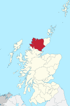
Sutherland-Scotland.svg 690 × 1,039; 1,001 KB
-
SutherlandBrit1.GIF 493 × 606; 8 KB
-
SutherlandBrit1.PNG 493 × 606; 13 KB
-
SutherlandTraditional.png 420 × 520; 12 KB


