Category:Maps of Sleeping Bear Dunes National Lakeshore
Jump to navigation
Jump to search
English: Maps of Sleeping Bear Dunes National Lakeshore
Wikimedia category | |||||
| Upload media | |||||
| Instance of | |||||
|---|---|---|---|---|---|
| Category combines topics | |||||
| Sleeping Bear Dunes National Lakeshore | |||||
protected area | |||||
| Instance of | |||||
| Location |
| ||||
| Operator | |||||
| Maintained by | |||||
| IUCN protected areas category | |||||
| Inception |
| ||||
| Area |
| ||||
| Visitors per year |
| ||||
| official website | |||||
 | |||||
Media in category "Maps of Sleeping Bear Dunes National Lakeshore"
The following 32 files are in this category, out of 32 total.
-
Map of Sleeping Bear Dunes National Lakeshore.png 2,073 × 3,676; 906 KB
-
NPS north-manitou-island-topographic-map.jpg 2,501 × 3,345; 1.53 MB
-
NPS north-manitou-island-topographic-map.pdf 3,125 × 4,181; 14.31 MB
-
NPS sleeping-bear-dune-trailhead-map.gif 1,360 × 1,260; 199 KB
-
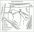
NPS sleeping-bear-dunes-alligator-hill-hiking-ski-trail-map.gif 1,322 × 1,233; 609 KB
-
NPS sleeping-bear-dunes-bay-campground-map.gif 1,458 × 952; 245 KB
-
NPS sleeping-bear-dunes-bay-view-hiking-ski-trail-map.gif 1,215 × 1,386; 463 KB
-
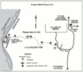
NPS sleeping-bear-dunes-empire-bluff-hiking-trail-map.gif 1,360 × 1,184; 407 KB
-
NPS sleeping-bear-dunes-features-map.jpg 986 × 1,255; 317 KB
-
NPS sleeping-bear-dunes-geology-map.jpg 988 × 1,259; 187 KB
-
NPS sleeping-bear-dunes-good-harbor-bay-hiking-ski-trail-map.gif 1,125 × 1,227; 304 KB
-
NPS sleeping-bear-dunes-land-cover-map.jpg 987 × 1,254; 340 KB
-
NPS sleeping-bear-dunes-land-type-map.jpg 988 × 1,256; 294 KB
-
NPS sleeping-bear-dunes-map.jpg 1,712 × 3,089; 690 KB
-
NPS sleeping-bear-dunes-map.pdf 1,283 × 2,316; 6.31 MB
-
NPS sleeping-bear-dunes-north-manitou-island-trail-map.gif 1,360 × 2,240; 297 KB
-
NPS sleeping-bear-dunes-old-indian-hiking-ski-trail-map.gif 1,140 × 1,248; 341 KB
-
NPS sleeping-bear-dunes-platte-plains-hiking-ski-trail-map.gif 1,215 × 1,195; 476 KB
-
NPS sleeping-bear-dunes-platte-river-campground-map.gif 1,760 × 1,360; 493 KB
-
NPS sleeping-bear-dunes-popple-campground-map.gif 957 × 742; 142 KB
-
NPS sleeping-bear-dunes-pyramid-point-hiking-ski-trail-map.jpg 556 × 556; 69 KB
-
NPS sleeping-bear-dunes-shauger-hill-hiking-trail-map.gif 1,144 × 1,093; 181 KB
-
NPS sleeping-bear-dunes-south-manitou-island-map.png 2,000 × 1,253; 476 KB
-
NPS sleeping-bear-dunes-trail-map.jpg 2,900 × 2,171; 440 KB
-
NPS sleeping-bear-dunes-valley-view-campground-map.gif 1,406 × 1,146; 164 KB
-
NPS sleeping-bear-dunes-weather-station-campground-map.gif 1,748 × 1,351; 480 KB
-
NPS sleeping-bear-dunes-white-pine-campground-map.gif 1,606 × 1,086; 219 KB
-
NPS sleeping-bear-dunes-windy-moraine-hiking-ski-trail-map.gif 1,082 × 1,244; 224 KB
-
NPS sleeping-bear-heritage-trail-map.jpg 1,000 × 970; 380 KB
-
NPS south-manitou-island-topogrpahic-map.jpg 2,462 × 3,212; 948 KB
-
NPS south-manitou-island-topogrpahic-map.pdf 3,077 × 4,014; 13.9 MB
-
South-Manitou-Island-Map.svg 782 × 490; 141 KB


