Category:Maps of Roi Et Province
Jump to navigation
Jump to search
Wikimedia category | |||||
| Upload media | |||||
| Instance of | |||||
|---|---|---|---|---|---|
| Category combines topics | |||||
| Roi Et | |||||
province in northeastern Thailand | |||||
| Instance of | |||||
| Location | Thailand | ||||
| Capital | |||||
| Population |
| ||||
| Area |
| ||||
| Elevation above sea level |
| ||||
| official website | |||||
 | |||||
Subcategories
This category has the following 2 subcategories, out of 2 total.
E
T
Media in category "Maps of Roi Et Province"
The following 70 files are in this category, out of 70 total.
-
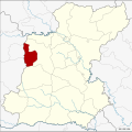
Amphoe 4501.png 405 × 450; 22 KB
-
Amphoe 4501.svg 1,580 × 1,573; 225 KB
-
Amphoe 4502.png 405 × 450; 22 KB
-
Amphoe 4502.svg 1,580 × 1,573; 228 KB
-
Amphoe 4503.png 405 × 450; 22 KB
-
Amphoe 4503.svg 1,580 × 1,573; 225 KB
-
Amphoe 4504.png 405 × 450; 22 KB
-
Amphoe 4504.svg 1,580 × 1,573; 224 KB
-
Amphoe 4505.png 405 × 450; 22 KB
-
Amphoe 4505.svg 1,580 × 1,573; 223 KB
-
Amphoe 4506.png 405 × 450; 22 KB
-
Amphoe 4506.svg 1,580 × 1,573; 225 KB
-
Amphoe 4507.png 405 × 450; 22 KB
-
Amphoe 4507.svg 1,580 × 1,573; 225 KB
-
Amphoe 4508.png 405 × 450; 22 KB
-
Amphoe 4508.svg 1,580 × 1,573; 226 KB
-
Amphoe 4509.png 405 × 450; 22 KB
-
Amphoe 4509.svg 1,580 × 1,573; 224 KB
-
Amphoe 4510.png 405 × 450; 22 KB
-
Amphoe 4510.svg 1,580 × 1,573; 229 KB
-
Amphoe 4511.png 405 × 450; 22 KB
-
Amphoe 4511.svg 1,580 × 1,573; 226 KB
-
Amphoe 4512.png 405 × 450; 22 KB
-
Amphoe 4512.svg 1,580 × 1,573; 222 KB
-
Amphoe 4513.png 405 × 450; 22 KB
-
Amphoe 4513.svg 1,580 × 1,573; 225 KB
-
Amphoe 4514.png 405 × 450; 22 KB
-
Amphoe 4514.svg 1,580 × 1,573; 225 KB
-
Amphoe 4515.png 405 × 450; 22 KB
-
Amphoe 4515.svg 1,580 × 1,573; 222 KB
-
Amphoe 4516.png 405 × 450; 22 KB
-
Amphoe 4516.svg 1,580 × 1,573; 223 KB
-
Amphoe 4517.png 405 × 450; 22 KB
-
Amphoe 4517.svg 1,580 × 1,573; 224 KB
-
Amphoe 4518.png 405 × 450; 22 KB
-
Amphoe 4518.svg 1,580 × 1,573; 224 KB
-
Amphoe 4519.png 405 × 450; 22 KB
-
Amphoe 4519.svg 1,580 × 1,573; 223 KB
-
Amphoe 4520.png 405 × 450; 22 KB
-
Amphoe 4520.svg 1,580 × 1,573; 222 KB
-
Amphoe Roi Et WLM.svg 1,585 × 1,576; 230 KB
-
Amphoe Roi Et.png 405 × 450; 26 KB
-
Amphoe Roi Et.svg 1,577 × 1,575; 255 KB
-
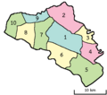
Districts Roi Et.svg 1,577 × 1,575; 303 KB
-
Map Roi-Et blank.png 5,919 × 5,908; 3.31 MB
-
Roi Et PESA.svg 1,577 × 1,575; 238 KB
-
Sriphum map.jpg 960 × 720; 86 KB
-
Tambon of At Samat.png 466 × 411; 11 KB
-
Tambon of Changhan.png 371 × 250; 8 KB
-
Tambon of Chaturaphak Phiman.png 479 × 344; 10 KB
-
Tambon of Chiang Khwan.png 289 × 264; 7 KB
-
Tambon of Kaset Wisai.png 471 × 555; 13 KB
-
Tambon of Meoi Wadi.png 340 × 252; 7 KB
-
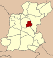
Tambon of Mueang Roi Et.png 400 × 502; 13 KB
-
Tambon of Mueang Suang.png 271 × 260; 6 KB
-
Tambon of Nong Hi.png 263 × 277; 6 KB
-
Tambon of Nong Phok.png 455 × 532; 12 KB
-
Tambon of Pathum Rat.png 343 × 328; 9 KB
-
Tambon of Phanom Phrai.png 421 × 461; 12 KB
-
Tambon of Pho Chai.png 298 × 548; 11 KB
-
Tambon of Phon Sai.png 379 × 275; 8 KB
-
Tambon of Phon Thong.png 498 × 521; 15 KB
-
Tambon of Selaphum.png 579 × 667; 19 KB
-
Tambon of Si Somdet.png 219 × 358; 7 KB
-
Tambon of Suwannaphum.png 513 × 541; 15 KB
-
Tambon of Thawat Buri.png 343 × 379; 10 KB
-
Tambon of Thung Khao Luang.png 234 × 284; 7 KB
-
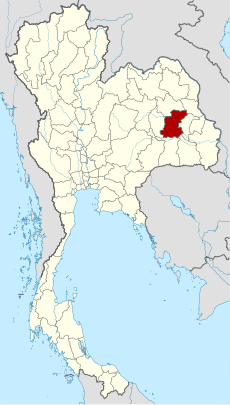
Thailand Roi Et location map.svg 1,577 × 1,575; 207 KB
-
Thailand Roi Et locator map.svg 1,052 × 1,849; 1.24 MB
-
Thailand Roi Et.png 178 × 300; 14 KB
