Category:Maps of Rochester, New York
Jump to navigation
Jump to search
- Cities in New York State
- ‒ Capital District
- Albany
- Cohoes
- Saratoga Springs
- Schenectady
- Troy
- ‒ Central New York
- Ithaca
- Syracuse
- ‒ New York City and Long Island
- New York City
- ‒ Finger Lakes
- Rochester
- ‒ Hudson Valley
- New Rochelle
- ‒ Mohawk Valley
- Utica
- ‒ North Country
- Plattsburgh
- ‒ Southern Tier
- Elmira
- ‒ Western New York
- Buffalo
- Niagara Falls
- North Tonawanda
Wikimedia category | |||||
| Upload media | |||||
| Instance of | |||||
|---|---|---|---|---|---|
| Category combines topics | |||||
| Rochester | |||||
county seat of Monroe County, New York, United States | |||||
| Instance of |
| ||||
| Named after | |||||
| Location | Monroe County, New York | ||||
| Located in or next to body of water | |||||
| Head of government |
| ||||
| Inception |
| ||||
| Population |
| ||||
| Area |
| ||||
| Elevation above sea level |
| ||||
| official website | |||||
 | |||||
Subcategories
This category has the following 3 subcategories, out of 3 total.
Media in category "Maps of Rochester, New York"
The following 25 files are in this category, out of 25 total.
-
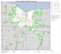
2010 Census Urbanized Area Reference Map for Rochester, New York - DPLA - 828378646f4986faa556f55dec339a6d.pdf 5,404 × 4,800, 5 pages; 5.35 MB
-
American Brewing Company Rochester, NY.png 1,920 × 1,080; 4.74 MB
-
Bartholomay Oothout Rau Breweries Rochester NY 1875.png 1,920 × 1,080; 3.05 MB
-
Burtis & Symes Rochester NY 1875.png 1,894 × 1,052; 2.94 MB
-
Can Of Worms interchange map.svg 885 × 591; 95 KB
-
City Spring Brewery Rochester NY 1875.png 1,920 × 1,080; 3.56 MB
-
File-Map of New York highlighting Rochester.png 650 × 506; 47 KB
-
George Marburger's Brewery Rochester NY 1851.png 1,891 × 1,056; 3.57 MB
-
Hand Drawn Map of Rochester, 1811.jpg 3,264 × 2,448; 1.95 MB
-
Joseph Nunn Brewery Brown Street Rochester NY 1875.png 1,920 × 1,080; 2.93 MB
-
Louis Bauer's Brewery Rochester NY 1851.png 1,920 × 1,080; 4.07 MB
-
Lyman Brewery Rochester NY 1820.png 1,920 × 1,080; 2.9 MB
-
Map of New York highlighting Rochester.png 300 × 232; 9 KB
-
Map of the city of Rochester - btv1b53020987p.jpg 7,446 × 8,723; 9.14 MB
-
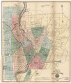
Map of the city of Rochester LOC 2011593646.jpg 6,263 × 7,338; 7.15 MB
-
Map of the city of Rochester LOC 2011593646.tif 6,263 × 7,338; 131.49 MB
-
Miller Brewing Company Rochester, NY.png 1,920 × 1,080; 4.09 MB
-
Moerlbach Brewing Company Rochester NY 1910.png 1,886 × 746; 3.46 MB
-
Original Marburger Brewery Rochester NY 1875.png 1,920 × 1,080; 3.02 MB
-
Rochester (NY) Highways map.png 2,091 × 1,286; 173 KB
-
Rochester Brewing Company 1900.png 1,920 × 1,080; 3.96 MB
-
Rochester Downtown Location.PNG 1,203 × 1,085; 165 KB
-
Rochester. From the west, 1853 (NYPL Hades-118807-54958).tif 6,131 × 4,384; 76.9 MB
-
Rochester. From the west, 1853. (3989999725).jpg 760 × 502; 72 KB


