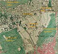
Category:Maps of Mariakerke
Jump to navigation
Jump to search
Media in category "Maps of Mariakerke"
The following 5 files are in this category, out of 5 total.
-
Cooleghemdriesch1576.jpg 1,134 × 850; 684 KB
-
Koolegem, Gent, Atlas der Buurtwegen.jpg 1,285 × 820; 154 KB
-
Mariakerke, Ghent, Belgium, Ferraris.jpg 1,680 × 1,050; 369 KB
-
MariakerkeLocation.svg 452 × 459; 132 KB
-
SitueringKolegemkouter1775.jpg 1,282 × 1,200; 1.04 MB


