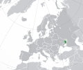
Category:Maps of Donetsk People's Republic
Jump to navigation
Jump to search
Wikimedia category | |||||
| Upload media | |||||
| Instance of | |||||
|---|---|---|---|---|---|
| Category combines topics | |||||
| Donetsk People's Republic | |||||
administrative division of Russia since 2022 in Ukraine | |||||
| Instance of |
| ||||
| Part of | |||||
| Location | |||||
| Capital | |||||
| Legislative body | |||||
| Executive body | |||||
| Official language | |||||
| Currency | |||||
| Head of government |
| ||||
| Inception |
| ||||
| Population |
| ||||
| Area |
| ||||
| Follows |
| ||||
| Different from | |||||
| official website | |||||
 | |||||
Media in category "Maps of Donetsk People's Republic"
The following 68 files are in this category, out of 68 total.
-
2014 Russo-ukrainian-conflict map.svg 4,126 × 4,480; 2.75 MB
-
2014 Ukraine War02.PNG 2,171 × 2,736; 1.79 MB
-
2014ko Ukraina ekialdeko gatazka armatua.png 1,816 × 2,056; 678 KB
-
Battle of Debaltseve.png 472 × 277; 92 KB
-
De Facto People's Republics in Ukraine.png 795 × 538; 93 KB
-
Dnrdivisions.png 1,802 × 2,326; 207 KB
-
Donetsk and Lugansk Peoples Republics in Ukraine.png 1,100 × 783; 125 KB
-
Donetsk and Luhansk People Republics en.jpg 1,240 × 1,754; 405 KB
-
Donetsk and Luhansk People's Republics uk.jpg 1,240 × 1,754; 389 KB
-
Donetsk Oblast (orthographic projection).svg 553 × 553; 470 KB
-
Donetsk People's Republic (2014-04-30).svg 659 × 891; 120 KB
-
Donetsk People's Republic new.svg 512 × 417; 426 KB
-
Donetsk People's Republic regions-it.svg 787 × 1,127; 428 KB
-
Donetsk People's Republic regions-ru.svg 787 × 1,127; 428 KB
-
Donetsk People's Republic.svg 680 × 520; 799 KB
-
Donetsk PR Map.png 1,200 × 879; 358 KB
-
Donetsk South Ossetia.png 1,280 × 979; 184 KB
-
Donetskrepublic.svg 531 × 725; 375 KB
-
Donrepublicraions.png 2,000 × 2,731; 468 KB
-
DPR LPR en.jpg 2,340 × 3,336; 1.29 MB
-
DPR LPR ja.jpg 2,480 × 3,508; 862 KB
-
DPR LPR sr.jpg 2,480 × 3,508; 839 KB
-
DPR LPR uk.jpg 2,480 × 3,508; 1.03 MB
-
DPR LPR zh.jpg 2,480 × 3,508; 887 KB
-
East Ukraine conflict (English language version).png 2,048 × 2,701; 1,012 KB
-
East Ukraine Conflict RBK.svg 2,048 × 2,701; 1.98 MB
-
East Ukraine conflict.png 2,048 × 2,701; 1.43 MB
-
European Russia laea location map (de facto).png 454 × 599; 184 KB
-
European Russia laea location map (disputed territories).svg 4,185 × 5,520; 3.37 MB
-
Federal State of New Russia.svg 815 × 1,075; 688 KB
-
Gorodskoy okrug Enakievo.jpg 839 × 601; 185 KB
-
Guerra civil Donbass.png 1,816 × 2,056; 868 KB
-
Guerra civil en Ucrania.svg 2,863 × 2,343; 1,006 KB
-
Ilo1.png 800 × 506; 267 KB
-
Insurgencia en Donbass.png 2,048 × 2,701; 1.14 MB
-
International Recognition of Donetsk and Lugansk.svg 825 × 387; 3.2 MB
-
Karte der Ukraine.png 4,844 × 3,255; 2.88 MB
-
Location of Donetsk People's Republic (before 2022 invasion).png 1,694 × 1,241; 890 KB
-
Location of Donetsk People's Republic.png 1,694 × 1,241; 697 KB
-
Map of Donbass Republics hu.png 4,000 × 4,031; 3.24 MB
-
Map of Donbass Republics.jpg 4,000 × 4,031; 3.42 MB
-
Map of Russia - Donetsk (disputed).svg 1,541 × 847; 6.58 MB
-
Map of Russia - Donetsk.svg 1,541 × 847; 6.58 MB
-
Map of the war in Donbass.svg 2,270 × 2,702; 2.83 MB
-
Map of Ukraine and Donetsk People's Republic and Lugansk People's Republic in 2016.svg 2,410 × 1,791; 3.65 MB
-
Map of Ukraine with Cities.png 4,844 × 3,255; 2.72 MB
-
Map of war in eastern Ukraine in 08.08.14.png 2,000 × 2,638; 1.58 MB
-
New Russia project.svg 700 × 480; 91 KB
-
Novorosia 2014.jpg 3,508 × 2,480; 679 KB
-
Novorossiya, areas under full and partial control.jpg 814 × 1,074; 145 KB
-
Novorussia-Donetsk Rep.svg 2,045 × 1,720; 7.33 MB
-
ORDO in Ukraine.svg 1,546 × 1,039; 559 KB
-
ORDO-Republic in Ukraine.svg 1,546 × 1,039; 457 KB
-
Recognition of Donetsk and Luhansk updated.png 1,920 × 804; 215 KB
-
Regions of Donetsk People's Republic.png 296 × 410; 83 KB
-
Russian annexations made in 2022.png 2,044 × 2,048; 772 KB
-
Russian Occupation of Donetsk Oblast.svg 1,042 × 1,446; 341 KB
-
Ukraine 2022-02-21.svg 1,546 × 1,038; 452 KB
-
Ukraine Russian-cropped.svg 1,546 × 1,038; 57 KB
-
War in donbass.svg 570 × 800; 79 KB
-
Území ovládané Doněckou lidovou republikou 20. července.svg 531 × 725; 372 KB
-
Военный конфликт на востоке Украины.svg 2,048 × 2,701; 1.97 MB
-
Военный конфликт на востоке Украины2.jpg 2,048 × 2,701; 1.07 MB
-
ДНР 29.04.1014.jpg 691 × 961; 156 KB
-
Карта боевых действий на Востоке Украины-b.svg 2,048 × 2,701; 2.09 MB
-
Карта боевых действий на Востоке Украины.svg 2,048 × 2,701; 2.17 MB

